Country:

 City:
City:


From Digne, head towards Barcelonnette. Turn right onto the D22 towards Draix, then right again towards Archail. Take the track in poor condition to the left of the Vieraron dam. Park just before the end of the track that’s suitable for vehicles.
(S/E) Continue along the track.
(1) Cross the forest track to take a path opposite: yellow markings. Cross another track, then continue straight ahead on the path which winds steeply up to the Pas d’Archail.
(2) Descend the track on the right, which heads south-east and joins the pass located in a hairpin bend (elevation 1544).
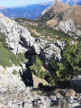
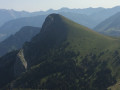
(3) Take the ridge path on the right to climb to the Sommet de Couard. Pass by the edge of a rock arch, then continue on the left-hand side of the ridge to avoid rocky sections. Finally, climb the fairly steep final cone. Enjoy the 360° panorama.
(4) Descend to the right via the hairpin bends on the north-eastern slope (yellow markers) until you rejoin the track you took on the way up near the Pas d’Archail. Turn left to reach it quickly.
(2) Descend opposite, following the reverse route of the ascent, and return to the car park (S/E).
 Visorando Member

 Very difficult
  Moderate
 Easy
Easy