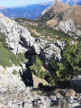
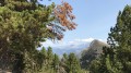
Forest park at Le Brusquet

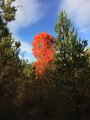
A family walk offering the chance to see a geological curiosity dating back 180 million years and to admire dozens of century-old trees of various species.

Details

1694939
Creation:
Last update:
Last review:
  • Walking
    Activity: Walking
  • ↔
    Distance: 3.41 mi
  • ◔
    Average duration: 1h 45 
  • ▲
    Difficulty: Easy

  • ⚐
    Back to start: Yes
  • ↗
    Ascent: + 240 ft
  • ↘
    Descent: - 253 ft

  • ▲
    Highest point: 2,690 ft
  • ▼
    Lowest point: 2,425 ft

Photos

Description of the walk

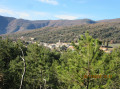
Park on Place des Vantaïres, at the entrance to the village of Le Brusquet.

(S/E) Take Rue Principale to the junction with Chemin du Gravas.

(1) Take the signposted path on the right and, after passing a small wash house, head down to the Mige Sol and cross it via a pretty wooden footbridge.

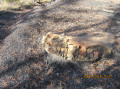
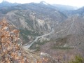
(2) Follow the path to the “slump balls” (information board) – see the link in the “During the walk” section.

(3) The path then winds through the black marl (robines) to the woodland park, where you may find a water point and numerous picnic tables.

(4) Then take a signposted path that climbs towards Draix until you come to a track.

(5) At this junction, leave the marked path and take the track on the right.
Follow this track until it splits.

(6) Take the right-hand branch, which descends and joins the small “Ronchaires” road.
This will take you back to the village. At Place du 8 Mai, you’ll rejoin the Rue Principale, which you follow to the left back to the starting point (S/E).

Waypoints

  1. S/E : mi 0 - alt. 2,536 ft - Place des Vantaïres
  2. 1 : mi 0.16 - alt. 2,543 ft - Start of the Chemin du Gravas
  3. 2 : mi 0.32 - alt. 2,467 ft - Mige Sol footbridge
  4. 3 : mi 0.49 - alt. 2,533 ft - Slump balls
  5. 4 : mi 1.56 - alt. 2,625 ft - Forest park
  6. 5 : mi 1.68 - alt. 2,667 ft - Junction with the track
  7. 6 : mi 2.58 - alt. 2,559 ft - Ronchaires crossroads
  8. S/E : mi 3.41 - alt. 2,536 ft - Place des Vantaïres

Notes

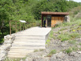
An ideal spot for a break or a picnic in the woodland park, with a drinking fountain, tables, benches, etc.
A “country bistro” near the start/finish point.
If you carry on along the track a few hundred metres past the forest park, you’ll find a fitness trail.

Worth a visit

Reviews and comments

4 / 5
Based on 4 reviews

Reliability of the description
4.3 / 5
Ease of following the route
3.8 / 5
Route interest
4 / 5
GHISL83AL
GHISL83AL

Overall rating : 3.3 / 5

Date of your route : Sep 08, 2025
Reliability of the description : ★★★★☆ Good
Ease of following the route : ★★☆☆☆ Disappointing
Route interest : ★★★★☆ Good
Very busy route : Yes

frequented by bicycles. The route was not clear enough, so we returned to Le Brusquet by another route

Machine-translated

Ourika
Ourika

Overall rating : 3.7 / 5

Date of your route : Sep 18, 2023
Reliability of the description : ★★★☆☆ Average
Ease of following the route : ★★★☆☆ Average
Route interest : ★★★★★ Very good
Very busy route : No

The route description wasn’t detailed enough; luckily, we met a walker who showed us the right way

Machine-translated

glaciers
glaciers

Overall rating : 4.3 / 5

Date of your route : Jan 16, 2022
Reliability of the description : ★★★★★ Very good
Ease of following the route : ★★★★★ Very good
Route interest : ★★★☆☆ Average
Very busy route : No

A lovely little walk.
There are plenty of icy patches at this time of year, but there are some lovely winter photos to be taken.
At point 4, the signposted path is a red and white G.R. trail.
Thanks to the author for sharing this.

Machine-translated

MBL
MBL

Overall rating : 4.7 / 5

Date of your route : Apr 03, 2019
Reliability of the description : ★★★★★ Very good
Ease of following the route : ★★★★★ Very good
Route interest : ★★★★☆ Good

A lovely walk on 30 March 2019 in glorious sunshine.
The route description was spot on. The walk is easy. It’s interesting to see the ‘slump balls’ and the robins. The woodland park is shaded by magnificent trees.
Thank you for suggesting this short but lovely walk.

Machine-translated

Other walks in the area

For more walks, use our search engine .

The GPS track and description are the property of this route's author. Please do not copy them without permission.