In and around the village of Pujols

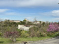
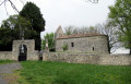
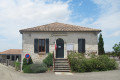
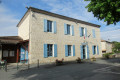
Pujols is one of the “Most Beautiful Villages in France”, with houses dating from the 15th and 16th centuries.

Details

32598074
Creation:
Last update:
Last review:
  • Walking
    Activity: Walking
  • ↔
    Distance: 2.53 mi
  • ◔
    Average duration: 1h 30 
  • ▲
    Difficulty: Easy

  • ⚐
    Back to start: Yes
  • ↗
    Ascent: + 348 ft
  • ↘
    Descent: - 325 ft

  • ▲
    Highest point: 604 ft
  • ▼
    Lowest point: 276 ft

Photos

Description of the walk

Large car park to the west of the village of Pujols.

(S/E) Heading south, visit the Paul Simonet orchard, where fruit trees are scattered across the land, each labelled with its name. Then take a very short stretch of road towards the village.

(1) Turn right onto a steeply sloping path. At the end of the path, turn left and follow the road for about 400 metres.

(2) Take a slightly descending dirt track on the left, which quickly becomes an uphill track and turns to the right. Pass a dovecote on your left near a large house; do not turn left, but follow the track to the end. Then veer left and head uphill along a narrow track lined with poplars.

(3) At the top of the track, turn left (Impasse du Jas) then continue straight on to the village, passing the cemetery. There’s a lovely view of the village on the left and a truffle field on the right.

(4) Turn left onto Passage des Ponts du Castel and enter the village. Do pop in to visit the museum of traditional toys (sign on the right).

(5) Turn right onto the museum lane, which leads to the esplanade, and admire the view over Villeneuve-sur-Lot. Enter the medieval village through the gate, cross Place Saint-Nicolas and turn right onto Rue de la Citadelle, then left onto Rue du Temple: there’s a lovely view here, and Sainte-Foy Church is worth a visit if it’s open. Continue along Rue de la Porte Salinière until you reach Passage des Ponts du Castel again.

(5) Turn left, passing Place Saint-Nicolas again. Continue straight on to leave the village via the Porte des Anglais. Turn left.

(1) Turn right and follow the route you took on the way there to return to the car park (S/E).

Waypoints

  1. S/E : mi 0 - alt. 577 ft - Car park
  2. 1 : mi 0.19 - alt. 581 ft - Junction of the first circular loop
  3. 2 : mi 0.82 - alt. 354 ft - Path on the left
  4. 3 : mi 1.27 - alt. 505 ft - Impasse du Jas
  5. 4 : mi 1.82 - alt. 568 ft - Village entrance
  6. 5 : mi 1.89 - alt. 597 ft - Junction of the Medieval Village circular loop
  7. S/E : mi 2.53 - alt. 577 ft - Car park

Worth a visit

Dovecote.
Rustic Toy Museum.
Lovely views.
Sainte-Foy Church.

Reviews and comments

4.6 / 5
Based on 3 reviews

Reliability of the description
5 / 5
Ease of following the route
5 / 5
Route interest
3.7 / 5
ChristianQ
ChristianQ

Overall rating : 4.7 / 5

Date of your route : Oct 30, 2025
Reliability of the description : ★★★★★ Very good
Ease of following the route : ★★★★★ Very good
Route interest : ★★★★☆ Good
Very busy route : No

A short and enjoyable hike, with a good descent and a good climb, including an interesting visit to the beautiful village, where you can admire the distant views on a clear day...

Machine-translated

jesuisenrandonné07
jesuisenrandonné07

Overall rating : 4 / 5

Date of your route : Jun 21, 2024
Reliability of the description : ★★★★★ Very good
Ease of following the route : ★★★★★ Very good
Route interest : ★★☆☆☆ Disappointing
Very busy route : No

There’s a lot of grass on the descent between 1 and 2

Machine-translated

278v2
278v2

Overall rating : 5 / 5

Date of your route : Sep 04, 2023
Reliability of the description : ★★★★★ Very good
Ease of following the route : ★★★★★ Very good
Route interest : ★★★★★ Very good
Very busy route : Yes

OK, would recommend

Machine-translated

Other walks in the area

For more walks, use our search engine .

The GPS track and description are the property of this route's author. Please do not copy them without permission.