Country:
 City:
City:


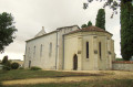
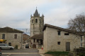
Start from the church car park in Castella.
(S/E) As you leave the car park, take the road leading uphill to the left. After reaching the top of the hill, turn left behind a large oak tree onto a grassy path marked with blue signposts. Continue along the edge of the woodland and then across open ground until you reach a junction of paths.
(1) Ignore the signposted direction to Noaillac/Barats on your left and turn right, following the yellow sign towards Castéra/Fonbourrugues (10 km). Walk alongside a horse paddock, then continue along the edge of the woodland, following the blue markings on mountain bike route No. 6. Continue to the D212, Route de Sainte-Livrade, and turn left onto it for 400 m.
At a left-hand bend in the road, take the first stony track on the right, between two horse paddocks, until you reach the woods. After about a hundred metres through the woods, leave the private track straight ahead and turn left onto the track marked with blue signs. As you emerge from the woods, rejoin the stony track and then enter the woods again.
(2) After about twenty metres through the woodland, turn right towards Castella/Fonbourrugues (8.5 km), as indicated on a yellow sign. Continue following the blue markings, sometimes on a stony or grassy track, sometimes on a footpath.
(3) At the junction with a small road, leave the blue markings which head straight ahead, cross the bridge over the Ruisseau de Fontirou on the right, and continue to the D226 road, which you should take to the right. After 400 m, on the uphill stretch, turn right onto the C4, which descends towards Castella and Cambeneuve.
(4) At the bottom of the descent, veer left onto a grassy path climbing between a hedge and a field, following the blue signposting. At the end of the path, pass the houses at Pech del Mas and La Carretal and continue to the Route de Fontirou on a tarmac road.
(5) At the road, turn left for 50 m then right onto Allée de Bourdéria, following the blue signposts. After passing the two houses at Bourdéria, carry on uphill opposite along the grassy path leading to Route de Sainte-Livrade.
(6) When you reach the road, turn left for 20 metres, then right at the edge of the woods. Continue to the hamlet of Mestre Vidal.
(7) At the junction, follow the road to the left, signposted ‘Castella Pech d’Âne’, for 200 metres, then continue straight on along a grassy path marked with yellow and green signs. When you reach the Bézille road, continue to the right for 500 metres
(8) At the end of the Route de Bézille, turn right onto the Route de Terre Longue towards La Tuque and Terre Longue.
At the three-way junction, leave the signposted route to Pech d’Âne on your left and carry on straight ahead, along the track marked ‘dead end’ and signposted in yellow.
(9) At the junction with a dirt track on the right signposted ‘Castella Pech d’Âne 1.1 km’, take this ascending track which joins the Chemin du Bourg and then leads to the church at Castella (S/E).

 Visorando Member
 Difficult
 Moderate