Country:
 City:
City:



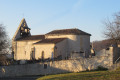
Park in the Auradou cemetery car park.
(S/E) Leave the car park on the right-hand side along the cemetery and continue straight ahead along the grassy or stony path.
Follow this path towards the woods, following the blue markings, until you reach a small road.
(1) Turn left onto the small road until you reach the next intersection.
(2) Follow this road to the left, then turn left again at the cross, after the rubbish bins. Continue towards Auradou until you reach the three-way junction at a place called Guinet.
(3) Leave the road to Auradou on your left and continue straight ahead on Route des Vignes. Continue on this road until you reach the intersection with Côte des Oliviers on your left.
(4) At the burgundy-coloured sign for local wine sales, turn left onto Côte des Oliviers. Go down the road between a vineyard and an orchard, then pass the Olivier farm.
(5) Be careful on the descent, just before the houses in the hamlet of Lissandres, turn right onto a small grassy path.
Follow the path through the woods, then along the edge of the woods until you reach a road, where you should turn right towards a house.
(6) Just after house number 859, go down the path on the left and continue through the woods on a stony path.
Pass by a ruined house at a place called Barry Bas and continue to a road.
(7) At the road with a transformer opposite, turn left towards a place called Le Trel.
(8) After the stone pine tree at the house in this locality, turn left onto the road leading down to Lacalcinie. After passing through the hamlet, at the next road, opposite a small pond, turn right towards the village of Auradou, following the blue markings.
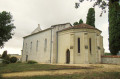
(9) At the entrance to the village, just after the first house on the left, take the grassy path that descends and then climbs back up towards the church and the starting point of the hike, marked with blue signs.
Cross the hamlet to return to the starting car park (S/E).

 Visorando Member

 Moderate