Country:
 City:
City:


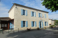
Parking is available in the car-share car park, in front of the library and the post office.
(S/E) From the car park, set off with your back to the post office, passing the town hall on Rue Robert Boin. Continue straight on along Route du Stade. On leaving the village, opposite the house at number 291, leave the road and take the grassy path veering to the right. You’ll reach a road at a fork.
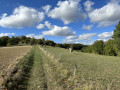
(1) Turn left onto Allée des Pommiers, cross Route du Stade and continue straight on towards Impasse Guillemon Bas. When you reach the second house, take the grassy path leading down to the left. Follow the track alongside a hedge and then a fence on the left. The path continues alongside a ditch, first on the left and then on the right. Cross the ditch via a small wooden bridge and head off to the left.
Cross a meadow, opening the wire fence on either side; make sure you close it properly behind you. Continue until you reach Route de Cours.
(2) Turn right onto this road for about a hundred metres, then turn right again, past the ‘Fayli’ sign, onto the stony track running alongside the woodland marked with yellow signposts. As you come out of the woodland, keep slightly to the left, running alongside a fenced-off field which you should go round to the left. Continue alongside the woodland until you reach a stony track.
(3) Walk about 50 metres along this road to the left, then turn right onto the ascending dirt track marked with a yellow arrow.
After about 300 metres along the edge of the woodland, veer right between two fields towards a hedge, following the yellow markings.
Pass by the hamlet of Gouzou and join the D113.
(4) Take this road to the right with care for about 100 metres, then turn left following the yellow markings.
After 200 m, turn right and follow the white/red markings ofthe GR® 652 to the end of the Route du Castella.
(5) Follow theGR® 652 to the right towards Lacastagnal. Just before this hamlet, take the grassy path on the left which goes round the house and continue to the hamlet of Lavedan. Pass through this hamlet and join the D113 at a multi-way junction.
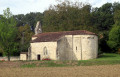
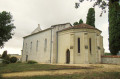
(6) Cross it carefully, then head up the small road opposite, to the right of Marsac church.
Pass by the foot of the water tower and continue following the white/red markings ofthe GR®652. At the pumping station, carry on straight ahead on theGR® and ignore the Red Cross.
(7) After passing between a hedge and a plum orchard, at a metal skip, turn right onto the grassy path leading to Laugnac (1.1 km away), signposted in red. Return to the starting junction of the circular route.
(1) Continue straight ahead, following the route in the opposite direction to the outward journey, to rejoin the (D:A).

 Visorando Member

 Moderate