Country:
 City:


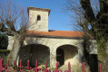
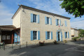
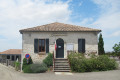
The starting point is the crossroads by Sembas Church, near which one of the two houses serves as a pilgrims’ hostel. A curious commune, with no main village centre and scattered hamlets.
(S) Set off westwards from the church along the Chemin de l’École. After following this road for 400 metres, turn left and head downhill to reach the crossroads in the hamlet of Les Manguets.
(1) Go round the property on the left, along a path running alongside box trees. Head downhill along the edge of the woodland, cross a stream and head back up into the woods to reach the RD113.
(2) Turn left onto the RD113 and follow it for 700 m until you reach a junction with a small road on a right-hand bend. Turn left; 150 m further on, you’ll rejoin the GR®®.
(3) Turn right onto it and follow it to the junction with the road leading to the hamlet of Rouquet.
(4) Leave theGR®® and continue straight ahead along the Route du Lac. Head downhill to reach the lake’s embankment.
(5) At the T-junction, take the left-hand lane. Pass the bridge leading to the Moulin d’Arasse on your left and carry on straight ahead. Pass the turn-off for Maurel Bas on your right, then follow the Ruisseau du Bourbon.
(6) Reach the D13 and follow it to the left, taking great care as there is heavy traffic. When the road bends to the left, just before a bridge, turn right and then immediately left onto the Route de Saint-Julien.
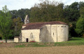
(7) At the junction, carry on straight ahead and walk past the church. Head south-west, pass the hamlet of Les Cauffours, then follow the Ruisseau du Bourbon at a slight distance on your left.
(8) At the entrance to the hamlet of Longueval, take a small road on the left. Just after the bridge, take the path leading uphill opposite – this isthe GR®®652(red and white markings, not very obvious at first but more visible in the woods). Then cross a meadow, take a hairpin bend to the right and head uphill to the right until you reach a road.
(9) Follow this road to the left (leaving theGR®®). Take the first right straight away, the Chemin de Roudigué. Descend steeply and you’ll come to a junction.
(10) Turn right, pass the hamlet of Trégan Bas, and follow the road to its end, the hamlet of Faure.
(11) Turn left towards Monbran, cross the bridge and follow the road uphill. Pass under some high-voltage power lines and cross over a dual carriageway. Continue uphill, ignoring a turn-off on the right, until you reach a T-junction.
(12) Join theGR®®652and follow it to the right. At the junction, carry on straight ahead with theGR®® along the Route de l’Escale. Head downhill, pass the hamlet of Vérone, ignore the side paths and reach the D302.
(13) Cross the road with care, then first turn left then right to head up a path. Walk alongside private properties, staying on theGR®® and following its red and white markings.
(14) At a T-junction, turn right, still following the GR®®. Pass the hamlet of Buard.
(15) At the junction near a church, carry on straight ahead and descend the winding path into the Ermitage neighbourhood.
(16) At the crossroads, turn sharply left and head downhill. At the ‘Stop’ sign, turn right. At the junction immediately ahead, go straight on and cross the Canal latéral à la Garonne (leaving theGR®®).
(17) On the other side, turn right and follow the canal on your right-hand side. After about 400 m, take the bridge on the left which crosses the railway lines. Then turn left with the road to reach a roundabout. Continue straight on, cross the coach station and head for Agen railway station (E).


 Visorando Member
 Easy
 Moderate