A short walk around Belval Abbey

A short walk around Belval Abbey which will take you to the village of Huclier. If you’re lucky, you might spot a few roe deer there.

Details

n°8410403
Creation:
Last update:
Last review:
  • Walking
    Activity: Walking
  • ↔
    Distance: 5.01 mi
  • ◔
    Average duration: 2h 30 
  • ▲
    Difficulty: Easy

  • ⚐
    Back to start: Yes
  • ↗
    Ascent: + 246 ft
  • ↘
    Descent: - 230 ft

  • ▲
    Highest point: 505 ft
  • ▼
    Lowest point: 295 ft
  • ⚐ Country: France
  • ⚐ City: Troisvaux (62130)
  • ⚑
    Start/End: N 50.416357° / E 2.338115°
  • ❏
    IGN map(s): Ref. 2305E, 2305O
  • Hour-by-hour weather

Description of the walk

Park in the abbey car park.

(S/E) Leave the car park and take the road on the left heading east-south-east

(1) At the first junction, turn left onto theGRP® du Ternois Nord and follow it north-east.

(2) When you reach a grassy path, leave theGRP® and turn right, then head uphill and turn right again.

(3) At the T-junction, turn left onto the stony track heading south-east and, when you reach the Y-junction, follow the track on the left until you reach the village road.

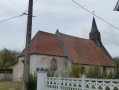
(4) At the junction, turn left into Huclier. In the village, take the first left towards the church (GRP®). Continue along the street and then follow the path that continues from it.

(5) At the crossroads, leave theGRP® and turn right onto the first path leading uphill, heading west, then after about 150 m, turn right and continue to the D88.

(6) At the junction, turn left towards the village of Conteville, follow the road keeping well to the right for about 400 m and, on the bend, take the path on the left heading south-south-east.

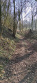
(7) Follow the road to the left and enter the woods via the footpath, passing by the gate. The paths through the woods have been altered due to demolition work and no longer match the IGN map; follow the route heading south-east.

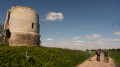
(8) At the crossroads of paths, turn right downhill and then, at the second crossroads, take the path on the left which leads to the Oratory of Saint Joseph.

(9) At the oratory, turn left and return to the starting point (S/E).

Waypoints

  1. S/E : mi 0 - alt. 302 ft - Car park at the - Abbaye de Belval
  2. 1 : mi 0.21 - alt. 318 ft - Crossroads. Take the road on the left
  3. 2 : mi 1.05 - alt. 390 ft - Crossroads
  4. 3 : mi 1.36 - alt. 463 ft - T-junction
  5. 4 : mi 2.07 - alt. 459 ft - Junction with the local road
  6. 5 : mi 2.61 - alt. 397 ft - T-junction
  7. 6 : mi 3.26 - alt. 505 ft - Junction with the D88
  8. 7 : mi 4.67 - alt. 404 ft - Path leading into the woods
  9. 8 : mi 4.81 - alt. 351 ft - Path junction
  10. 9 : mi 4.93 - alt. 295 ft - St Joseph’s Oratory
  11. S/E : mi 5 - alt. 308 ft - Belval Abbey car park

Notes

You’ll be walking on paths that are either stony or grassy, so choosing the right footwear is essential.

Alternative route: if you wish to avoid the woodland at point (7), follow the road to point (9)

Worth a visit

Reviews and comments

4 / 5
Based on 2 reviews

Reliability of the description
4 / 5
Ease of following the route
4 / 5
Route interest
4 / 5
Elisabeth62
Elisabeth62

Overall rating : 4.7 / 5

Date of your route : Oct 24, 2026
Reliability of the description : ★★★★★ Very good
Ease of following the route : ★★★★★ Very good
Route interest : ★★★★☆ Good
Very busy route : No

The first half of the walk is really lovely, winding through woods and fields. I found the return leg less enjoyable as it follows a quiet country lane in the middle of the plain (and I don’t like monotony!), but overall it was a lovely walk!

Machine-translated

elvenly
elvenly

Overall rating : 3.3 / 5

Date of your route : Aug 21, 2022
Reliability of the description : ★★★☆☆ Average
Ease of following the route : ★★★☆☆ Average
Route interest : ★★★★☆ Good
Very busy route : No

A lovely little walk alternating between woodland and fields, with very few cars about!

We did indeed spot a roe deer in the middle of the maize field

You only catch a brief glimpse of the abbey on the first climb and the final descent, but then again, it’s rather ugly so you’re not missing out on anything!

However, as for landmark number 7, either we’re completely blind, or you have to climb over barbed wire in the middle of the bushes, or the path in question doesn’t exist (or no longer does). So the easiest thing to do is carry on straight ahead and turn left at the crossroads to get back to the car park.

Machine-translated

Other walks in the area

For more walks, use our search engine .

The GPS track and description are the property of this route's author. Please do not copy them without permission.