Country:
 City:


Park in the car park of the Valhuon village hall
(S/E) With your back to the village hall, head left towards the north-east, cross Rue d’Antin and take the path opposite heading north-east. This path is passable but nature is beginning to reclaim it.
(1) At the T-junction, turn right towards the south-south-east, passing the sewage treatment works. Leave the path on your left. At the end of the path, rejoin the GRP®.
(2) Turn left towards the east, following the yellow and red markings. Ignore the two paths on the left and walk past a gas installation. At the T-junction, turn left towards the north-north-east.
(3) At the Y-junction with a track, leave theGRP® and follow the yellow markings heading north-north-east for approximately 2,000 metres. Enter Monneville, a hamlet of Bourg.
(4) At the junction with the D 89, follow it by turning right towards the east, pass under the railway tunnel and turn right at a 90° angle towards the south. Follow the yellow markings.
(5) At the Y-junction, leave the D 89 and turn right towards the south, following the yellow markings.
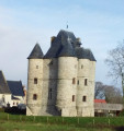
(6) At the Bois d’Antigneul junction, turn right towards the south-west and walk past Antigneul Castle. Turn left towards the south for 200 metres and take the path on the right towards the west. Follow the yellow signposts and cross the railway line.
(7) After the unmanned level crossing, take the path on the left heading south-west. Follow the track.
(8) At the junction with the D 77, turn right towards the north-west, following the yellow markings.
(9) At the Antin crossroads, by the chapel, take the road on the left heading south-south-west. At the next crossroads, turn right heading north-north-west and leave the yellow markings.
(10) At the cluster of houses, turn left onto the path heading south-west. After about 500 m, take the path on the right heading north-west.
(11) At the livestock farm, cross the road and take the grassy track heading south-west between the hedges, following the yellow markings. At the end of the track, continue straight ahead onto the road. Cross the D916 ( a busy road) and take the track opposite, heading north-west.
(12) At the next junction, turn right towards the east-north-east, leave the yellow markings behind and cross the D916 again, taking care as always. First turn right then left to take the path between the houses. At the end of the path, cross Rue du Rietz and return to the starting point (S/E).

 Visorando Member

 Easy
 Association / Club / Walk leader