In the footsteps of Saint Benoît Labre

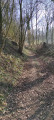
A short walk in the Ternois area to discover Belval Abbey and the house where Saint-Benoit Labre lived in Conteville-en-Ternois. You’ll enjoy the tranquillity of these paths and the beauty of the surrounding countryside.

Details

n°3133831
Creation:
Last update:
Last review:
  • Walking
    Activity: Walking
  • ↔
    Distance: 5.36 mi
  • ◔
    Average duration: 2h 40 
  • ▲
    Difficulty: Easy

  • ⚐
    Back to start: Yes
  • ↗
    Ascent: + 220 ft
  • ↘
    Descent: - 203 ft

  • ▲
    Highest point: 505 ft
  • ▼
    Lowest point: 256 ft
  • ⚐ Country: France
  • ⚐ City: Troisvaux (62130)
  • ⚑
    Start/End: N 50.416354° / E 2.338123°
  • ❏
    IGN map(s): Ref. 2305E, 2305O
  • Hour-by-hour weather

Description of the walk

Park in the car park at Belval Abbey.

(S/E) Leave the car park behind you and take the road to the right (west). Follow the road for approximately 1.8 km (yellow signposting). Enter Bethonval.

(1) Take the second road on the right (north).

(2) At a fork in the road, carry straight on along the path that goes uphill (yellow signposts; ignore the path branching off to the right). At the end of the path, you’ll come out onto a road; follow it to the right and enter Conteville-en-Ternois.

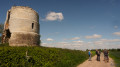
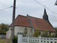
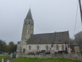
(3) At the junction, carry on straight ahead (ignore the yellow signpost leading off to the left). Walk past the church in Conteville (the house where Saint-Benoit Labre lived). Leave the road when it bends to the right (oratory) and take the path straight ahead (north-east).

(4) At the junction, carry on straight ahead and you’ll come across yellow signposts again. Ignore a turn-off to the left, then turn right onto the path.

(5) At the T-junction, follow the D88 to the right. After about 350 m, take a small road on the left. At the first track on the left, leave the yellow markings and go straight on (south-south-east). At the next junction, follow the track on the left.

(6) At the crossroads, turn right (south-west) and follow theGRP® du Ternois Nord. This will take you to Belval.

(7) Follow the main road to the right to return to the starting car park (S/E).

Waypoints

  1. S/E : mi 0 - alt. 302 ft - Car park - Abbaye de Belval
  2. 1 : mi 0.92 - alt. 256 ft - Béthonval
  3. 2 : mi 1.25 - alt. 299 ft - Fork in the road
  4. 3 : mi 2.06 - alt. 466 ft - Conteville-en-Ternois
  5. 4 : mi 2.64 - alt. 492 ft - Crossroads
  6. 5 : mi 3.42 - alt. 489 ft - T-junction
  7. 6 : mi 4.27 - alt. 397 ft - GRP of Northern Ternois
  8. 7 : mi 5.15 - alt. 318 ft - Belval
  9. S/E : mi 5.36 - alt. 302 ft - Car park - Abbaye de Belval

Notes

Hiking boots and walking poles are recommended.
Don’t forget to bring a small bottle of water

Worth a visit

Reviews and comments

4.2 / 5
Based on 2 reviews

Reliability of the description
4.5 / 5
Ease of following the route
4 / 5
Route interest
4 / 5
Mireille MELINE
Mireille MELINE

Overall rating : 3.3 / 5

Date of your route : Apr 14, 2025
Reliability of the description : ★★★★☆ Good
Ease of following the route : ★★★☆☆ Average
Route interest : ★★★☆☆ Average
Very busy route : No

I think the route needs updating,
for example, a road no longer exists but there is a small country lane.

The hamlet of Bethonval isn’t mentioned anywhere, and the locals don’t know it...

Machine-translated

Cloclo et Cricri
Cloclo et Cricri

Overall rating : 5 / 5

Date of your route : Jul 18, 2020
Reliability of the description : ★★★★★ Very good
Ease of following the route : ★★★★★ Very good
Route interest : ★★★★★ Very good
Very busy route : No

A lovely walk through the Ternois countryside, offering a variety of landscapes: a short stretch along a minor road at the start, followed by shaded paths through the forest, fields and a bit of an uphill climb – very pleasant. A hat is recommended in sunny weather. We made the most of the afternoon to visit Belval Abbey. The only downside: there are still no signposts for the walk, which partly follows another route, ‘In the Footsteps of Saint Benedict’, covering 12.7 km; luckily, we had the map and the accompanying instructions.

Machine-translated

Other walks in the area

For more walks, use our search engine .

The GPS track and description are the property of this route's author. Please do not copy them without permission.