Petit Pic d’Arriel via Lac d’Arrious and Passage d’Orteig

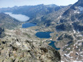
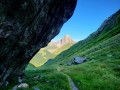
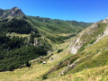
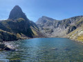
A very lovely circular walk featuring a summit with views, the Petit Pic d’Arriel at 2,683 m, a dizzying (yet perfectly safe) exposed section, the Passage d’Orteig, the magnificent Lac d’Arrious (not to mention all the lakes visible from the summit) and impressive nearby peaks such as the Pics d’Arriel, du Palas and the Balaïtous in particular.
Please note: this hike is only suitable for those accustomed to walking on difficult terrain, off the marked trail and using their hands for support. It may be considered very difficult.

Details

n°38714829
Creation:
Last update:
Last review:
  • Walking
    Activity: Walking
  • ↔
    Distance: 7.41 mi
  • ◔
    Average duration: 7h 00 
  • ▲
    Difficulty: Difficult

  • ⚐
    Back to start: Yes
  • ↗
    Ascent: + 4,114 ft
  • ↘
    Descent: - 4,094 ft

  • ▲
    Highest point: 8,707 ft
  • ▼
    Lowest point: 4,636 ft

Photos

Description of the walk

After Laruns, take the D934 leading to the Col du Portalet and, shortly after Lake Fabrèges, park at the Caillou de Soques.

(S/E) Head north-east along the HRP (Haute Route Pyrénéenne), which climbs quite steeply through the forest.

(1) On leaving the forest, cross the Ruisseau d’Arrious via a footbridge and follow the very wide HRP, which runs alongside the stream, to reach the Cabane d’Arrious.

(2) Carry on and, shortly afterwards, pass the Quèbe d’Arrious, a huge block of granite. Stay on the main path with its tight hairpin bends, until you reach a fork (alt. 2,068 m).

(3) Carry on straight ahead and eventually reach the Col d’Arrious (elevation 2,252).

(4) Turn immediately right and head towards the shores of Lac d’Arrious (alt. 2,283 m). The Petit Pic d’Arriel towers in the background.

(5) Continue the ascent to reach the Passage d’Orteig (alt. 2,316 m).

(6) Cross this impressive but completely safe pass, which has a handrail cable running its entire length; it’s no trouble at all in fine, dry weather. Continue along the HRP until you reach a fork in the path (alt. 2,362 m).

(7) Head up to the right – using your hands for a few metres – to reach the Pic du Lac d’Arrious.
This section is poorly marked with cairns and signposts but poses no navigation difficulties; head generally southwards towards the foot of the Petit Pic d’Arriel. Then descend towards a small, unnamed pass (alt. 2,505 m).

(8) Head south-west across a scree slope to reach the start of the actual ascent of the Petit Pic d’Arriel.

(9) Start with a small couloir where you’ll need to use your hands before reaching the ridge and joining a well-marked path that follows the ridge line and leads to the summit of the Petit Pic d’Arriel (elevation 2,683).

(10) After taking a moment to admire the view, don’t hesitate to use your hands for the first few metres. Continue south-east downhill to reach the Col d’Arriel (2,605 metres).

(11) Turn right, due west, onto the well-marked and cairned path leading to the Col de Sobe (2,449 metres).

(12) Caution: do not take the path that descends steeply to the left (due south) and leads into the neighbouring Spanish valley towards Sallent de Gallegomais. Descend due north towards the Vallon d’Arrious, where you’ll come to a fork in the path that you passed earlier on the way up.

(3) Turn left onto the HRP and follow the ascent route in the opposite direction to reach the Caillou de Soques (S/E).

Waypoints

  1. S/E : mi 0 - alt. 4,636 ft - Caillou de Soques
  2. 1 : mi 0.57 - alt. 5,141 ft - Footbridge
  3. 2 : mi 1.15 - alt. 5,722 ft - Cabane-d-Arrious (1695m)
  4. 3 : mi 2.13 - alt. 6,745 ft - Crossroads at the end of the circular loop
  5. 4 : mi 2.8 - alt. 7,408 ft - Col d'Arrious (2252m)
  6. 5 : mi 2.93 - alt. 7,480 ft - Lac d'Arrious (2290m)
  7. 6 : mi 3.08 - alt. 7,602 ft - Orteig Pass
  8. 7 : mi 3.24 - alt. 7,749 ft - Crossroads towards the Pic du Lac d’Arrious
  9. 8 : mi 3.6 - alt. 8,087 ft - A small pass below the - Pic du Lac d'Arrious (2495m)
  10. 9 : mi 3.76 - alt. 8,228 ft - Couloir du Petit Pic d’Arriel
  11. 10 : mi 3.96 - alt. 8,707 ft - Petit Pic d'Arriel (2683m)
  12. 11 : mi 4.09 - alt. 8,560 ft - Col d'Arriel (2605m)
  13. 12 : mi 4.49 - alt. 8,058 ft - Col de Sobe (2449m)
  14. S/E : mi 7.41 - alt. 4,642 ft - Caillou de Soques

This route passes through a protected area, which may be subject to special regulations:

Reviews and comments

5 / 5
Based on 1 review

Reliability of the description
5 / 5
Ease of following the route
5 / 5
Route interest
5 / 5
MCTOUL
MCTOUL

Overall rating : 5 / 5

Date of your route : Jun 19, 2025
Reliability of the description : ★★★★★ Very good
Ease of following the route : ★★★★★ Very good
Route interest : ★★★★★ Very good
Very busy route : No

Thank you, Morti93, for this route via the Pic du Lac d’Arriel. We did it last Thursday, in semi-wintery conditions, as persistent snowfields blocked our path several times after the Pic.
After climbing up the rocky ridge, we headed towards the Col de Sobe to tackle the Arriel, followed by the Petit Pic d’Arriel.

Machine-translated

Other walks in the area

For more walks, use our search engine .

The GPS track and description are the property of this route's author. Please do not copy them without permission.