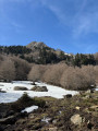
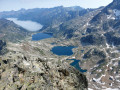
The banks of the Brousset

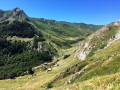
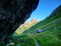
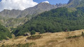
A leisurely walk, largely in the shade, with little change in altitude. A return trip along the same very pleasant path, which follows the banks of the Gave du Brousset in the Upper Ossau Valley. Halfway along the route, there is a possible turn-off to climb up to the Pombie Refuge.

Details

100023935
Creation:
Last update:
Last review:
  • Walking
    Activity: Walking
  • ↔
    Distance: 6.67 mi
  • ◔
    Average duration: 3h 55 
  • ▲
    Difficulty: Easy

  • ⚐
    Back to start: Yes
  • ↗
    Ascent: + 968 ft
  • ↘
    Descent: - 971 ft

  • ▲
    Highest point: 5,075 ft
  • ▼
    Lowest point: 4,104 ft

Description of the walk

On the Route du Pourtalet (D934), park in the car park near the restaurant just after Lac de Fabrèges, at Pont-de-Camps.

(S/E) Cross the D934 very carefully, turn left towards the restaurant, then take the wide path on the right just before the bridge over the Gave.

(1) Head straight on along the path on the left bank of the Gave du Brousset. Pass the climbing site and reach the Cabane des Quèbes.

(2) Carry on, leaving the bridge over the Gave on your left, and continue along the riverbank. Walk to the footbridge crossing the Gave towards the D934 and the Cabane du Caillou de Soques, the starting point of the path to Lac d’Artouste and the Lacs d’Arrémoulit.

(3) Keep straight ahead on the left bank of the Gave without crossing it, and carry on.

(4) As you pass, note a menhir and arrive at the wooden footbridge.

(5) Cross it and continue along the path, which climbs further, until you rejoin the D934 at the Pont de l’Ouradé.

(6) Follow the same route in the opposite direction to return to the car park (S/E).

Waypoints

  1. S/E : mi 0 - alt. 4,108 ft - Pont-de-Camps car park
  2. 1 : mi 0.16 - alt. 4,150 ft - Follow the path straight ahead
  3. 2 : mi 0.88 - alt. 4,275 ft - Cabane des Quèbes
  4. 3 : mi 2 - alt. 4,423 ft - Crossroads
  5. 4 : mi 2.91 - alt. 4,774 ft - Menhir
  6. 5 : mi 3.1 - alt. 4,862 ft - Wooden footbridge
  7. 6 : mi 3.3 - alt. 5,049 ft - Ouradé Bridge
  8. S/E : mi 6.67 - alt. 4,104 ft - Pont-de-Camps car park

Notes

Bar and toilets at the Pont-de-Camps restaurant. Several spots to cool off along the banks of the Gave du Brousset.

This route passes through a protected area, which may be subject to special regulations:

Worth a visit

(3) Halfway along the route, there is a possible turn-off to the right leading up to the Refuge de Pombie.
(4) Just before the wooden footbridge, there is a menhir on the right-hand side of the path.

Other walks in the area

For more walks, use our search engine .

The GPS track and description are the property of this route's author. Please do not copy them without permission.