Country:

 City:
City:


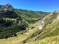
(S/E) Leave the Pont de Camps car park, above Lac de Fabrèges in the upper Ossau valley. Take the small road on the right just below the bridge, and 80 metres after the hairpin bend, look out for the marked path on the left.
(1) Follow it up through a shady woodland, winding south-westwards, but with a steep gradient. As you emerge from the forest, the chamois await you in a wide-open landscape.
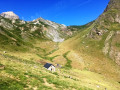
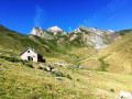
(2) The path continues to the left, along the edge of the forest, until you catch sight of the Cabane Saoubiste, occupied by a shepherd during the summer (cheese on sale at the hut).
(3) Head back north-east, slightly to the right of the access path, to follow the contour line heading towards the forest. The path is barely marked. It turns at a 90° angle towards the south-east and follows the forest edge as it descends towards the south. Follow the GPX track: there are few markings on the ground. The path crosses a first scree slope (Arrec de Gréchat), then a second (Ravin de Pombie: don’t be put off by the word ‘ravine’!)
(4) Carry on, then turn right, heading south-west towards the Cabane d’Arrégatiou, further down. A lovely little hut in stunning natural surroundings, with a lounge and duplex bedrooms!
(5) From the hut, take a path heading south-west which very quickly leads into the forest and rejoins the very wide track descending from the Refuge de Pombie. Please note: this wide track is intended for livestock heading up to the summer pastures!
(6) Take a small path to the left, following a small yellow arrow, to rejoin the trail. Otherwise, you’ll have to walk an extra 3 km of uninteresting terrain. You’ll come out onto the plain and the GR®108.
(7) Facing the Gave de Brousset, turn left heading due north along the GR®108, which leads back to Pont de Camps (S/E).
 Visorando Member
 Easy
Easy 
 Difficult
 Very difficult
 Association / Club / Walk leader