


Refine your search for walks in Pas de l'Oeille (2009m)
Pas de l'Oeille (2009m) walks


 From Col du Coq to Sainte-Marie-du-Mont
 Visorando Member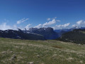
 14.29 mi
 +4,423 ft
 -5,938 ft
 10h 25
 Very difficult
 Departure from Saint-Pancrasse (Isère)
The route runs mainly through the Chartreuse Natural Park, passing through the massif's iconic passes and mountains. The route combines fairly steep climbs, passages through plateaus, mountain pastures and a village.
Dent de Crolles and Lance Sud de Malissard loop via Perquelin
 11.77 mi
+5,079 ft
-5,052 ft
8 hrs
Very difficult
Departure from Saint-Pierre-de-Chartreuse (Isère)
11.77 mi
+5,079 ft
-5,052 ft
8 hrs
Very difficult
Departure from Saint-Pierre-de-Chartreuse (Isère)
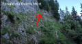
Here is an unusual and challenging hike. It takes in all the must-see sights of the Dent de Crolles and its surroundings: Source du Guiers Mort, Arche à l’Aiguille, Sangle Barrère, Chemin des Crêtes, Arche de Rocheplane and Lance Sud de Malissard.
⚠️ 05/06/2026: route modified to avoid the Trou du Glaz path, which has been closed since November 2025 following a rockslide.
 Aulp du Seuil Hut – Pravouta Hut
6.81 mi
+2,815 ft
-3,009 ft
8 hrs
Very difficult
Departure from Saint-Bernard (Isère) (Isère)
Day2 of this trip via the Col de Bellefont to reach the Dent de Crolles plateau.Descent via the pass above the Trou du Glaz, then down to the Col des Ayes and up the Roc d’Arguille to the Col de Pravouta and the hut of the same name.
⚠️ 27/11/2025: Route modified following a rockfall. It is no longer possible to take the path via the Trou du Glaz (5). The area remains particularly dangerous due to the high risk of further rockfall and falling boulders. Following this incident, the municipality of Saint-Pierre de Chartreuse has issued a by-law to close several hiking trails (for walking, snowshoeing and ski touring). For an ascent of the Dent de Crolles, it is possible to take the route via the Pas de l’Oeille.
You can also go via the Guiers waterfalls to reach (E).
Walks near Pas de l'Oeille (2009m)
Cabane de Pravouta - La Plagne
15.41 mi
+4,469 ft
-6,211 ft
12 hrs
Very difficult
Departure from Saint-Pierre-de-Chartreuse (Isère)
Third and final day of this trip to the Chartreuse to collect the car.
Col de Bellefont via Le Chaos and back via the Col de Saulce
6.85 mi
+3,720 ft
-3,678 ft
6h 25
 Difficult
Departure from Saint-Pierre-de-Chartreuse (Isère)
Difficult
Departure from Saint-Pierre-de-Chartreuse (Isère)
A beautiful, wild hike in the heart of the Chartreuse and on the edge of its nature reserve. The route starts in the woodland, to the sound of the waterfall and the source of the Guiers, climbs up the cliff face, crosses the wild and rugged Chaos de Bellefont, passes through mountain pastures, and reaches the ridge with its stunning views.
Le Pal de Fer
1.43 mi
+2,001 ft
-0 ft
2h 25
 Moderate
Departure from Crolles (Isère)
Moderate
Departure from Crolles (Isère)
An original outing that allows you to discover the superb work carried out here for the construction of the Touvet funicular railway. The ascent is on foot and the descent, to relieve the knees, is by funicular.
(Please note): This route is currently closed. See explanations here
(Comment from a hiker) dated 18 June 2023: small difficult section: crossing the scree slope where you need to use two ropes to reach the path in the forest.
Manival - Côte Bonne
 4.52 mi
+1,434 ft
-1,421 ft
3h 20
4.52 mi
+1,434 ft
-1,421 ft
3h 20
 Easy
Departure from Saint-Ismier (Isère)
Easy
Departure from Saint-Ismier (Isère)
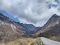
Footprints in the snow for this walk, which can be enjoyed in the summer sun or in the shade of oak and fir trees...
Tour of the two highest peaks in the Chartreuse
 17.39 mi
+6,673 ft
-8,005 ft
7 hrs
Very difficult
Departure from Sarcenas (Isère)
17.39 mi
+6,673 ft
-8,005 ft
7 hrs
Very difficult
Departure from Sarcenas (Isère)
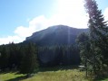
Chamechaude (2,082 m) and the Dent de Crolles (2,062 m) are the two highest peaks in the Chartreuse; allow for a walk of around 30 km – fancy a go?
Lac de la Jasse and Col de Bédina
 4.20 mi
+410 ft
-2,562 ft
2h 15
Moderate
Departure from Les Adrets (Isère)
4.20 mi
+410 ft
-2,562 ft
2h 15
Moderate
Departure from Les Adrets (Isère)
A beautiful high-altitude lake accessible by chairlift from Prapoutel. Descent via the wilder side of the resort. Passes by Gros Caillou, a popular spot for climbers.
Pont de la Betta - Lac Blanc
 7.77 mi
+4,072 ft
-1,286 ft
7h 05
Difficult
Departure from Laval (Isère)
7.77 mi
+4,072 ft
-1,286 ft
7h 05
Difficult
Departure from Laval (Isère)
First stage of this lovely circular route in Belledonne, with the magnificent mountain lake, Lac Blanc, as the final backdrop.
From Lac de la Jasse to Prapoutel via Gros Cailloux
 3.08 mi
+2,241 ft
-2,684 ft
3h 20
Moderate
Departure from Les Adrets (Isère)
3.08 mi
+2,241 ft
-2,684 ft
3h 20
Moderate
Departure from Les Adrets (Isère)
This is a magnificent, easy walk that takes you through many beautiful natural sites, with breathtaking views of the Grésivaudan valley and the Chartreuse mountains.
Sept Laux Day 1
 7.18 mi
+4,232 ft
-1,614 ft
7h 00
Difficult
Departure from Laval (Isère)
7.18 mi
+4,232 ft
-1,614 ft
7h 00
Difficult
Departure from Laval (Isère)
A very beautiful stage in the Belledonne Massif, starting from the mountain pastures, which takes us through a mineral world to a setting of tranquillity on the edge of the Sept Laux (seven lakes).
Grenoble and the Isère Greenway
 5.31 mi
+16 ft
-7 ft
2h 25
Easy
Departure from Grenoble (Isère)
5.31 mi
+16 ft
-7 ft
2h 25
Easy
Departure from Grenoble (Isère)
You’ll pass through the narrow streets of Grenoble city centre and on to the wide open green spaces on the northern outskirts of the city. In particular, you’ll pass through the Parc de l’Île d’Amour (suitable for all ages…) and the arboretum at the university campus. You’ll hardly feel as though you’re in an urban setting anymore.