Country:

 City:


Start from L’Herbe Tendre in Saint-Pierre-d’Entremont.
(S) Follow the road towards the church.
(1) At the junction, turn right and cross the bridge over the Guiers Vif. Walk past the town hall and the chapel, following the road alongside the Cozon.
(2) Take a short detour to the right along Rue de la Fruitière, rejoin the road and continue along it to the right.
(3) Cross the bridge over the Cozon, pass the Pont du Lac and carry on straight ahead, staying on the road to reach Épernay. Reach the junction between the town hall and the church.
(4) Turn right onto Route de l’Église, then continue along the track towards the hamlet of La Plagne.
(5) Pass the turn-off to the houses at La Grénery on your left and carry on straight ahead to join the Route de la Plagne.
(6) Before reaching the telecoms mast, ignore the road on the left and carry on straight ahead. Pass the Habert farm.
(7) Leave the road and take the path on the left leading to the centre of La Plagne. Cross the hamlet from the north, then turn left onto the forest track to head for the Priz barns.
(8) Turn right and continue climbing. The gradient becomes much steeper.
(9) At the junction, head sharply to the right to begin the very steep climb leading to La Balme à Collomb (incorrectly spelt on the IGN map).
(10) Pass through this cave, which was home to cave bears over 25,000 years ago, then continue to the left above the cave, following the path to the ridge: yellow signpost.
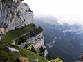
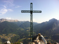
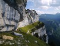
(11) Temporarily ignore the path on the right which descends to the Col de l’Alpette and continue straight on to the summit of Mont Granier, marked by a plaque on the ground. The cross is 300 m further on, to the north.
(12) Retrace your steps to the junction.
(11) Head down to the left towards the Col de l’Alpette via the Pas des Barres.
(13) Descend the Pas des Barres chimney, which is equipped with cables. Continue to the Col de l’Alpette.
(14) Head down to the left towards the Cabane de l’Alpette, leave it on your right and climb through the woodland in the Cirque du Pinet until you reach the edge of the forest.
(15) Head right to reach the summit of Le Pinet (Le Truc).
(16) Return to the junction.
(15) Continue the route to the right across the vast Alpe plateau.
(17) Pass by the pastoral ruins of Habert de Saint-Vincent, walk alongside a small lake, then take a sharp right-hand bend, leaving the Chalet de l’Alpe on your left. Look out to the south for posts marking the path through the sharp limestone pavement and head for the first one.
(18) Look out for the next marker and continue south. Cross a gap next to a marker post and continue zigzagging through the sharp limestone pavement until you reach the Pas de l’Échelle: note the engravings in the rock marking the border between the Kingdom of France (fleur-de-lis) and Savoy (cross).
(19) Continue downwards.
(20) Go through a barbed-wire fence to descend into the Pratcel valley. You’ll reach a watering trough at the Pré de Pratcel, where a few cows graze on the mountain pastures in season.
(21) Continue along a good forest track which descends steeply.
(22) Leave the forest track and take a path on the left which winds down through the forest. This path starts just after a large concrete support beam. This fairly steep path leads out onto the Route de Saint-Même, which you follow to the left up to the Chalet du Cirque de Saint-Même (E).
 Visorando Member
 Moderate
 Tourist office


 Easy
 Difficult
 Extremely difficult