Cirque de Saint-Même – Col du Coq

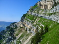
The fifth and final stage of the Tour of the Ten Highest Peaks of the Chartreuse, linking the Cirque de Saint-Même to the Col du Coq, via the Lance Sud de Malissard, the Dôme de Bellefond, the Piton de Bellefond, and the Dent de Crolles. This is one of the longest stages of the Tour, featuring a technical section: the Pas de la Mort.

This walk is part of a multi-day hike: Tour des 10 plus hauts sommets de Chartreuse

Details

n°100891376
Creation:
Last update:
–
Last review:
–
  • Walking
    Activity: Walking
  • ↔
    Distance: 13.05 mi
  • ◔
    Average duration: 11h 35 
  • ▲
    Difficulty: Very difficult

  • ⚐
    Back to start: No
  • ↗
    Ascent: + 6,362 ft
  • ↘
    Descent: - 4,580 ft

  • ▲
    Highest point: 6,759 ft
  • ▼
    Lowest point: 2,818 ft

Description of the walk

(S) Set off from the Chalet du Cirque de Saint-Même and head for the Sentier des Cascades.

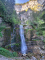
(1) Follow it and don’t hesitate to take detours to admire the successive waterfalls cascading at different levels. Continue and, via several traverses equipped with cables, reach the Pas de la Mort.

(2) Cross it along a dihedral equipped with steps, handholds and cables. Continue slightly uphill through the woods and reach the junction with the Alpette des Dames trail in the Forêt de l’Aulp du Seuil. At this crossroads, you’ll find the GRP® Tour de Chartreuse trail.

(3) Turn left onto it, follow the yellow and red markings and arrive in a clearing at the junction with the Roman inscriptions.

(4) Turn right to reach these inscriptions.

(5) Head back down the path you came up via to the crossroads.

(4) Turn right onto the GRP®, walk along the almost flat path through the Vallon de Marcieu and you’ll soon come to the path leading to the Chalet de l’Aulp du Seuil.

(6) Ignore this chalet and continue on to the Col de Bellefont.

(7) Take the path on the right and climb towards the Lance Sud de Malissard. The start is a little steep on unstable ground, then follow the well-marked path to reach the summit.

(8) Turn back and descend via the same route you took up.

(7) Cross the Col de Bellefont and continue straight ahead. At the T-junction, turn left towards the Dôme de Bellefont.

(9) Retrace your steps, then at the junction continue along the ridge to reach the Piton de Bellefont.

(10) Keep the ridge straight ahead, descend and reach the Pas de Montbrun.

(11) Cross it, and continue along the ridge to the Pas de Rocheplane.

(12) Turn right down the slope, enter the forest and then find the Chemin d’Assise in the Chaos de Bellefont.

(13) Take this path to the left and continue to the junction with the path leading to the Trou du Glaz.

(14) Turn left onto the path leading directly up to the Dent de Crolles. Then make your way to the summit.

(15) From the summit, descend north-westwards towards a clearly marked rocky lookout point. Then enter the Pas de l’Oeille via a short section of downclimbing, continue to the Col des Ayes and rejoin the GRP® here.

(16) Turn left onto it and complete the descent to the Col du Coq, the end point of this five-day trek (E).

Waypoints

  1. S : mi 0 - alt. 2,828 ft - Cirque de St-Même
  2. 1 : mi 0.23 - alt. 2,838 ft - Waterfall Trail
  3. 2 : mi 1.09 - alt. 4,206 ft - Pas de la Mort (1340m)
  4. 3 : mi 1.71 - alt. 4,849 ft - L'Alpette des Dames
  5. 4 : mi 3.06 - alt. 5,269 ft - Junction for the Roman inscriptions
  6. 5 : mi 3.79 - alt. 6,211 ft - Roman inscriptions
  7. 6 : mi 5.33 - alt. 5,469 ft - Chalet de l'Aulp du Seuil
  8. 7 : mi 6.44 - alt. 6,250 ft - Col de Bellefont (1902m)
  9. 8 : mi 6.74 - alt. 6,637 ft - Malissard South Spire
  10. 9 : mi 7.4 - alt. 6,460 ft - Dôme de Bellefont
  11. 10 : mi 7.76 - alt. 6,398 ft - Piton de Bellefont (1958m)
  12. 11 : mi 7.99 - alt. 6,115 ft - Pas de Montbrun
  13. 12 : mi 8.4 - alt. 6,073 ft - Pas de Rocheplane (1860m)
  14. 13 : mi 8.69 - alt. 5,594 ft - Junction
  15. 14 : mi 10.11 - alt. 5,850 ft - Junction towards the Trou du Glaz
  16. 15 : mi 10.91 - alt. 6,759 ft - Dent de Crolles
  17. 16 : mi 12.15 - alt. 5,059 ft - Col des Ayes
  18. E : mi 13.05 - alt. 4,596 ft - Col du Coq

Notes

Access via the Pas de la Mort is exposed but very well equipped.

Important: signs are posted throughout the Vallon de Marcieu, asking walkers not to leave the path to protect the flora and fauna; in reality, this is to preserve a 750-hectare private hunting reserve that encompasses the Aulp du Seuil, the famous Tour Percée and the entire Vallon de Marcieu, including access via the pass to the Lances de Malissard.

This pass, situated to the left of the Roman inscriptions (5), used to provide access to a path leading to the Lances de Malissard. The safety equipment and climbing cables were removed in August 2023, and the anchors were sawn through, rendering the passage impassable.

From (12), it is possible to continue along the ridge to the Cheminée du Paradis (technical and exposed).

From (14), it is possible to reach the Sangle de Barrère (aerial), leading up to the Dent de Crolles.

This route passes through a protected area, which may be subject to special regulations:

Worth a visit

(S/E): the Cirque de Saint-Même, the jewel in the crown of the Chartreuse Massif, with a meandering torrent, numerous waterfalls, a gigantic cave, and a labyrinth winding through a jumble of enormous boulders.
Between (4) and (6): the much-coveted Vallon de Marcieu.
(5) : The Roman inscriptions that once marked a property boundary, that of the Avéiens.
Between (9) and (15): the repeated yet ever-changing views from the four successive summits.

Other walks in the area

For more walks, use our search engine .

The GPS track and description are the property of this route's author. Please do not copy them without permission.