Country:
 City:


Start at the Fort Montbarey stop, accessible by bus (line 11) or tram (line A).
Yellow signposting
(S) Head south-east, leaving the car park on your right. Turn left onto Rue du 11 Novembre 1918, then right onto Rue Albert Thibeaudet. Continue along this street, which winds in places, ignoring any side streets and cul-de-sacs.
(1) Cross Rue de Pont al Louet and continue straight ahead into Rue Jacques Blaise. At the end, turn left into Rue Alexandre Trauner. At the end, turn right into Rue de Kervaze. Continue along Chemin du Hildy. Go round the oil depot on the right and head down to the junction with Rue de la Maison Blanche.
Unmarked
(2) At the junction, to avoid an area that may be marshy or poorly maintained, head down Rue de la Maison Blanche to the left until you reach the beach of the same name.
Red and white markings
(3) Turn right onto theGR® 34, which runs alongside the Route de Saint-Anne de Portzic. Continue along this route for approximately 500 m.
(4) As you come out of a right-hand bend on an uphill stretch, leave the road and turn left onto the path which winds down towards the sea.
(5) Pass by the foot of Portzic Lighthouse and continue along the coastal path which runs alongside the road.
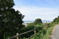
(6) The path veers away from the road. Walk along Anse de Sainte-Anne and its beach. The path then moves away from the beach. Further on, climb a metal staircase.
(7) At the top, turn left and follow the road back down to the coast. Continue along the road, skirting Sainte-Anne Bay once more.
(8) At the jetty in the port of Sainte-Anne, continue along the road. After about 150 m, leave the road and turn sharply left onto a path. Walk along the rocky coast to the Pointe du Diable.
(9) Continue to follow theGR® path which runs alongside Dellec Beach. Walk past the beach car park and head towards Fort du Dellec.
(10) Continue to follow the coastal path until you reach a stretch of road.
(11) After about a hundred metres on the road, take a path on the left. Turn right and follow the coastal path westwards.
(12) Cross the road leading down to Fort du Mangant (closed to the public) and continue along the path opposite. Climb up and turn left onto the path. At the top, ignore two paths branching off to the right and walk past the fort on your left. Join the coastal path again and follow it for a long stretch, heading west-south-west.
No signposting
(13) When you reach the tarmac road, turn left to access Fort du Minou and the headland (viewpoint). Retrace your steps.
Red and white markings
(13) Continue along the road with theGR® and, after a few dozen metres, take a path on the left. Join a road again and follow it northwards for about fifty metres.
(14) Then climb a flight of steps on the left. At the top, turn left and continue along the coastal path. Walk alongside a stream, come out onto a small road and follow it to the left. At the junction that appears immediately, first turn left then right. After two successive left-hand bends, you’ll reach Fort de Toulbroc’h.
(15) Turn right and walk past the fort on your left. Pass an old battery and continue along the coastal path. Ignore all turn-offs to the right. After a long walk, you’ll reach Trégana Beach.
(16) Walk up Impasse du Goulet and ignore the cul-de-sacs on the right.
(17) You’ll come out onto Route de Trégana; follow it downhill to the left. Walk alongside Tréganat Beach.
(18) At Portez Beach, continue along theGR® to Porsmilin Beach.
No signposting
(19) At the car park, head up Rue de Porsmilin on the right, ignoring another street on the right.
(20) You’ll come out onto Rue de Quelarguy; follow it to the right. Join Rue Jean Colle and follow it slightly to the right until you reach the bus stop for line 11 (E).

 Visorando Member
 Easy

 Moderate