Country:
 City:
City:


Park in the car park at the entrance to the village (Rue du Château).
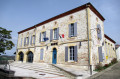
(S/E) Leave the car park to the left and head up towards the village centre via Rue des Remparts. Walk past the town hall, continue straight on past the foot of the cross and, at the end of the tarmac, carry on down the grassy path.
(1) About a hundred metres before the end of the descent, turn left onto the grassy path to the left of a wire fence. Continue to the next path on the right (a shortcut is possible; see the Practical Information section).
(2) Turn right onto a stony track and continue to a road, where you should turn left. Pass the turn-off for Jouanroux and carry on to the next track.
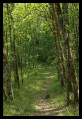
(3) Turn left onto the Chemin de Las Traverses until you reach the Roman road at a place called Téraudet. Turn left and, once the road ends near a stream, continue along the grassy path.
(4) Turn right onto the path leading uphill until you reach the road where you turn left.
(5) At the hamlet of Mestrébernat, leave the road leading up to Clermont-Soubiran on your left and take the road descending to the right for about 100 metres. At the rubbish collection point, leave the Route des Vignes on your left and carry on straight ahead along the Côte de Rigou, a dead-end road marked with yellow signposts and the first climb of the route. Pass through the hamlets of Rigou and then Jeangris.
(6) At the end of the road, continue along the path leading down to Calpré to rejoin the tarmac of the Route des Narcisses.
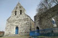
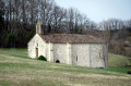
(7) At the hamlet of Lapeyrade, turn left, then immediately right onto the C102, Route des Orchidées. This second climb on the route passes through the hamlet of Cardayre and leads to the Chapel of Notre-Dame d’Aureillac. Continue to the end of the road. At the end of the public road, at the small ‘Aureillac’ sign, turn off onto the stony track on the left which leads to the Espérou house and then rejoins a section of road, marked with yellow signposts.
(8) At the bend in the road, pass between the two cedars and take the grassy ridge path to the left. Continue along the path until you reach a road with the Belle Vue house on your right.
(9) Leave the road leading down into the valley on your left and the road to the Belle Vue house on your right. Cross the road and head down the grassy path opposite. After passing the Jeanpau house on your right, the yellow-marked path becomes narrow and can be muddy in winter or in wet weather. The suggested route bypasses this area to the left, joining the road leading to Jeanpau before descending to the D121. When you reach the D127, Route des Iris, turn right for about 250 metres, then left onto the Route de Vignes towards the Moulin de Mallet. Pass the entrance to the mill and continue uphill – this is the third climb on the route.
(10) After several bends, at the corner of a fenced-off meadow on the right, take the path along the wire fence, running parallel to a private gravel track. Follow this path, which leads onto a road; turn right here and then, immediately afterwards, left to return to the starting car park (S/E).

 Association / Club / Walk leader
 Visorando Member
 Easy
Easy 
 Difficult