Mont Saint-Mury

Mont Saint-Mury is a prominent peak on the northern ridge descending from the Lances de Domène via the Pointe de la Sitre. It is fairly easily accessible, in both summer and winter, and offers a fine view of the Belledonne range.

Details

n°31373699
Creation:
Last update:
Last review:
  • Snowshoeing
    Activity: Snowshoeing
  • ↔
    Distance: 5.94 mi
  • ◔
    Duration according to the author: 6 hrs 
  • ▲
    Difficulty: Difficult

  • ⚐
    Back to start: Yes
  • ↗
    Ascent: + 2,743 ft
  • ↘
    Descent: - 2,743 ft

  • ▲
    Highest point: 6,634 ft
  • ▼
    Lowest point: 3,888 ft

Photos

Description of the walk

From Brignoud or Villard-Bonnot, in the Grésivaudan region, head up to Saint-Mury-Monteymond and join the CD280. Take a road heading west which joins the Route de Pré Long; follow this up to the pass (car park before the sign).

(S/E) At the signpost, turn left (east) onto the forest track towards the Refuge du Pré du Molard. It climbs at a more or less moderate gradient through the forest to join the forest road, which you follow to the left until you reach the bend and junction at La Souille (signposted ‘Pré Comté’).

(1) Leave the road, ignoring the path to the Refuge Jean Collet, and take the path that climbs southwards up a steeper slope before rejoining the forest track at its summer terminus at the Col du Pré du Molard.

(2) Head for the mountain pasture (signposted ‘Le Clos’) and take the track on the left heading south. It winds upwards in a few hairpin bends to a junction (which you’ll come across again on the way back) where the refuge is signposted to the right.

(3) Turn right and reach the Pré du Molard mountain hut after about 200 m.

(4) Climb behind the refuge up the grassy ridge heading east, with Mont Saint-Mury (actually its secondary summit) in your sights.

(5) At the top of the mountain pasture, turn right and continue the ascent. The slope steepens and the path becomes steeper, winding between the rocks. It reaches a small plateau on the secondary summit: two humps are still visible leading up to the summit. Pass to the left of the first one to rejoin the tracks coming from Les Sabottes.

(6) Continue along the right-hand side beneath the north-eastern slope of the summit to pass it and reach the small pass linking it to the Sitre ridge. Turn right to climb the final, rockier metres to the main summit.

(7) Return to the small pass and then follow your tracks north-west until you reach the junction of the tracks.

(6) Then descend the slopes to the right, which have become easier going, before veering left to join a ridge line overlooking Les Sabottes.

(8) Do not miss the turn-off to the left onto the path descending towards the Habert des Sabottes, before traversing level towards the west. It is possible to descend directly to the Habert and take its access path leading to the Croisement Pré du Molard-Habert des Sabottes, or to continue level towards the refuge (GPS track).

(5) Before descending to the refuge, take the snowy slope on the right, which leads easily back to the Habert access track; turn left onto this track.

(3) At the junction, descend via the hairpin bends to the Col du Pré du Mollard.

(2) Turn right onto the path you took on the way up and head towards La Souille.

(1) Descend via the path you took on the way up to the car park (S/E).

Waypoints

  1. S/E : mi 0 - alt. 3,891 ft - Pré-Long - Col de Pré Long (1189m)
  2. 1 : mi 0.87 - alt. 4,436 ft - La Souille or Pré Comté
  3. 2 : mi 1.29 - alt. 4,885 ft - Col du Pré du Molard or Le Clos - Col du Pré du Molard (1485m)
  4. 3 : mi 2.06 - alt. 5,623 ft - Pré du Molard-Habert des Sabottes junction
  5. 4 : mi 2.2 - alt. 5,689 ft - Pré du Molard mountain hut - Refuge du Pré du Molard (1740m)
  6. 5 : mi 2.34 - alt. 5,856 ft - Junction shared by ascent and descent routes
  7. 6 : mi 2.72 - alt. 6,532 ft - Junction with the Sabottes path
  8. 7 : mi 2.88 - alt. 6,634 ft - Mont Saint-Mury
  9. 8 : mi 3.31 - alt. 6,122 ft - Turn left towards Les Sabottes
  10. S/E : mi 5.94 - alt. 3,891 ft - Pré-Long - Col de Pré Long (1189m)

Notes

The road is passable by vehicle in summer as far as La Souille and even the Col du Pré du Mollard. In winter, it is not cleared of snow and you may have to set off from the bottom. In spring, you generally ascend the entire paved section, up to the Col de Pré Long.

The ascent to the refuge is signposted (yellow markers plus signs), as is the return route from Les Sabottes, but snow covers most of the markings.

The two main summits can be climbed directly via a steep snow couloir, but without snowshoes (ice axe recommended). If you wish to keep your snowshoes on, you must bypass the summit to the left as indicated: the snowshoes are left at the small pass on the ridge, and you climb the final ridge on foot.

When snow is scarce later in the season, the route via Les Sabottes remains passable on skis or snowshoes for longer.

(2) On the return journey, you can choose to stay on the forest track, which takes a wide detour to reach La Souille. Similarly, after the (1), the descent to the car park can be done entirely via the forest track.

Worth a visit

The refuge is well-equipped and modernised: it is sometimes open during the winter season; otherwise, there is a winter refuge next door (bring everything you need for the night).

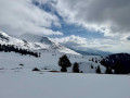
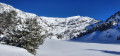
The views open up as you climb.
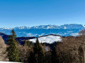
From the summit, the view is sweeping: the western slopes of Belledonne (Grand Replomb, the Trois Pics, Lances de Domène, Grand Colon), and opposite: the Vercors, Chartreuse, Bauges and Aravis.

Reviews and comments

4.7 / 5
Based on 1 review

Reliability of the description
5 / 5
Ease of following the route
5 / 5
Route interest
4 / 5
gire38
gire38

Overall rating : 4.7 / 5

Date of your route : Oct 16, 2022
Reliability of the description : ★★★★★ Very good
Ease of following the route : ★★★★★ Very good
Route interest : ★★★★☆ Good
Very busy route : No

I’d already done this route before it was listed on Visorando. It really is a lovely viewpoint, but the section between the Pré Long car park and the Pré du Molard car park isn’t particularly interesting, apart from the mushrooms in autumn!

Machine-translated

Other walks in the area

For more walks, use our search engine .

The GPS track and description are the property of this route's author. Please do not copy them without permission.