Refine your search for walks in Mont Charvin
Mont Charvin walks


 The Mont Charvin circular
 Visorando Member
 6.75 mi
 +3,596 ft
 -3,566 ft
 6h 15
6h 15
 Difficult
 Departure from Le Bouchet (Haute-Savoie)
A somewhat aerial hike offering spectacular views. The passage by the lake provides an opportunity for a pleasant break.
As the route includes a section of via ferrata, cables are in place during the summer season on the most difficult parts. However, it is not recommended to attempt this route in wet weather, as some sections can be slippery and falls are not permitted.
The final section of this hike is reserved for experienced hikers.
Mont Charvin
5.10 mi
+2,526 ft
-2,500 ft
4h 35
 Moderate
Departure from Saint-Jean-d'Arves (Savoie)
Moderate
Departure from Saint-Jean-d'Arves (Savoie)
The unmissable hike in Saint-Jean-d'Arves.
The Charvin circular loop from Sous l’Aiguille
 8.06 mi
+5,564 ft
-5,607 ft
8h 35
Difficult
Departure from Manigod (Haute-Savoie)
8.06 mi
+5,564 ft
-5,607 ft
8h 35
Difficult
Departure from Manigod (Haute-Savoie)
Mont Charvin is the southernmost peak of the Aravis range. The hike described is quite long and demanding. From the Pas de l’Ours onwards, there is a stunning panorama. The full 360° view takes in the entire Mont Blanc massif, the Chablais, the Oisans and as far as the Vanoise, and even further towards the Gran Paradiso. The summit is hard-earned but well worth the effort. This hike is not recommended for those who are afraid of heights.
⚠️ A user wrote:
> For your information, the via ferrata is ‘open’ from 30 June to 15 October. Outside these dates, the cables are taken down. This was the case on that particular day (17 June).
Walks near Mont Charvin
 From Chaucisse to the Col des Aravis via the Chalet du Curé
 9.45 mi
+2,146 ft
-1,463 ft
5 hrs
Difficult
Departure from Saint-Nicolas-la-Chapelle (Savoie) (Savoie)
9.45 mi
+2,146 ft
-1,463 ft
5 hrs
Difficult
Departure from Saint-Nicolas-la-Chapelle (Savoie) (Savoie)
Starting from the hamlet of Chaucisse, this walk, with Mont Blanc as a backdrop, takes you into a magnificent landscape at the foot of the Étalle, then past the well-known Chalet du Curé, before descending gently towards the Col des Aravis.
Les Saisies - Roselette Chalet
10.55 mi
+2,303 ft
-1,647 ft
6h 50
Moderate
Departure from Hauteluce (Savoie)
Stage 1 of the Tour du Beaufortain, connecting Les Saisies resort to the Roselette chalet.
Aiguille des Calvaires and Combe de Borderan
4.54 mi
+1,762 ft
-2,923 ft
3h 35
Moderate
Departure from La Clusaz (Haute-Savoie)
A great pointy summit with a cross on top and good views followed by a descent of Borderan Combe. This could easily be done in reverse and/or without the use of the cable cars.
Molliessoulaz Lodge - Les Saisies
9.49 mi
+4,888 ft
-2,579 ft
8h 35
Difficult
Departure from Queige (Savoie)
The final stage of the Tour du Beaufortain, between Molliessoulaz and Les Saisies.
From Albertville station to the Refuge du Soplat des Streams
 7.03 mi
+4,177 ft
-604 ft
6h 50
Difficult
Departure from Albertville (Savoie)
7.03 mi
+4,177 ft
-604 ft
6h 50
Difficult
Departure from Albertville (Savoie)
A lovely climb starting from Albertville, passing through the medieval town of Conflans and pretty mountain hamlets with views of the Tarentaise Valley, before reaching the Refuge du Soplat des Stream. The refuge is ideally located near the Tour du Beaufortain with a beautiful view of Albertville and the Olympic Park. Hike to be done from May to November: avalanche risk in winter above 1,100 metres.
Col des Annes
 7.55 mi
+2,178 ft
-2,300 ft
6 hrs
Difficult
Departure from Le Grand-Bornand (Haute-Savoie)
7.55 mi
+2,178 ft
-2,300 ft
6 hrs
Difficult
Departure from Le Grand-Bornand (Haute-Savoie)
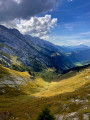
A breathtaking view of the Aravis, with a variety of vantage points.
Chalets de l’Eau Froide – Stream Fourchu car park
10.52 mi
+2,142 ft
-4,190 ft
6h 40
Difficult
Departure from Giez (Haute-Savoie)
The second day of a two-day route around the Pointe d’Arcalod, the highest point in the Bauges, passing through wild areas, valleys and along rivers. The proposed route mainly follows the western section of the GR® de Pays Tour de l’Arcalod, marked in yellow and red. Spectacular views of the mountains and Lake Annecy. This wild and little-used route is situated mainly within a sensitive, regulated area. The terrain is good and presents no particular difficulties.
From the Baraque de l'Abbaye to the Chalet de l'Alpettaz
 9.20 mi
+3,583 ft
-2,201 ft
7h 20
Difficult
Departure from Seythenex (Haute-Savoie)
9.20 mi
+3,583 ft
-2,201 ft
7h 20
Difficult
Departure from Seythenex (Haute-Savoie)
This hike takes you to the heart of the Faverges-Seythenex valley, following the Lac d'Annecy with the Torrent de Saint-Ruph, which is the lake's main source of water, ending with a view of Albertville and Mont Blanc at the Col de l'Alpettaz (alt. 1,580 m).
Gouille des Fours - Col des Annes via Lac de Tardevant
8.45 mi
+3,120 ft
-4,147 ft
6h 35
Difficult
Departure from Sallanches (Haute-Savoie)
From Gouille des Fours, head towards Lac de Tardevant via the Grande Forclaz and Ambrevetta passes, then return via alpine pastures and forests to La Pointe and Col des Annes.