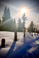
From Chaucisse to the Col des Aravis via the Chalet du Curé

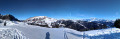
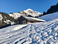
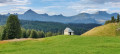
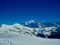
Starting from the hamlet of Chaucisse, this walk, with Mont Blanc as a backdrop, takes you into a magnificent landscape at the foot of the Étalle, then past the well-known Chalet du Curé, before descending gently towards the Col des Aravis.

Details

n°4121234
Creation:
Last update:
Last review:
  • Snowshoeing
    Activity: Snowshoeing
  • ↔
    Distance: 9.45 mi
  • ◔
    Duration according to the author: 5 hrs 
  • ▲
    Difficulty: Difficult

  • ⚐
    Back to start: No
  • ↗
    Ascent: + 2,146 ft
  • ↘
    Descent: - 1,463 ft

  • ▲
    Highest point: 5,764 ft
  • ▼
    Lowest point: 4,203 ft

Photos

Description of the walk

Start from the car park by the church in the hamlet of Chaucisse.

(S) Stand on the road with the church on your right. Head back towards the main junction you passed by car (Route de Saint-Nicolas) and carry on straight ahead.

(1) Turn right onto the Route des Montagnes and head towards the Les Rosets neighbourhood. Keep following this small road at all times, ignoring any paths to the right or left.

(2) The path crosses the avalanche-prone slope of the Croix de Stata and Croix Cartier and continues through a series of hairpin bends.

(3) Stay on the main path and ignore the trails to the right leading to the Croix de Stata and the Croix Cartier.

(4) At the next Y-junction, at elevation 1688, take the left-hand branch and pass the Boegneuve chalet on its left. Take a wide bend to the left to get closer to the rock faces, whilst staying on the path.

(5) Reach the hamlet known as Les Stallets (small chalets). Turn back and head towards the Chalet de Boegneuve.

(6) Cut across the meadow, rejoin the path, then turn left towards the Chalet du Curé.
Alternatively, you can walk down to the foot of the Chalet de Boegneuve and turn left towards the Chalet du Curé.

(7) Reach Les Mouilles (chalet) and continue along the path.

(8) At Les Stapssets (chalets), stay on the main path (Route de la Soif).

(9) When you reach La Frête (chalet), turn left and head uphill towards the Chalet du Curé.

(10) At the Chalet du Curé (private), head back towards the main path and follow it, ignoring the path on your right leading to the Régié chalets. Continue along this main path until you reach the hamlet of Psamo, marked by a signpost.

(11) At Psamo, do not take the paths leading down to the right but continue along the main path.

(12) Reach the orientation table above the path at the hamlet of La Tête, on the edge of the forest. Then take a left-hand bend. Stay on the path until you emerge from the forest.

(13) At La Zorette, where several paths branch off, take the one on the right, which initially runs alongside the forest for a short while before veering away to head straight towards the Montagne du Crot chalet. Take a slight left-hand bend, then continue to the finish at the Col des Aravis (E).

Waypoints

  1. S : mi 0 - alt. 4,203 ft - Église Saint-François de Sales (Chaucisse)
  2. 1 : mi 0.24 - alt. 4,337 ft - Main junction and Route des Montagnes
  3. 2 : mi 1.69 - alt. 5,135 ft - Path at the foot of the Croix de Stata slope
  4. 3 : mi 2.65 - alt. 5,610 ft - Path from Croix Stata and Cartier
  5. 4 : mi 2.88 - alt. 5,558 ft - At the foot of the Chalet de Boegneuve
  6. 5 : mi 4.11 - alt. 5,663 ft - Viewpoint at the Chalet des Stallets
  7. 6 : mi 4.97 - alt. 5,686 ft - Access to the Chalet du Curé
  8. 7 : mi 5.85 - alt. 5,246 ft - Chalet les Mouilles
  9. 8 : mi 6.23 - alt. 5,161 ft - Chalet les Stapssets
  10. 9 : mi 6.81 - alt. 5,335 ft - Chalet la Frête
  11. 10 : mi 6.99 - alt. 5,420 ft - Chalet du Curé
  12. 11 : mi 8.03 - alt. 5,121 ft - Psamo (signpost)
  13. 12 : mi 8.54 - alt. 5,233 ft - Orientation board at La Tête
  14. 13 : mi 8.93 - alt. 5,085 ft - La Zorette. Descent to the finish
  15. E : mi 9.45 - alt. 4,875 ft - Col des Aravis

Notes

In Flumet, head towards Saint-Nicolas-la-Chapelle, then on to the hamlet of Chaucisse.

I personally completed this route in winter in 4 hours 45 minutes (including 30 minutes’ breaks).

This is a one-way hike: you’ll therefore need a lift to Chaucisse and a pick-up at the finish, where it’ll be lovely to enjoy a tasty crêpe and some hot chocolate (or mulled wine) amidst the magnificent scenery of the Col des Aravis.

When snowshoeing, the trail may deviate slightly from the main path, depending on the tracks left by those before you or your desire to make ‘your own trail’, for example to cut across a hairpin bend.

In winter, if there are no tracks (which is unlikely), you’ll need to rely mainly on visual navigation, using the chalets mentioned as landmarks. A map will help with your navigation.

Suitable equipment for a snowshoe hike (and water).

The difficulty is ‘moderate to slightly difficult’ given the length, but there are no vertiginous sections.
IBP index = 82 (for a hiker with moderate to difficult fitness)

(4) For those who do not wish to go as far as the viewpoint at the Chalet des Stallets – thereby shortening the route by an hour – it is possible to head directly to the (7), by turning right at the (4), just before reaching the Chalet de Boegneuve.

Worth a visit

Col des Aravis (shops, bars, restaurants, crêperie).

Reviews and comments

5 / 5
Based on 1 review

Reliability of the description
5 / 5
Ease of following the route
5 / 5
Route interest
5 / 5
Pounet Rando
Pounet Rando

I’m really glad you enjoyed the hike. I’ve been going to La Giettaz in winter for about thirty years, but it’s already been three years since my last visit. It really is a magnificent area.

Machine-translated

PAPY JACQUES
PAPY JACQUES
• Edited:

Overall rating : 5 / 5

Date of your route : Jan 16, 2025
Reliability of the description : ★★★★★ Very good
Ease of following the route : ★★★★★ Very good
Route interest : ★★★★★ Very good
Very busy route : No

We set off in glorious sunshine. I did a round trip, so I didn’t go all the way to the Col des Aravis. I stopped at the Chalets de Régié, next to the Chalet du Curé. Although the route follows a summer track, it’s a very pleasant walk. Magnificent, unspoilt scenery; you never go through any woodland. There’s the option to cut across the hairpin bends on the way back by making the most of the snow. The round trip takes 4 hours 30 minutes’ walking.

Machine-translated

Other walks in the area

For more walks, use our search engine .

The GPS track and description are the property of this route's author. Please do not copy them without permission.