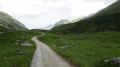
Lake La Moutière

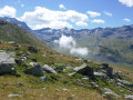
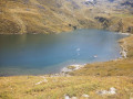
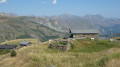
Walk up to the Moutière restaurant from the Moutière chairlift station. View of the Moutière reservoir.

Details

12497986
Creation:
Last update:
Last review:
  • Walking
    Activity: Walking
  • ↔
    Distance: 4.94 mi
  • ◔
    Average duration: 3h 30 
  • ▲
    Difficulty: Moderate

  • ⚐
    Back to start: Yes
  • ↗
    Ascent: + 1,365 ft
  • ↘
    Descent: - 1,352 ft

  • ▲
    Highest point: 8,146 ft
  • ▼
    Lowest point: 6,847 ft

Description of the walk

Park in the car park by the Chalet de Caron.

(S/E) Head south, passing the Chalet de Caron on your left, followed by the joint cable car station for the Cairn and Caron cable cars.

(1) Pass under the Moutière chairlift line and head up a stony track which runs roughly parallel to the Caron cable car line. This will take you to the upper station of the Caron cable car (which is also the lower station of the Cime de Caron cable car).

(2) Pass beneath the cable car line and continue eastwards along a wide dirt track. Go round the start of the Grand Fond Funitel on the left and reach the Refuge de la Moutière.

(3) Then turn left to quickly reach the lakeside.

(4) There are two options for returning to the starting car park (S/E):
- On foot, following the same route in the opposite direction.
- Take the Moutière chairlift, whose top station is situated between the lake and the refuge.

Waypoints

  1. S/E : mi 0 - alt. 6,847 ft - Chalet de Caron car park
  2. 1 : mi 0.15 - alt. 6,909 ft - Directly below the La Moutière chairlift line
  3. 2 : mi 1.59 - alt. 7,598 ft - Top station of the - Télécabine de Caron
  4. 3 : mi 2.26 - alt. 8,140 ft - Refuge de la Moutière
  5. 4 : mi 2.47 - alt. 8,133 ft - Lac de la Moutière
  6. S/E : mi 4.94 - alt. 6,847 ft - Chalet de Caron car park

Notes

(4) Restaurant at La Moutière.

To get back down, you can take the La Moutière chairlift if you’re too tired or short of time. Make sure you bring warm clothes for the chairlift ride down if the air is chilly.

Worth a visit

There are a few streams worth seeing along the way up.

Reviews and comments

4.5 / 5
Based on 2 reviews

Reliability of the description
5 / 5
Ease of following the route
4.5 / 5
Route interest
4 / 5
Weda
Weda
• Edited:

Overall rating : 4 / 5

Date of your route : Jun 26, 2023
Reliability of the description : ★★★★★ Very good
Ease of following the route : ★★★★☆ Good
Route interest : ★★★☆☆ Average
Very busy route : No

The plateau with the streams is really lovely
Apart from that, we didn’t enjoy the walk, though that may have been down to the fact that there was a lot of construction machinery, both on the walking route and at the various crossings near the chairlifts.
In fact, we decided to stray off the beaten track to avoid them as much as possible
The lake was completely empty

Machine-translated

Rhéa25
Rhéa25
• Edited:

Overall rating : 5 / 5

Date of your route : Jun 12, 2023
Reliability of the description : Not used / Not applicable
Ease of following the route : ★★★★★ Very good
Route interest : ★★★★★ Very good
Very busy route : No

A simple and enjoyable walk. A good warm-up hike.
Plenty of marmots at this time of year and still quite a lot of snow, which makes the scenery and the route absolutely stunning.
Stunning views.

Machine-translated

Other walks in the area

For more walks, use our search engine .

The GPS track and description are the property of this route's author. Please do not copy them without permission.