


Prévoir cette randonnée lors d'une période de beau temps : consulter la météo avant de partir.
Ne pas partir trop chargé, 15 kg maxi dans le sac.
Prévoir le ravitaillement pour l'étape 3.
Le bivouac est possible à chaque étape.
Quatre jours dans le Jura autour du Lac de Coiselet

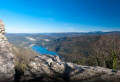
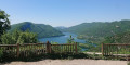
Et si on se déconnectait vraiment, le temps d'un long week-end. C'est ce que je propose, dans cette micro-aventure qui vous propulse dans un gigantesque espace sauvage et permet de découvrir un coin nature de toute beauté. Avec plus de 100 km en immersion totale dans le Jura, cette randonnée vous permettra de découvrir des lacs, des rivières, des cascades, des belvédères et des petits villages pittoresques dans une boucle entre Moirans-en-Montagne, Grand-Corent et Matafelon-Granges.
Details
Creation:
Last update:
Last review:
-
 Activity: Walking
 -
 Distance: 64.54 mi
 -
 Average duration: 4 days
 -
 Difficulty: Very difficult
 -
-
 Back to start: Yes
 -
 Ascent: + 8,356 ft
 -
 Descent: - 8,281 ft
 -
-
 Highest point: 2,625 ft
 -
 Lowest point: 876 ft
-
 Country:
France
Country:
France
-
 Areas: Jura mountains, Haut-Jura
 -
 City:
Moirans-en-Montagne (39260)
City:
Moirans-en-Montagne (39260) -
 Start/End: N 46.42861° / E 5.725239°
 -


 Hour-by-hour weather
Photos
Stages of the route
This route needs several days, find the details below:
Notes
Reviews and comments
3.7 / 5
Based on 1 review
Reliability of the description
4 / 5
4 / 5
Ease of following the route
4 / 5
4 / 5
Route interest
3 / 5
3 / 5

User 26761046
Overall rating : 3.7 / 5
Date of your route : Aug 18, 2025
Reliability of the description : ★★★★☆ Good
Ease of following the route : ★★★★☆ Good
Route interest : ★★★☆☆ Average
Very busy route : No
The route is pleasant and passes through some pretty spots. Be aware that most water sources (fountains) are closed in summer due to restrictions. However, it is always possible to refill your water bottles in cemeteries or directly from local residents.
We didn't meet many people on our way, and it's easy to find places to camp. On the downside, the route crosses several departmental roads, which isn't very pleasant when you're not on the trail (easily 15-20 km in total on busy roads). This is important to know. Also, at the end of the route on the last day, the path below the viaduct is no longer maintained or marked, so we had to take a detour because it was impassable.
I recommend this route for experienced walkers who are up for long days and want to walk between lakes and forests. For those who would prefer a route with a mountain feel, I would recommend another trail.
Machine-translated
Other walks in the area
Moirans-en-Montagne – Oliferne Castle
 Visorando Member
14.66 mi
+2,592 ft
-2,011 ft
9h 00
Visorando Member
14.66 mi
+2,592 ft
-2,011 ft
9h 00
 Difficult
 Departure from Moirans-en-Montagne (Jura)
Thisfirst stage, starting from Moirans-en-Montagne, takes you up to higher ground with a superb view of Lake Coiselet and, ultimately, a peak and a castle that are well worth the detour. Indeed, the Pic d’Oliferne towers over the Ain Valley by almost 500 metres and offers a beautiful view, particularly of the Haute-Chaîne du Jura.
The Belvédère de la Vierge in Moirans-en-Montagne
 1.81 mi
+358 ft
-358 ft
1h 10
1.81 mi
+358 ft
-358 ft
1h 10
 Easy
Departure from Moirans-en-Montagne (Jura)
Easy
Departure from Moirans-en-Montagne (Jura)
A short walk to help you explore the hills of Moirans-en-Montagne.
Around Mont Robert
 3.63 mi
+794 ft
-771 ft
2h 20
Easy
Departure from Moirans-en-Montagne (Jura)
3.63 mi
+794 ft
-771 ft
2h 20
Easy
Departure from Moirans-en-Montagne (Jura)
A pleasant route on the slopes of Mont Robert, interspersed with sections through the undergrowth, offering unobstructed views of Moirans-en-Montagne.
Over hill and dale around Mont Saint-Christophe
 6.15 mi
+1,125 ft
-1,109 ft
3h 50
6.15 mi
+1,125 ft
-1,109 ft
3h 50
 Moderate
Departure from Moirans-en-Montagne (Jura)
Moderate
Departure from Moirans-en-Montagne (Jura)
This route takes you over hills to the tops of cliffs, with viewpoints that invite you to contemplate the lush green countryside, and through valleys and deep, steep-sided gorges, offering cool respite and the chance to discover a natural world rich in diverse flora and fauna.
A 10 km route with some good climbs on all types of terrain awaits you from start to finish, offering a sense of tranquillity and a few panoramic views well worth capturing on camera.
Villards-d'Héria - Pic d'Oliferne
 14.58 mi
+2,438 ft
-1,972 ft
8 hrs
Very difficult
Departure from Villards-d'Héria (Jura)
14.58 mi
+2,438 ft
-1,972 ft
8 hrs
Very difficult
Departure from Villards-d'Héria (Jura)
First stage of the Way of St James. This first stage, starting from Villards-d'Héria, takes you up to higher ground with a superb view of Lake Coiselet and, ultimately, a peak and a castle that are well worth the detour. Indeed, the Pic d’Oliferne towers over the Ain Valley by almost 500 metres and offers a beautiful view, particularly of the Haute-Chaîne du Jura.
The Way of St James from Villards d’Héria to Santiago de Compostela
 1,231.39 mi
+106,063 ft
-107,326 ft
84 days
Very difficult
Departure from Villards-d'Héria (Jura)
1,231.39 mi
+106,063 ft
-107,326 ft
84 days
Very difficult
Departure from Villards-d'Héria (Jura)
Do you want to connect with nature, admire its beauty at the slow pace of walking, walk to get to know yourself better, get back to basics, and push yourself to new limits? Set off on an adventure along the Camino de Santiago. That’s what I’m offering you with this route. I set off from my village in the Jura (the first six stages aren’t part of the signposted routes of the Camino de Santiago) to reach Santiago de Compostela in Spain, but there’s nothing to stop you setting off from your own home to join the route at one of the stages, or starting from Le Puy-en-Velay or any other town along the way..
La Refrèche
 7.60 mi
+1,043 ft
-1,033 ft
4h 25
Difficult
Departure from Moirans-en-Montagne (Jura)
7.60 mi
+1,043 ft
-1,033 ft
4h 25
Difficult
Departure from Moirans-en-Montagne (Jura)
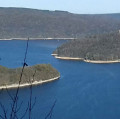
Hiking is often the best way to discover places – places that are all too often overlooked or simply underestimated. This new hike is proof of that, taking us to spots frequented by lovers of the great outdoors.You can admire Lake Vouglans from the viewing points, swim in its wild coves, explore a cave or simply discover the incredible biodiversity and birdlife of its vast forest.
Circular route of the 4 viewpoints in Moirans-en-Montagne
 7.79 mi
+1,283 ft
-1,296 ft
4h 40
Moderate
Departure from Villards-d'Héria (Jura)
7.79 mi
+1,283 ft
-1,296 ft
4h 40
Moderate
Departure from Villards-d'Héria (Jura)
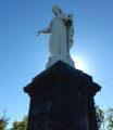
A route through the hills, with stunning views of the surroundings of Moirans-en-Montagne.Sections across the Jura mountains, with unobstructed views, interspersed with sections through the undergrowth and amongst boulders.A very varied, fairly challenging walk.
For more walks, use our search engine .
The GPS track and description are the property of this route's author. Please do not copy them without permission.

