


Refine your search for walks in Médière
Médière walks


 Circular walk starting from Médière
 Visorando Member
 7.78 mi
 +256 ft
 -253 ft
 3h 50
3h 50
 Average
 Departure from Médière (Doubs)
A walk through the woods and along the River Doubs, taking in four small villages around Médière.
Please note: three-quarters of the route is not shaded.
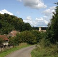
Circular field in the woods between Montenois and Lougres
 9.29 mi
+712 ft
-699 ft
4h 55
9.29 mi
+712 ft
-699 ft
4h 55
 Easy
Departure from Montenois (Doubs)
Easy
Departure from Montenois (Doubs)
This is a good family walk to do outside of flood season, as the area along the Doubs river would not be passable. Apart from one or two poorly marked spots, the route is easy to follow, winding through fields and undergrowth. Most of the time, the paths are well marked (used by tractors) and widely accessible by mountain bike.
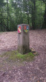
The Four Boundaries Marker
 4.05 mi
+456 ft
-436 ft
2h 15
Easy
Departure from Lougres (Doubs)
4.05 mi
+456 ft
-436 ft
2h 15
Easy
Departure from Lougres (Doubs)
Enjoy a pleasant stroll through the Lougres Forest to discover the inter-municipal boundary marker.
Short circular loop above Colombier-Fontaine
 2.74 mi
+325 ft
-325 ft
1h 35
Easy
Departure from Colombier-Fontaine (Doubs)
2.74 mi
+325 ft
-325 ft
1h 35
Easy
Departure from Colombier-Fontaine (Doubs)
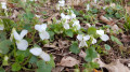
A circular loop that allows you to experience a variety of landscapes and atmospheres. The woods boast a rich variety of plant life; do take the time to admire it throughout the seasons. But remember, look but don’t touch! Be an observer, not a participant.
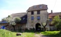
La Roche du Châtelard
 6.73 mi
+1,184 ft
-1,184 ft
4h 10
Average
Departure from Lanthenans (Doubs)
6.73 mi
+1,184 ft
-1,184 ft
4h 10
Average
Departure from Lanthenans (Doubs)
This country walk starts in Lanthenans, a small village in the Comté region hidden away in the countryside, and takes you over hills and through valleys to the Roche du Châtelard viewpoint overlooking Lomont and the Doubs valley. The return route takes you through airy woods, which Marcel Aymé might have described as "the forest is still a little bit of paradise lost. God did not want the first garden to be wiped out by the first sin."
A detour via the archery range in Arcey
 3.62 mi
+141 ft
-135 ft
1h 45
Easy
Departure from Arcey (Doubs) (Doubs)
3.62 mi
+141 ft
-135 ft
1h 45
Easy
Departure from Arcey (Doubs) (Doubs)
This is a short hike that is suitable for families, with no difficulty in terms of distance, elevation or risk of getting lost. It mainly follows the yellow-blue marked trails created by the Rupt Valley Hiking Association. It can be done by mountain bike, with a few sections where you will need to dismount.
Arcey circular route via Gonvillars and Villers-sur-Saulnot
 5.60 mi
+538 ft
-515 ft
3h 05
Easy
Departure from Arcey (Doubs) (Doubs)
5.60 mi
+538 ft
-515 ft
3h 05
Easy
Departure from Arcey (Doubs) (Doubs)
An easy walk through the woods and along small village roads, passing through Gonvillars and Villers-sur-Saulnot, and returning via the ‘Bois des Jonquilles’ in spring, between Villers and Arcey.
A short walk in the Mont Bart Forest at Sainte-Marie
 4.56 mi
+404 ft
-390 ft
2h 25
Easy
Departure from Sainte-Marie (Doubs) (Doubs)
4.56 mi
+404 ft
-390 ft
2h 25
Easy
Departure from Sainte-Marie (Doubs) (Doubs)
A lovely little walk with several possible starting points (the one suggested here, or from the village of Sainte-Marie to follow the signposts) and several different routes. A pleasant mix of countryside and woodland, particularly lovely in early spring, for example.
Around Goux-les-Dambelin
 7.28 mi
+469 ft
-459 ft
3h 45
Average
Departure from Goux-lès-Dambelin (Doubs)
7.28 mi
+469 ft
-459 ft
3h 45
Average
Departure from Goux-lès-Dambelin (Doubs)
View of the wind turbines, the Vosges mountains and the Roches de Pont de Roide.
An easy hike through fields, which may be subject to change.
The surroundings of Goux
 4.24 mi
+328 ft
-328 ft
2h 15
Easy
Departure from Goux-lès-Dambelin (Doubs)
4.24 mi
+328 ft
-328 ft
2h 15
Easy
Departure from Goux-lès-Dambelin (Doubs)
This route will allow you to admire the fountains and flower beds of the village of Goux-lès-Dambelin. Magnificent views of the wind turbines, the Doubs valley and the Vosges mountains.
The Princes' Ponds
 4.67 mi
+121 ft
-125 ft
2h 15
Easy
Departure from Sainte-Marie (Doubs) (Doubs)
4.67 mi
+121 ft
-125 ft
2h 15
Easy
Departure from Sainte-Marie (Doubs) (Doubs)
A loop around the Étangs des Princes, a series of ponds that bear witness to the former principality of Montbéliard. Abandoned in the 18th century, they were refilled with water in 1990 and since then have offered a landscape that changes with each season.
La Motte de Grammont to Bournois
 2.44 mi
+384 ft
-387 ft
1h 25
Easy
Departure from Bournois (Doubs)
2.44 mi
+384 ft
-387 ft
1h 25
Easy
Departure from Bournois (Doubs)
A short family walk starting from Bournois towards La Motte de Grammont, with a lovely view over the valleys of Haute-Saône. No major difficulties, apart from the numerous fallen trees blocking the path at this time of year (February 2025). Let’s hope the local council takes the necessary steps soon to clear this rather pleasant path.
Crête sur Chavanne in Désandans
 3.71 mi
+459 ft
-446 ft
2h 05
Average
Departure from Désandans (Doubs)
3.71 mi
+459 ft
-446 ft
2h 05
Average
Departure from Désandans (Doubs)
Désandans, hike on the ridge, Chavanne side.
Please note: at (4), as the path leading to Désandans is not currently maintained, you will need to return to Désandans via the same route you took to get there.
The fountains of Abbenans and Fallon
 9.80 mi
+866 ft
-869 ft
5h 15
Average
Departure from Fallon (Haute-Saône)
9.80 mi
+866 ft
-869 ft
5h 15
Average
Departure from Fallon (Haute-Saône)
A walk with little elevation gain, through woods and pastures, offering the chance to discover the area’s beautiful fountains, notably those at Abbenans and Fallon.
On the iron and mirabelle plum route
 10.16 mi
+1,444 ft
-1,444 ft
5h 55
Average
Departure from Mélecey (Haute-Saône)
10.16 mi
+1,444 ft
-1,444 ft
5h 55
Average
Departure from Mélecey (Haute-Saône)
Hike through the mirabelle plum orchards and follow in the footsteps of iron mining.
Tour of the Princes' Ponds and discovery of Saint-Julien-lès-Montbéliard
 6.56 mi
+581 ft
-581 ft
3h 30
Average
Departure from Raynans (Doubs)
6.56 mi
+581 ft
-581 ft
3h 30
Average
Departure from Raynans (Doubs)
The Princes' ponds, named after the Württemberg family who ruled the duchy, are located in the heart of the Rupt valley. Drained two centuries ago, they were refilled with water in 1991 and then stocked with fish. Improvements have been made to secure the surroundings for visitors to this true haven of peace. After a tour of the ponds, the circular offers the opportunity to discover the heritage of Saint-Julien-lès-Montbéliard with a return trip through the villages of Issans and Raynans.