La Motte de Grammont to Bournois

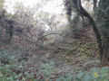
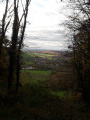
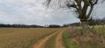
A short family walk starting from Bournois towards La Motte de Grammont, with a lovely view over the valleys of Haute-Saône. No major difficulties, apart from the numerous fallen trees blocking the path at this time of year (February 2025). Let’s hope the local council takes the necessary steps soon to clear this rather pleasant path.

Details

69275149
Creation:
Last update:
Last review:
  • Walking
    Activity: Walking
  • ↔
    Distance: 2.44 mi
  • ◔
    Average duration: 1h 25 
  • ▲
    Difficulty: Easy

  • ⚐
    Back to start: Yes
  • ↗
    Ascent: + 384 ft
  • ↘
    Descent: - 387 ft

  • ▲
    Highest point: 1,706 ft
  • ▼
    Lowest point: 1,299 ft
  • ⚐ Country: France
  • ⚐ City: Bournois (25250)
  • ⚑
    Start/End: N 47.4989° / E 6.496674°
  • ❏
    IGN map(s): Ref. 3522O
  • Hour-by-hour weather

Photos

Description of the walk

Park in the car park opposite the church.

(S/E) Join the GR®59 (marked in white and red), which passes through the centre, in front of the church. With your back to the church, head right and then turn left. Cross the Grande Rue and follow the GR®, which leads out of Bournois and then climbs gradually towards the hill.

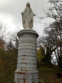
(1) When the GR®59 begins to descend, turn left to leave it, following the blue and yellow markings. Follow the path that leads into the woodland and reach the summit of La Motte de Grammont. Continue on to the viewpoint and the orientation table.

(2) Retrace your steps a little and take the path that descends to the left and passes between two trees: blue and yellow markings. Continue along this path, which runs along the western slope of the hill and leads back towards Bournois. 

(3) Take a first turn left then right to head towards the village centre, rejoining the Grande Rue and the car park (S/E). 

Waypoints

  1. S/E : mi 0 - alt. 1,322 ft - Car park - Église Saint-Nicolas (Bournois)
  2. 1 : mi 0.59 - alt. 1,519 ft - Exit GR°°®°°
  3. 2 : mi 1.2 - alt. 1,686 ft - Viewpoint - Motte de Grammont
  4. 3 : mi 2.26 - alt. 1,381 ft - Junction
  5. S/E : mi 2.44 - alt. 1,319 ft - Car park

Notes

Take care when passing near fallen trees (which are common at the end of winter). Check that they are not precariously balanced before passing. 

(1) You can continue through the pasture alongside the woodland to rejoin the path a little further on.

Always be cautious and plan ahead when you're outdoors. Visorando and the author of this route cannot be held responsible for any accidents occurring on this route.

The GR® and PR® markings are the intellectual property of the Fédération Française de Randonnée Pédestre.

Reviews and comments

4.8 / 5
Based on 2 reviews

Reliability of the description
5 / 5
Ease of following the route
4.5 / 5
Route interest
5 / 5
Azimut71
Azimut71

Overall rating : 5 / 5

Date of your route : Sep 05, 2025
Reliability of the description : ★★★★★ Very good
Ease of following the route : ★★★★★ Very good
Route interest : ★★★★★ Very good
Very busy route : No

As soon as you leave the GR59 at (1), the path becomes very pleasant, with only one fallen tree, which is easy to get around.
The view from the orientation table is largely obscured by young trees, and if no pruning takes place, it will soon be impossible to see anything.
The descent is slippery in wet weather.

Machine-translated

Pierrot DAVID
Pierrot DAVID

Overall rating : 4.7 / 5

Date of your route : Nov 03, 2025
Reliability of the description : ★★★★★ Very good
Ease of following the route : ★★★★☆ Good
Route interest : ★★★★★ Very good
Very busy route : No

A lovely short hike to break up an afternoon. Special attention should be paid to the sometimes ambiguous markings on the section near the summit of La Motte.

Machine-translated

Other walks in the area

For more walks, use our search engine .

The GPS track and description are the property of this route's author. Please do not copy them without permission.