Circular walk starting from Médière

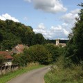
A walk through the woods and along the River Doubs, taking in four small villages around Médière.
Please note: three-quarters of the route is not shaded.

Details

24873051
Creation:
Last update:
Last review:
  • Walking
    Activity: Walking
  • ↔
    Distance: 7.78 mi
  • ◔
    Average duration: 3h 50 
  • ▲
    Difficulty: Moderate

  • ⚐
    Back to start: Yes
  • ↗
    Ascent: + 256 ft
  • ↘
    Descent: - 253 ft

  • ▲
    Highest point: 1,204 ft
  • ▼
    Lowest point: 958 ft
  • ⚐ Country: France
  • ⚐ City: Médière (25250)
  • ⚑
    Start/End: N 47.456798° / E 6.60086°
  • ❏
    IGN map(s): Ref. 3522O
  • Hour-by-hour weather

Description of the walk

Park near the Coquelicots Lodge.

(S/E) Take Rue du Crépenot, heading north-east, and turn right off it about 200 m further on to follow the path winding through the Coteau Jean Blanc. You’ll reach a crossroads with several directions in the Bois de Cugnot.

(1) Turn onto the path on the right and then reach a tight 160° hairpin bend. Turn left and immediately right at a 90° angle. You’ll reach a wider track; take it to the right and you’ll come out onto the D663.

(2) Cross the road with great care, turn left and follow it at a distance until you reach a track at a place called Coteau de Bray.

(3) Turn right onto this track, follow the right bank of the Doubs, pass under the railway bridge and then reach the village of Le Châtelot.

(4) Take thesecond track on the left to reach the Doubs via the plain, just before the village of Blussangeaux.

(5) Cross the river and then turn right onto the D316b. At the junction with the D316, continue straight ahead to cross the Arbues plain and then reach the junction with a new road.

(6) Turn left onto this road and you’ll easily reach the village of La Prétière.

(7) Turn left towards the village centre and head for the stadium, passing over the power station’s intake canal. After the stadium, turn right to cross the canal again and return to the local road leading to Médière. Turn left, pass under the railway line and you’ll then reach the D663.

(9) Walk alongside it on the left for just over 100 m, then cross it and take the Route de Montbéliard opposite. Walk past Médière town hall and head for the car park near the Lodge des Coquelicots (S/E).


Waypoints

  1. S/E : mi 0 - alt. 965 ft - Car park near the Coquelicots Lodge
  2. 1 : mi 0.85 - alt. 1,204 ft - Cugnot Wood
  3. 2 : mi 1.72 - alt. 1,102 ft - D663
  4. 3 : mi 2.1 - alt. 994 ft - Bray Hillside
  5. 4 : mi 3.27 - alt. 974 ft - Le Châtelot
  6. 5 : mi 4.28 - alt. 965 ft - Blussangeaux
  7. 6 : mi 5.38 - alt. 1,050 ft - Road junction
  8. 7 : mi 5.74 - alt. 1,001 ft - La Prétière
  9. 8 : mi 6.9 - alt. 978 ft
  10. 9 : mi 7.4 - alt. 961 ft - D663
  11. S/E : mi 7.78 - alt. 965 ft - Car park near the Coquelicots Lodge

Worth a visit

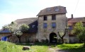
(4) Le Châtelot: you can climb the old watchtower, taking care to avoid falling rocks.
(9) Médière: in the centre of the village, see the fountain and the Poux spring behind the school.

Reviews and comments

4.2 / 5
Based on 4 reviews

Reliability of the description
4.3 / 5
Ease of following the route
4.3 / 5
Route interest
4 / 5
le saut de bonneille

Overall rating : 5 / 5

Date of your route : Aug 09, 2026
Reliability of the description : ★★★★★ Very good
Ease of following the route : ★★★★★ Very good
Route interest : ★★★★★ Very good
Very busy route : No

A very easy route
We didn’t see a soul along the way as it was a relatively sunny and warm afternoon
It’s a shame the Doubs is so low; the route must be lovely at certain times of year

Machine-translated

User 11845506

Overall rating : 4 / 5

Date of your route : Oct 13, 2025
Reliability of the description : ★★★★☆ Good
Ease of following the route : ★★★★☆ Good
Route interest : ★★★★☆ Good
Very busy route : No

Machine-translated

claudie90
claudie90

Overall rating : 3 / 5

Date of your route : Oct 28, 2024
Reliability of the description : ★★★☆☆ Average
Ease of following the route : ★★★☆☆ Average
Route interest : ★★★☆☆ Average
Very busy route : No

Between points 2 and 3, we’re blocked by trees, so we have to take a detour to get back onto the route… Otherwise, the rest of the route goes smoothly…

Machine-translated

cyprienrbt25
cyprienrbt25

Overall rating : 4.7 / 5

Date of your route : Aug 29, 2024
Reliability of the description : ★★★★★ Very good
Ease of following the route : ★★★★★ Very good
Route interest : ★★★★☆ Good
Very busy route : No

A really lovely route – as someone who lives in the area, I was really surprised to discover such beautiful spots.
I particularly loved the banks of the Doubs towards the end – there’s a lovely beach there, so do make a detour.
I highly recommend it,
Long live our beautiful Franche-Comté!

Machine-translated

Other walks in the area

For more walks, use our search engine .

The GPS track and description are the property of this route's author. Please do not copy them without permission.