A short walk in the Mont Bart Forest at Sainte-Marie

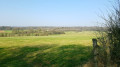
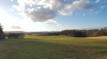
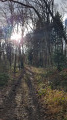
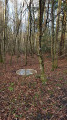
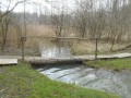
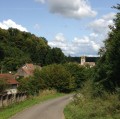
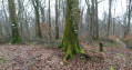
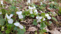
A lovely little walk with several possible starting points (the one suggested here, or from the village of Sainte-Marie to follow the signposts) and several different routes. A pleasant mix of countryside and woodland, particularly lovely in early spring, for example.

Details

19057395
Creation:
Last update:
Last review:
  • Walking
    Activity: Walking
  • ↔
    Distance: 4.56 mi
  • ◔
    Average duration: 2h 25 
  • ▲
    Difficulty: Easy

  • ⚐
    Back to start: Yes
  • ↗
    Ascent: + 404 ft
  • ↘
    Descent: - 390 ft

  • ▲
    Highest point: 1,463 ft
  • ▼
    Lowest point: 1,135 ft

Photos

Description of the walk

If you’re travelling by car, park by the path leading off the D460. Please ensure you don’t block the way.

(S/E) Follow the path with your back to the road.

(1) At the junction, go straight on.

(2) Turn right, following the signposts. You’ll come to a meadow with horses; walk along the right-hand side of it, continuing to follow the signposts. You’ll reach a road; turn right and head up towards the Mont Bart Forest.

(3) Take the wide path on the left. Continue along this main path through the woods. After just under 500 metres, turn left, staying on the main path, and you’ll then reach a flat section where the path splits into two opposite tracks.

(4) Take the right-hand path; make the most of this peaceful stretch to listen to the birds singing, look up at the treetops, take a deep breath and simply feel at peace. You’ve now completed the bulk of the climb.
The main path continues on level ground for a while before starting to descend. Be careful, as it can become quite slippery if it has rained recently.

(5) Turn right at the Fork in the road, stay on the path on the right, then take the central path a little further on.

(6) Walk slightly uphill on the path on the right, then carry on straight ahead for several hundred metres.

(7) At the fork in the road, take the left-hand path. Continue to the edge of the forest.

(3) Follow the route in reverse to return to the starting point (S/E).

Waypoints

  1. S/E : mi 0 - alt. 1,161 ft - Parking at the side of the path
  2. 1 : mi 0.25 - alt. 1,214 ft - Crossroads
  3. 2 : mi 0.38 - alt. 1,240 ft - Field with signposts
  4. 3 : mi 0.81 - alt. 1,260 ft - Edge of the Mont Bart Forest
  5. 4 : mi 1.39 - alt. 1,463 ft - Flat stretch
  6. 5 : mi 2.49 - alt. 1,188 ft - Fork in the road, turn right
  7. 6 : mi 2.91 - alt. 1,135 ft - Ascent
  8. 7 : mi 3.2 - alt. 1,181 ft - Three-way junction
  9. S/E : mi 4.56 - alt. 1,161 ft - Parking at the side of the path

Notes

(S/E) You can also park in Sainte-Marie, past the last houses on Ru des Peurres Raies (you couldn’t make it up!), and join the walk at (1). Then turn left.

The first part is through fields, the second through woodland, but with machinery that sometimes damages the path: watch out for mud!

Also, watch out for ticks – unfortunately, our beautiful region is full of them.

Don’t forget to protect your four-legged (or two-legged) companions as well.

Reviews and comments

4.1 / 5
Based on 3 reviews

Reliability of the description
4.3 / 5
Ease of following the route
4 / 5
Route interest
4 / 5
llapetitereine
llapetitereine

Overall rating : 4.7 / 5

Date of your route : Jun 11, 2026
Reliability of the description : ★★★★★ Very good
Ease of following the route : ★★★★★ Very good
Route interest : ★★★★☆ Good
Very busy route : No

We went for a walk one mild afternoon, starting from the temple, then along Rue de Bavans, and joined the circular route from point 3 to point 6. We continued along a path that took us back to point 1, via Rue des Peurres Raies and the temple. An easy, well-shaded walk.

Machine-translated

Théophile25
Théophile25

Overall rating : 4.7 / 5

Date of your route : May 05, 2024
Reliability of the description : ★★★★★ Very good
Ease of following the route : ★★★★☆ Good
Route interest : ★★★★★ Very good
Very busy route : No

A lovely walk; most of it is through the woods in the shade, which is very pleasant in summer. The forest is very pretty and pleasant; I’d highly recommend this walk. As for parking, you’re better off parking in the village on the town hall square, as there are very few parking spaces at the starting point...

Machine-translated

corna54
corna54

Overall rating : 3 / 5

Date of your route : Sep 13, 2022
Reliability of the description : ★★★☆☆ Average
Ease of following the route : ★★★☆☆ Average
Route interest : ★★★☆☆ Average
Very busy route : No

We set off from the village of St Marie. We found the sign for Mont Bart, but then I realised we’d gone astray, so we turned back. Along the way, we saw signs with the names of villages on them. I think we took the wrong path – why didn’t they indicate the name of the village we were supposed to head for? It would have made everything much simpler.

Daniel

Machine-translated

Other walks in the area

For more walks, use our search engine .

The GPS track and description are the property of this route's author. Please do not copy them without permission.