The marshes and woods of Penfoulic in Fouesnant

A short walk through the woods and marshes of Penfoulic, a protected natural area managed by the Conservatoire du Littoral.

Details

20769945
Creation:
Last update:
Last review:
  • Walking
    Activity: Walking
  • ↔
    Distance: 2.92 mi
  • ◔
    Average duration: 1h 25 
  • ▲
    Difficulty: Easy

  • ⚐
    Back to start: Yes
  • ↗
    Ascent: + 98 ft
  • ↘
    Descent: - 105 ft

  • ▲
    Highest point: 115 ft
  • ▼
    Lowest point: 7 ft
  • ⚐ Country: France
  • ⚐ City: Fouesnant (29170)
  • ⚑
    Start/End: N 47.893994° / W 4.003843°
  • ❏
    IGN map(s): Ref. 0519ET
  • Hour-by-hour weather

Photos

Description of the walk

In the centre of Fouesnant, take the “Descente du Cap” road and park just after Collège Saint-Joseph, on the right: a large car park with a fountain (water not suitable for drinking).

(S/E) From the car park, walk round the fountain and head left towards the pedestrian crossing. Cross the road carefully towards a bus shelter. At the start of the road, where you’ll see the sign for “Maison du Marais”, turn immediately right (yellow metal barrier) to take a footpath between the houses. This leads to a dead end. Head down to the right until you find the continuation of the footpath on your left (yellow barrier). Follow this to reach a small road, Chemin de la Digue.

(1) Turn right and follow this small, sunken road – which is full of flowers in spring – until you reach a Fork in the road.

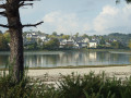
(:2) Continue straight on to reach the sea wall bordering a saltwater pond; turn left and pass the Maison du Marais on your left (information boards). Continue straight on along the small private road reserved for local residents, with a heritage orchard of cooking apples on your left and meadows on your right where sheep are often seen. Pass the Coat Veil Voor farm to reach the entrance to the Bois de Penfoulic (protected natural area).

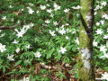
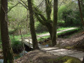
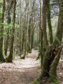
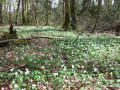
(3) Turn left to enter the woodland, dominated by silver firs. At the first Fork in the road, continue straight down and, further on, join another path coming from the left. In this area, in spring, you can admire carpets of wood anemones. Walk alongside the heritage orchard once more, as well as meadows where ponies regularly graze, and emerge onto a wide path flanked by a small aqueduct carrying the fresh water of the Pen Al Len stream. Turn right, ignore a path on the right that leads back up into the woods, and continue to a wooden footbridge (Pen al Len signpost).

(4) After crossing this footbridge, before turning right to continue along the stream, walk on for about ten metres to discover a pedunculate oak known as the “giraffe tree”. Back at the footbridge, follow the path between the small aqueduct on your left and the vast marshy area on your right. Climb a flight of steps to cross the stream and continue along the path through the woods overlooking the stream before rejoining it. Carry on straight ahead and climb a wooden staircase to reach a small road, Allée de Penfoulic.
Turn left onto this narrow road, where two cars can barely pass each other, and walk alongside the grounds of the Manoir de Penfoulic.

(5) Cross a car park (information sign), climb a small flight of steps and continue to the left along the wide path called Hent Touroulou. This runs alongside the seawater channel, which is the pond (algae are visible). You will reach the junction from the outward journey.

(2) Turn right and follow the Chemin de la Digue back in the opposite direction as far as the pedestrian crossing (yellow barrier).

(1) Turn left here, then continue straight on to leave the Résidence de la Fontaine. Cross the road at the pedestrian crossing and head up to the right to return to the car park (S/E).


Waypoints

  1. S/E : mi 0 - alt. 105 ft - Car park on the descent from Cap
  2. 1 : mi 0.21 - alt. 59 ft - The dyke path
  3. 2 : mi 0.49 - alt. 13 ft - Crossroads at the circular loop
  4. 3 : mi 1.09 - alt. 75 ft - Entrance to the woods
  5. 4 : mi 1.53 - alt. 10 ft - Footbridge
  6. 5 : mi 2.23 - alt. 20 ft - Penfoulic Manor
  7. S/E : mi 2.92 - alt. 105 ft - Car park on the descent from Cap

Notes

In some places, old white or blue signposting is present, but it is so old that I have not mentioned it.

Worth a visit

Maison du Marais open in July and August.
Penfoulic Marshes.
History of the ponds.
Giraffe tree.

Penfoulic Manor: The present manor house, built on the site of the old one, dates only from the second half of the 19th century. Furthermore, various alterations carried out subsequently have completely changed the layout of the property.

Reviews and comments

4.4 / 5
Based on 4 reviews

Reliability of the description
4 / 5
Ease of following the route
4.5 / 5
Route interest
4.8 / 5
User 8775907

Overall rating : 5 / 5

Date of your route : Jul 08, 2026
Reliability of the description : ★★★★★ Very good
Ease of following the route : ★★★★★ Very good
Route interest : ★★★★★ Very good
Very busy route : No

Thank you for this lovely, shaded walk – it was just what we needed during this heatwave!

Machine-translated

Pepettearoulette
Pepettearoulette

Overall rating : 4.3 / 5

Date of your route : Jul 11, 2025
Reliability of the description : ★★★★☆ Good
Ease of following the route : ★★★★★ Very good
Route interest : ★★★★☆ Good
Very busy route : No

A lovely walk for the whole family in the woods. Southern Finistère isn't just about the GR34.
A fox and a giraffe await you on the trail to the marsh house
A beautiful discovery of the Penfoulic marshes.
Avoid weekends as there is limited parking near the manor house

Machine-translated

Vince West29
Vince West29

Overall rating : 5 / 5

Date of your route : Nov 26, 2023
Reliability of the description : ★★★★★ Very good
Ease of following the route : ★★★★★ Very good
Route interest : ★★★★★ Very good
Very busy route : No

I loved it! A route through dense woodland – at mushroom season, the scent really fills your nostrils! The route takes you from a footpath to a track, then onto a short stretch of tarmac, before returning to a footpath through the undergrowth; it’s very pleasant.
I didn’t find it difficult at all; you walk along the water’s edge, discover lovely views and new spots to come back to later – in short, it’s great fun!

Machine-translated

FLOCH
FLOCH ★

I’m sorry, but naturally I did walk this route myself before describing it and suggesting it.
This is the case for all routes in order for them to be accepted on Visorando.

Machine-translated

GCD1401
GCD1401

That’s your point of view. Give the courses a go and you’ll understand what I mean.
Kind regards.

Machine-translated

FLOCH
FLOCH ★

Thank you for this feedback.
What suggestions do you have for providing more precise information?

At each checkpoint, the distance covered is shown on the form (see copy below).

S/E km 0 – alt. 35m – Car park on the descent from Cap
1: km 0.34 – alt. 21m – Chemin de la digue
2: km 0.79 – alt. 8m – Junction of the circular route
3: km 1.75 – alt. 27m – Entrance to the woods
4: km 2.46 – alt. 8m – Footbridge
5: km 3.6 – altitude 13m – Penfoulic Manor
S/E: km 4.7 – altitude 35m – Car park on the descent from the headland

A simple mental calculation will tell you the distance between each point.

Furthermore, as this route is easy, there is no need to work out particularly short distances as you go along.

Kind regards.

Machine-translated

GCD1401
GCD1401

Overall rating : 3.3 / 5

Date of your route : May 01, 2022
Reliability of the description : ★★☆☆☆ Disappointing
Ease of following the route : ★★★☆☆ Average
Route interest : ★★★★★ Very good
Very busy route : No

It’s always the same – there’s no information on the distance between each point in the descriptions, so it’s difficult to find your way around.

Machine-translated

Other walks in the area

For more walks, use our search engine .

The GPS track and description are the property of this route's author. Please do not copy them without permission.