Country:
 City:




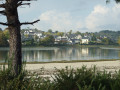
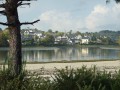
Car park opposite the Forêt-Fouesnant ria.
GR® 34 + Blue and Yellow signposting
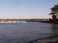
(S/E) Leave the car park and take the path that runs alongside the ria on the La Forêt-Fouesnant side (town hall). Follow this path, which runs below the École Notre-Dame Izel Vor, past a sports ground, and leads to a car park. Follow the road running alongside the cove, where a dedicated lane has been marked out for pedestrians and cyclists, until you reach a new car park; cross it and ignore the footbridge on the left leading to the Port la Forêt water sports centre.
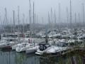
(1) Continue along the cove, past the slipway of the old harbour and then an oyster farm where the road ends. Carry on (with a view of the forest of masts at the marina) and turn right along a wall to go round a property. You’ll arrive facing Anse de Penfoulic.
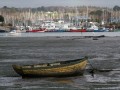
(2) Continue along the beach at low tide or via the right of way provided for high tide (gate). Follow the coastal path that runs alongside the cove, where, at low tide, you can see the oyster beds (wintering grounds for brant geese). This path is lined with old oak trees and leads to a dyke marking the boundary of the marshland.
(3) Cross it and, at the end, leave theGR® 34.
No signposting
Take a small, sunken road, ignore the road on the left and cross a dyke.
(4) Turn left towards the Maison des Marais, leave the buildings on your right and continue straight on along the marshland. Ignore the path leading up into the woods and you’ll reach a small dyke at a crossroads.
(5) Turn left, pass by the ‘giraffe tree’ – a pedunculate oak voted Tree of the Year 2011 (sculpture) – and continue towards the car park near the Manoir de Penfoulic. Turn right and follow the small road for about 400 m until you reach a wooden staircase marking the start of a path alongside a stream in the marsh.
(6) Head down to the right and follow the path overlooking the stream. After a series of short ascents and descents, cross a footbridge, continue on the other side and arrive at the footbridge near the “giraffe tree”.
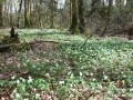
(5) Turn left and follow the route you took on the way there for about a hundred metres. At the signpost, turn left to head up into the woods. At the first Fork in the road, keep left then go straight on until you reach the exit onto a small road (there are plenty of wood anemones in spring in this wooded section).
Follow the small private road reserved for local residents on the left until you reach the D44.
(7) Cross with extreme caution (traffic can be heavy at times) and continue opposite along the disused road known as Chemin du Petit Rospiec. Walk round the buildings of the Atelier 5 chocolate factory and a metalworking company. Look out for a cross on the left with a commemorative plaque marking the liberation of the Fouesnant district in August 1944. When you reach the D44 again, proceed with extreme caution, cross it and continue along the small road opposite. Pass by a cider house and a campsite and arrive at a house on the right at a bend in the road.
(8) Walk between the house and an old barn and follow a stony path – the embankments of which are covered in flowers in spring – which descends gently to join a road near a wash house with a picnic table.
Turn right, go through a gate and continue along a wide, tree-lined path which runs alongside the Penfoulic Ponds on your right – these were once used for mussel farming – and reach the embankment.
(3) Turn left up the tarmac path designated for cyclists and walkers and continue for about 500 m along the main road (signposted for cyclists) until you reach a beautiful property called “Les Korrigans” on your right.
(9) Turn right and head down this narrow tarmac path. At the bottom, turn left, ignoring the path leading down to the slipway. Continue straight ahead along a wide grassy strip, go round a property and carry on across a grassy area, then follow a track suitable for vehicles alongside the houses on your right. At the road, turn right to head down towards the cove.
(1) Turn left twice (at the washhouse), go up the street, ignoring a dead end on the right, and join a cross street.
(10) Turn right onto Route de Kerambarber, which further on becomes the path of the same name, and arrive near the École Notre-Dame d’Izel Vor.
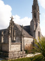
Head up the alley opposite, go round the church and its calvary, then head back down to the right to return to the car park (S/E).

 Visorando Member

 Moderate