Country:
 City:
City:




Access: From Fouesnant, follow the D45 towards Beg Meil and Cap Coz. At the roundabout, after the Lycée de Bréhoulou, turn left and follow the signs for Cap Coz. Continue to the car park, which lies in line with the beach, before the ‘no entry’ sign (except for harbour users).
(S/E) From the car park, walk along the beach towards the east until you reach the harbour esplanade (with a view of Concarneau opposite). Follow the one-way road until you reach a car park. Cross it and head down to the top of the beach. Follow the coastline until you reach the landscaped esplanade running alongside Anse de Penfoulic.
GR®34signposting: White and red
(1) Turn right, follow the edge of the cove along the tarmac path designed for pedestrians and cyclists, and pass a jetty.
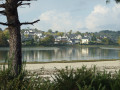
(2) At a bend, keep to the right, either along a path or along the top of the beach depending on the tide, and head towards the sea wall at the far end of the cove.
(3) At the sea wall, turn left onto a wide, sunken path. Before crossing another sea wall, let theGR® trail branch off to the left. Cross this sea wall and head for the Maison des Marais.
There are no proper signposts (just a few signposts at junctions)
(4) Turn left (signposted ‘giraffe tree’ 500m ahead) and follow the path which runs alongside a marshy area and meadows where ponies are often grazing, until you reach a small bridge.
(5) Cross the bridge, turn left and look out for the ‘giraffe tree’ (an old, gnarled oak, very tall and slender). You’ll reach a road at a car park marked by a barrier. Take the road to the right (glance left at the Manoir de Penfoulic) and follow this small road, with a 30 km/h speed limit, heading north-west.
(6) About 100 metres before the departmental road, at a ‘alternating traffic’ sign, head down to the right via a flight of steps onto a path that leads into a wooded area. The path runs above a stream, which you’ll follow on your left. Some sections with steps may be slippery. Cross the stream via a small footbridge and follow it to the right until you reach the small bridge you crossed earlier.
(5) Turn left to take it again, then after about a hundred metres turn onto a path leading into a wooded area on the left (signpost with an arrow to the left and a sign for Maison du Marais on the right). Follow this path through the woods and then along a large orchard until you reach a small road opposite a white gate.
(7) Turn left and follow this road until you reach the junction with the D44. Cross it (take care, as traffic can be heavy at times) and take the disused road opposite, known as the Chemin du Petit Rospiec. Go round a sawmill and look out for a cross on the left with a commemorative plaque marking the liberation of the Fouesnant canton in August 1944.
Signposting: VTT15
(8) Cross the D44 again (take care) and take the Route de Pontérec opposite, which you can spot by the signs for the cider house and campsite. Follow this road, ignoring the turn-offs to the left, until you reach the next junction.
(9) Turn right and continue along the Route de Prad Ar Sant, which descends gently, until you reach a grassy area where some wash houses have been restored.
(10) Leave the road, go through a gate and continue along a wide path lined with tall trees. Walk along the right-hand side of the reservoir by the dyke until you reach it. Turn right to cross it.
GR®34signposting: White and Red
(3) Turn left to follow the route taken on the way out, either along the path or along the top of the beach depending on the tide level, then continue along the landscaped embankment.
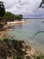
(1) Head to the edge of Cap Coz Beach and follow it eastwards along the line of maritime pines to return to the car park (S/E).


 Visorando Member
 Moderate