Country:

 City:
City:


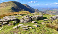
Start the walk from the car park at the Itzulegi Pass (702 m), where the small road leading from the Otxondo Pass to Gorramakil (NA 2655) crosses a plateau.
(S/E) Follow the tarmac road for approximately 450 m.
(1) Leave the road and take a stony path on the left, which climbs, passing another path on the left at the same point. Then take a little-known and little-used forest track that climbs along the western flank of Gorramendi-Gorramakil.
(2) Pass a small hill on your left: the Olaintzin (842 m), near Urtsuko Borda, and continue along the path.
(3) Similarly, pass Uniz (781 m) on your left – which you can easily climb – and continue along the path, which gradually ascends to the Burdimotx Pass (898 m).
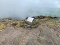
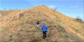
(4) From there, begin the short ascent of the Akomendi (also known as Barda on some maps), characterised by a bell at its summit (954 m).
(5) After a break, if you wish, return to the Col de Burdimotx.
(4) Follow the well-marked path to the left, now along the ridges.
(6) Pass the summit of Gorramakil (1,087 m), then continue straight on towards the south to reach the Otanarte road (1,064 m).
(7) Leave this road and turn right onto the shortcut leading to the Col d’Otanarteko. Continue straight ahead, ignoring the road, to reach the summit of Otanarte (1,071 m).
(8) Keep going straight ahead to reach Gorramakil (1,071 m).
(8) Turn back and then take the grassy slope on the right to descend towards Aizpitza (959 m), which you must also climb.
(9) Descend to the road and follow it to the right to return to the Col d’Itzulegi and reach the car park (S/E).
 Visorando Member

 Difficult
  Association / Club / Walk leader