


 Country:

 City:
City:


Take the N121B from Dantcharia towards the Otxondo Pass.
When you reach the pass, take the road on the left towards Gorramendi, which passes through a cattle grid.
Head to the starting point, which is a car park on the left-hand side of the road, just past a house.
(S/E) From the car park, head back onto the road heading west, then take a wide path branching off to the right.
(1) At the first junction, head straight on along thePR®-NA6 path.
At the next fork in the road, take the left-hand branch to reach the pass.
(2) Turn right towards the Antsestegi summit, following the ridge; climb over a fence using a ladder and ignore a path on the right (not shown on the map).
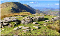
To reach this first summit, you’ll need to negotiate a few stepped sections on the rocks.
(3) Continue north-eastwards to make a large hairpin bend which is not marked on the ground, although it appears on the map.
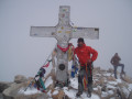
The tip of this bend is the Antsestegi summit at 803m, marked by a bizarre sculpture.
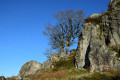
Head back down to the left to go round a magnificent cluster of trees, then descend towards the pidgeon hunting huts.
At the plateau, head back up opposite, northwards towards the Burdiako Kaskoa summit, following the ridge line.
(4) Continue northwards to the next flat area, situated next to a cattle grid.
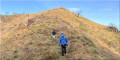
(5) At the junction, take the track on the right, then turn left at the next Fork in the road and climb north-east along the ridge towards the summit of Lizartzu.
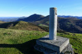
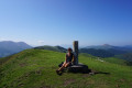
The summit is marked by a triangulation point belonging to the Spanish Geographical Society.
(6) Descend via the same route and continue straight on towards the summit of Mailarreta.
(7) Descend back to the cattle grid you passed on the way up.
(5) Take the track on the right, then the first track on the left. At the top of the hill, the track becomes tarmac and rejoins the route taken on the way up.
(2) Take the path on the right towards the summit of Meatzetako Bizkarra.
(8) Head back down due south towards the car park (S/E).
 Visorando Member

 Difficult
 Easy
Easy 
