


Refine your search for walks in Les Sauvages
Les Sauvages walks


 The Mont des Salles loop starting from Les Sauvages
 Visorando Member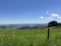
 7.76 mi
 +1,358 ft
 -1,358 ft
 4h 45
4h 45
 Moderate
 Departure from Les Sauvages (Rhône)
This circuit with pleasant trails allows us to admire views of Amplepuis and its surroundings, the Château de Rochefort and splendid views of the Monts du Lyonnais, Tarare and its surroundings. Not to be missed.
Following work to install wind turbines, the French Hiking Federation has significantly modified the route at point (8) to divert theGR®7. I have redrawn the route as indicated by the FFR, so please follow this modification to complete the circuit.
Route du Pin Bouchain, Amplepuis, Cublize, Col du Pilon les Sauvages
20.97 mi
+2,306 ft
-2,293 ft
11h 40
 Difficult
Departure from Les Sauvages (Rhône)
Difficult
Departure from Les Sauvages (Rhône)
On this route, you’ll enjoy splendid scenery: the Forêt du Roannais plain and its hills, the Monts de Tarare and Monts du Lyonnais along theGR®7, and Rochefort Castle to your right, plus a section along parts of the Route Napoléon.
A challenging route due to its length and elevation gain. See the ‘Practical Information’ section.
La Tête de Cochon starting from the Col du Pin Bouchain
 10.98 mi
+1,949 ft
-1,926 ft
6h 45
Moderate
Departure from Les Sauvages (Rhône)
10.98 mi
+1,949 ft
-1,926 ft
6h 45
Moderate
Departure from Les Sauvages (Rhône)
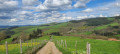
A magnificent hike around the countryside of Machézal and Amplepuis. The views of the Roanne and Haut-Beaujolais regions are breathtaking.
Around Tarare and Joux
6.32 mi
+1,063 ft
-1,066 ft
3h 50
Moderate
Departure from Joux (Rhône)
A hike of around ten kilometres ending with a walk around the Joux Dam. Suitable for mountain bikes. The start is an uphill stretch of just over 3 km, followed by a pleasant downhill path. Lovely views along the route.
Loop starting from Joux
 8.89 mi
+1,654 ft
-1,624 ft
5h 30
Moderate
Departure from Joux (Rhône)
8.89 mi
+1,654 ft
-1,624 ft
5h 30
Moderate
Departure from Joux (Rhône)
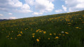
I recommend this hike when nature is waking up in mid-April, to enjoy the green meadows and bright yellow dandelions. There are unobstructed views over much of the route. The ridge offers beautiful views of the Loire and Rhône departments. Picnics by the pond are very enjoyable and peaceful. The return trail near the river (Turdine) is very wild and quiet.
From Saint-Cyr-de-Valorges to Violay in a circular route along the ridges
12.22 mi
+1,841 ft
-1,857 ft
7h 15
Moderate
Departure from Saint-Cyr-de-Valorges (Loire)
A very beautiful hike starting from the car park at the bar in Saint-Cyr-de-Valorges. You will travel through the Saint-Cyr and Violay countryside, passing by the Échanssieux dam and then Violay, returning via Les Crêtes (GR®7) where you will enjoy two magnificent landscapes: on your right, the Monts du Lyonnais (and, on a clear day, the Alps and Mont Blanc); on your left, the Monts du Forez, Auvergne and Cantal.
Crêtes route starting from Saint-Cyr-de-Valorges
 8.92 mi
+1,345 ft
-1,345 ft
5h 15
Moderate
Departure from Saint-Cyr-de-Valorges (Loire)
8.92 mi
+1,345 ft
-1,345 ft
5h 15
Moderate
Departure from Saint-Cyr-de-Valorges (Loire)
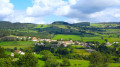
Starting from Saint-Cyr-de-Valorges, this route runs along the ridges surrounding this small village in the Montagnes du Matin. The first ridge is open. The second part, on theGR®7, is in the forest.
Located halfway along the route, the Lac de Saint-Cyr, which is more of a pond, is ideal for a break in the shade.
The return journey offers beautiful unobstructed views of the plain and the Monts du Forez.
Route around Saint-Marcel-l'Éclairé
 2.98 mi
+466 ft
-472 ft
1h 45
2.98 mi
+466 ft
-472 ft
1h 45
 Easy
Departure from Saint-Marcel-l'Éclairé (Rhône)
Easy
Departure from Saint-Marcel-l'Éclairé (Rhône)
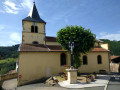
This circular route of almost 5 km allows you to discover the heights of Saint-Marcel-l'Éclairé and enjoy the view over the entire valley. The paths at the edge of the forest are very pleasant.
The Brou departmental forest
 5.60 mi
+1,184 ft
-1,184 ft
3h 35
Moderate
Departure from Dième (Rhône)
5.60 mi
+1,184 ft
-1,184 ft
3h 35
Moderate
Departure from Dième (Rhône)
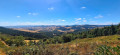
This is a large loop offering several views of the Lyon area and, on a clear day, even Mont Blanc and the Alps. You will also discover the Beaujolais des Pierres Dorées (Oingt, Le Bois d'Oingt, Moirée, etc.) and part of the Tarare Mountains. No major difficulties to expect, the route passes along forest tracks, trails and a small section of tarmac (D629, very little traffic).
Short tour of Ronzière
 4.36 mi
+627 ft
-604 ft
2h 35
Easy
Departure from Saint-Forgeux (Rhône)
4.36 mi
+627 ft
-604 ft
2h 35
Easy
Departure from Saint-Forgeux (Rhône)
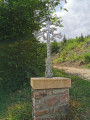
A trip to the heights of Ronzière in Saint-Forgeux offers a beautiful view of the valley.
Tour of Lac des Sapins
 2.80 mi
+43 ft
-43 ft
1h 20
Easy
Departure from Cublize (Rhône)
2.80 mi
+43 ft
-43 ft
1h 20
Easy
Departure from Cublize (Rhône)
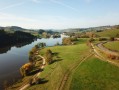
A circular loop around Lac des Sapins, taking about an hour and presenting no difficulties, allowing you to admire the lake from a perfectly maintained path.
Around Saint-Loup
 6.35 mi
+856 ft
-856 ft
3h 40
Moderate
Departure from Saint-Loup (Rhône) (Rhône)
6.35 mi
+856 ft
-856 ft
3h 40
Moderate
Departure from Saint-Loup (Rhône) (Rhône)
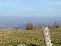
A stroll around the magnificent village of Saint-Loup.
The Pont Marteau Viaduct route in Sainte-Colombe-sur-Gand
 5.55 mi
+728 ft
-758 ft
3h 10
Easy
Departure from Sainte-Colombe-sur-Gand (Loire)
5.55 mi
+728 ft
-758 ft
3h 10
Easy
Departure from Sainte-Colombe-sur-Gand (Loire)
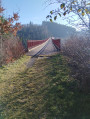
This circular route, which starts in Sainte-Colombe-sur-Gand, follows an old railway line through countryside and forest, finally crossing the vertiginous Pont Marteau bridge, which is 320 m long and 50 m high.
This route follows the signs for "Sur les traces du tacot" (In the footsteps of the old train) and, in the forest, the yellow and red markings ofthe GRP® "Terre de tisseurs en forêt" (Land of weavers in the forest).
"Alongside Aëdan" circular in Saint-Just-d'Avray
 5.97 mi
+1,181 ft
-1,175 ft
3h 45
Moderate
Departure from Saint-Just-d'Avray (Rhône)
5.97 mi
+1,181 ft
-1,175 ft
3h 45
Moderate
Departure from Saint-Just-d'Avray (Rhône)
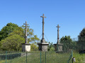
This walk, entitled "Alongside Aëdan", is a circular route starting from Saint-Just-d'Avray. This route offers you the chance to explore the area around the village and enjoy the countryside as well as some magnificent views.
Lac des Sapins in Cublize
 10.21 mi
+1,424 ft
-1,424 ft
5h 55
Moderate
Departure from Cublize (Rhône)
10.21 mi
+1,424 ft
-1,424 ft
5h 55
Moderate
Departure from Cublize (Rhône)
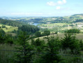
Hike near a beautiful lake that is very popular in summer (with a beach, water sports, horse riding centre, tree climbing, etc.) and in the Mollières woods.
Circular Cublize route via La Longère and La Croix de Vienne
 Local authority
 5.34 mi
+748 ft
-738 ft
3h 05
Easy
Departure from Cublize (Rhône)
5.34 mi
+748 ft
-738 ft
3h 05
Easy
Departure from Cublize (Rhône)
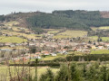
This route is recommended by the municipality of Cublize. It allows you to explore the eastern and western shores of Lac des Sapins. It is marked with two blue lines; this is Route A.
Cublize circular route via the Croix du Gravillon
 4.29 mi
+787 ft
-787 ft
2h 40
Easy
Departure from Cublize (Rhône)
4.29 mi
+787 ft
-787 ft
2h 40
Easy
Departure from Cublize (Rhône)
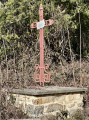
This route is one of three offered by the municipality of Cublize. It allows you to explore the eastern side of the municipality. It is signposted with two blue lines. This is Route C.