Circular Cublize route via La Longère and La Croix de Vienne

This route is recommended by the municipality of Cublize. It allows you to explore the eastern and western shores of Lac des Sapins. It is marked with two blue lines; this is Route A.

Details

69310763
Creation:
Last update:
Last review:
  • Walking
    Activity: Walking
  • ↔
    Distance: 5.34 mi
  • ◔
    Average duration: 3h 05 
  • ▲
    Difficulty: Easy

  • ⚐
    Back to start: Yes
  • ↗
    Ascent: + 748 ft
  • ↘
    Descent: - 738 ft

  • ▲
    Highest point: 1,847 ft
  • ▼
    Lowest point: 1,447 ft

Photos

Description of the walk

Park at Place de l’Europe in Cublize.

(S/E) Head towards the far end of the square (towards the church), cross the leat, turn right onto Chemin du Roton, and continue to Place de l’Église.

(1) Turn left onto Rue du Midi, then onto Rue de la Platte, and head towards the bridge over the River Reins.

(2) Cross the bridge, carry on, then turn left at the Y-junction to take Route de Pomerol, slightly to the left. Walk alongside a pond; at the end, turn left onto Chemin du Saignard and head for the hamlet of Saignard.

(3) Continue along the path on the left, skirting the edge of a wood. When you reach the tarmac road, carry on to the right (Chemin de la Croix de Montagny) until you reach some buildings at the junction with the road leading to the hamlet of La Longère.

(4) Turn right onto this road and proceed to a crossroads with four perpendicular roads.

(5) Carry on straight ahead, then, a few metres further on, turn right to enter the Pommerol woods. Follow an easy descent to reach the Croix des Bergers crossroads.

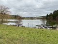
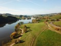
(6) Carry on to the right to reach the tip of Lac des Sapins.

(7) Cross the Le Melard stream, follow the lakeshore, cross the embankment to find, on the opposite bank, the Jean Recorbet lodge.

(8) Take the path on the right, then the one leading uphill to the left until you reach the junction with the D504 at the Croix Chandollan.

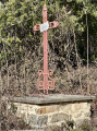
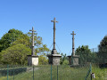
(9) Cross it carefully, then take the tarmac road opposite to reach the Croix de Vienne. 

(10) Before a multi-way junction, turn right onto the Perchonnière footpath, walk alongside the Meyré housing estate, then arrive near the D504 roundabout.

(11) Turn left here, taking great care, and then head back to the original junction at Place de l’Église.

(1) Follow the route taken on the way there, in the opposite direction, to return to the car park at Place de l’Europe (S/E).


Waypoints

  1. S/E : mi 0 - alt. 1,483 ft - Place de l’Europe - Salle des Fêtes de Cublize
  2. 1 : mi 0.1 - alt. 1,509 ft - Crossroads of the circular loop
  3. 2 : mi 0.38 - alt. 1,460 ft - Rhins (rivière) - Affluent de la Loire
  4. 3 : mi 0.94 - alt. 1,644 ft - The hamlet of Le Saignard
  5. 4 : mi 1.68 - alt. 1,811 ft - La Longère crossroads
  6. 5 : mi 1.97 - alt. 1,699 ft - Crossroads with four perpendicular directions
  7. 6 : mi 2.52 - alt. 1,552 ft - Croix des Bergers
  8. 7 : mi 2.71 - alt. 1,450 ft - Le Melard stream
  9. 8 : mi 3.25 - alt. 1,453 ft - Group lodge - Lac des Sapins
  10. 9 : mi 3.5 - alt. 1,476 ft - RD504
  11. 10 : mi 4.32 - alt. 1,847 ft - Croix de Vienne
  12. 11 : mi 4.89 - alt. 1,535 ft - Statue of the Naiad
  13. S/E : mi 5.34 - alt. 1,483 ft - Place de l’Europe - Salle des Fêtes de Cublize

Notes

(7) Dry toilets along the lake.
(8) Toilets and water point at the Jean Recorbet lodge.

(2) The river that runs through the commune from north to south and crosses Lac des Sapins is spelled REINS. The name of this river changes when it enters the Loire department, becoming RHINS. In the Rhône department, all references to this river are spelled REINS.

Worth a visit

(7) Lac des Sapins
(11) D504 roundabout: admire the statue of the Naïade du Lac on the right.
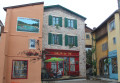
Before (1) on the way back: take a look at the trompe-l’œil mural on the corner of Rue Saint-Martin and Rue de l’Hôtel-de-Ville.

Reviews and comments

4.3 / 5
Based on 3 reviews

Reliability of the description
5 / 5
Ease of following the route
4 / 5
Route interest
4 / 5
Dom6269
Dom6269

Overall rating : 4.7 / 5

Date of your route : Mar 22, 2026
Reliability of the description : ★★★★★ Very good
Ease of following the route : ★★★★★ Very good
Route interest : ★★★★☆ Good
Very busy route : No

A lovely little walk in the hills around Lac des Sapins, which we only skirted to avoid the Sunday crowds.

Machine-translated

Maurice GIROUDON
Maurice GIROUDON

Thank you for your comment. It shows that, using the route description on the Visorando app, it is possible to tailor a route to suit your preferences.
Kind regards

Machine-translated

pierre huraux
pierre huraux

Overall rating : 4.7 / 5

Date of your route : Mar 21, 2026
Reliability of the description : ★★★★★ Very good
Ease of following the route : ★★★★★ Very good
Route interest : ★★★★☆ Good
Very busy route : No

Hello everyone!
Note: this route was fairly quiet given the time of year we walked it. In summer, the area around Lac des Sapins attracts a considerable crowd.
The path is tarmac-surfaced at the start, roughly up to point 3, Le Seignard. After that, it’s very pleasant and often shaded all the way to point 7.
At this point, you reach the lake and start to come across other people.
At point 9, we decided to follow the lakeside to reach point 11 (and avoid the tarmac section between points 9 and 10).
Once we reached point 11, we made our way to point 10 (the Croix de Vienne) via a pleasant, uphill path.
Once at the cross, we descended via the small, relatively steep tarmac road known as the ‘Montée du Tinard’, finishing via Rue du Nord, Rue de l’Hôtel de Ville, Avenue Edmond Perras and the car park where we started.
GPS: 9.35 km, elevation gain 205 m, elevation loss 209 m, 2 hours 55 minutes (leisurely pace).
A pleasant, easy walk, best done when Lac des Sapins is not too busy.

Machine-translated

Maurice GIROUDON
Maurice GIROUDON

Thank you for your comment.
The double blue markings do indeed need to be redone. Did the route description help you to compensate for the poor markings?
Kind regards

Machine-translated

BORDE Jean Marc
BORDE Jean Marc

Overall rating : 3.7 / 5

Date of your route : Oct 19, 2025
Reliability of the description : ★★★★★ Very good
Ease of following the route : ★★☆☆☆ Disappointing
Route interest : ★★★★☆ Good
Very busy route : Yes

The signposting leaves something to be desired!
On the section leading to the lake, it starts off well but then disappears (luckily we had the map)
After that, we couldn't find the route and ended up taking a random path back!
The double blue line markings really need to be redone carefully
Thank you

Machine-translated

Other walks in the area

For more walks, use our search engine .

The GPS track and description are the property of this route's author. Please do not copy them without permission.