Cublize circular route via the Croix du Gravillon

This route is one of three offered by the municipality of Cublize. It allows you to explore the eastern side of the municipality. It is signposted with two blue lines. This is Route C.

Details

71464833
Creation:
Last update:
Last review:
  • Walking
    Activity: Walking
  • ↔
    Distance: 4.29 mi
  • ◔
    Average duration: 2h 40 
  • ▲
    Difficulty: Easy

  • ⚐
    Back to start: Yes
  • ↗
    Ascent: + 787 ft
  • ↘
    Descent: - 787 ft

  • ▲
    Highest point: 2,270 ft
  • ▼
    Lowest point: 1,483 ft

Photos

Description of the walk

Park at Place de l’Europe in Cublize.

(S/E) Turn right onto Avenue Edmond Perras, heading towards the fire station, and cross the River Rhins. Turn left onto Rue du Stade. Keep going straight ahead along this road.

(1) Ignore Rue des Favres on the right (which you’ll take on the way back), continue to the end and leave Cublize on the right via the D504 until you reach thefirst junction at Reviralet.

(2) Take the road on the right, then the one on the left, towards Les Yandes and Les Roches. Carry on straight ahead until you reach the hamlet of Chez Brun.

(3) Carry on straight ahead along the Route du Gravillon until you reach a junction after Les Roches.

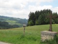
(4) Go straight on along the Chemin des Pommiers, then take the path on the right towards the Croix du Gravillon. You will reach the Montée de Grandmont.

(5) At the junction with the Montée de Grandmont, continue straight ahead along the footpath towards the Croix du Gravillon.

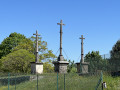
(6) Cross the road towards the Croix de Montagny. Continue straight on until you reach the crossroads at the cross.

(7) Turn right onto Route de la Croix de Montagny. As you approach the hamlet of Chez Doye, you’ll reach Chemin de la Raffinière.

(8) Follow this path to the left, which passes by the Bayard chestnut tree, crosses a track and reaches a junction leading towards the Montée des Grossières.

(9) Take the Impasse des Moineaux opposite and return to the village via the Rue du Vieux Pont and the hamlet of Chez Favre, which joins the Rue du Stade.

(1) Turn left to return to Place de l’Europe via the reverse route of the outward journey (S/E).

Waypoints

  1. S/E : mi 0 - alt. 1,483 ft - Place de l’Europe - Salle des Fêtes de Cublize
  2. 1 : mi 0.14 - alt. 1,486 ft - Junction of the circular loop
  3. 2 : mi 0.47 - alt. 1,509 ft - Reviralet
  4. 3 : mi 1.01 - alt. 1,801 ft - Chez Brun
  5. 4 : mi 1.36 - alt. 2,024 ft - Fork in the road, Chemin des Pommiers
  6. 5 : mi 1.75 - alt. 2,083 ft - Grandmont climb
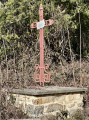
  7. 6 : mi 2.08 - alt. 2,270 ft - Croix du Gravillon
  8. 7 : mi 2.99 - alt. 2,005 ft - Croix de Montagny
  9. 8 : mi 3.25 - alt. 1,919 ft - Chez Doye
  10. 9 : mi 3.84 - alt. 1,647 ft - Les Grossières, Impasse des Moineaux
  11. S/E : mi 4.29 - alt. 1,483 ft - Place de l’Europe - Rhins (rivière) - Affluent de la Loire

Notes

After Reviralet, the first part of the climb up Les Yandes is very steep.

Worth a visit

-Visit Cublize

Reviews and comments

4.6 / 5
Based on 3 reviews

Reliability of the description
4.7 / 5
Ease of following the route
4.7 / 5
Route interest
4.3 / 5
minique
minique

Overall rating : 4 / 5

Date of your route : Sep 22, 2025
Reliability of the description : ★★★★☆ Good
Ease of following the route : ★★★★☆ Good
Route interest : ★★★★☆ Good
Very busy route : Yes

Hike in the sunshine with plenty of forest, easy hike. The start is a bit steep but the view is worth it

Machine-translated

Maurice GIROUDON
Maurice GIROUDON

Thank you for your comments

Machine-translated

User 973532

Overall rating : 4.7 / 5

Date of your route : Jul 31, 2025
Reliability of the description : ★★★★★ Very good
Ease of following the route : ★★★★★ Very good
Route interest : ★★★★☆ Good
Very busy route : No

I was alone and everything went very well. Thank you to whoever created the listing.

Machine-translated

Maurice GIROUDON
Maurice GIROUDON

Thank you for your positive comments.
I'm glad to see that GPS tracking allows you to complete the route without relying on signposts. The signposting does indeed need to be reviewed, but we don't have enough volunteers to do this.
Please feel free to try one of the other loops and let us know what you think.

Machine-translated

TOUTCOTON
TOUTCOTON

Overall rating : 5 / 5

Date of your route : Jun 30, 2025
Reliability of the description : ★★★★★ Very good
Ease of following the route : ★★★★★ Very good
Route interest : ★★★★★ Very good
Very busy route : No

Route completed on 30 June 2025. A lovely route starting at Croix de Montagny and returning via the Chemin des Pommiers. Magnificent views all along the route, with a mix of sunny and shaded sections.
I followed the GPS track on my smartphone. Thank goodness, as the blue markings are either missing, obscured or worn away… So you can’t really rely on them. As for the route description, I didn’t read it. I’m sure it’s very good. Part of the path, near the apple trees, was overgrown with brambles, but you could get past them.
Heading the other way, the first climb is steep. The descent along the tarmac road is a bit bumpy, but it’s a lovely walk.

Machine-translated

Other walks in the area

For more walks, use our search engine .

The GPS track and description are the property of this route's author. Please do not copy them without permission.