Route du Pin Bouchain, Amplepuis, Cublize, Col du Pilon les Sauvages

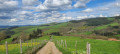
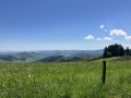
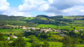
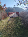
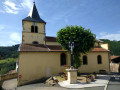
On this route, you’ll enjoy splendid scenery: the Forêt du Roannais plain and its hills, the Monts de Tarare and Monts du Lyonnais along theGR®7, and Rochefort Castle to your right, plus a section along parts of the Route Napoléon.
A challenging route due to its length and elevation gain. See the ‘Practical Information’ section.

Details

2264688
Creation:
Last update:
Last review:
  • Walking
    Activity: Walking
  • ↔
    Distance: 20.97 mi
  • ◔
    Average duration: 11h 40 
  • ▲
    Difficulty: Difficult

  • ⚐
    Back to start: Yes
  • ↗
    Ascent: + 2,306 ft
  • ↘
    Descent: - 2,293 ft

  • ▲
    Highest point: 2,841 ft
  • ▼
    Lowest point: 1,378 ft

Description of the walk

Start at the Col du Pin Bouchain car park by the chapel.

(S/E) Head towards the N7, cross it carefully and take theGR®7opposite. A few metres past the yellow tower, leave theGR® and turn right onto the path running alongside the N7.

(1) After leaving the hamlet of La Maconnière, take the path on the right just before a hairpin bend.
When you reach the crossroads, cross the N7 carefully, take the road opposite and continue to the last house on the left.

(2) Take Route Napoléon on the left and follow it to the next crossroads.

(3) When you reach the road, turn left then immediately right, follow the track to thefirst path on the right and take it.

(4) At the crossroads, continue straight on; when you reach Le Fay, take the tarmac road on the right and continue straight up.

(5) At the three-way junction, turn left, continue straight on towards the path and follow it straight on until the next tarmac road.

(6) Turn right and head down to the hamlet of Le Pilon. At the crossroads, go straight ahead and follow the path down. When you reach the houses, turn left until you reach the junction with the D10 at the hamlet of Le Vervas.

(7) Walk a few metres up the D10, turn right onto the tarmac road with the no entry sign and follow it down, keeping to the right, until you reach Le Rançon (the first houses in the commune of Amplepuis).

(8) Turn right onto Boulevard de Rançon and follow it to the bottom, cross the D10 carefully and go through the railway tunnel. Go round the roundabout on the left and take Rue de Belfort towards the florist.

(9) Walk up this street; when you reach the centre, continue straight on past the church and follow Rue du 8 Mai 1945 to the next roundabout. Turn immediately right towards the swimming pool, cross the D313 with care and, heading towards the stadium, take the path on the left towards Sandrin.

(10) Follow this path uphill, keeping to the right, and when you reach the crossroads with the cross, continue straight on along Chemin de Sandrin until the end of the tarmac road and the houses.

(11) Take the path straight on to the farm building, turn left at the junction of the three paths, then a few metres further on turn right and follow the path straight on.

(12) At the junction of four paths, go straight on. When you reach the D56, cross over and take the path opposite, then the tarmac road to the left. Follow it to Lac de Cublize, then head left towards the car park and the restaurants where you can get something to eat and rest.

(13) Take the path around the lake on the right, cross the tarmac road and take the tree-top adventure trail. Follow it uphill to the hamlet of La Graviche, cross it heading to the right and go down the path to the reservoir.

(14) Continue straight on towards the village of Ronno, cross through it past the church and, about 100m further on, take a straight road to the left. At the next crossroads with a cross, turn right then take thefirst path on the left.

(15) Follow this path up to the D98, cross carefully to the other side, walk about 50m and take the path on the right. Follow it up and, further on, ignore the path on the right; pass in front of the Dumas Chapel and, at the crossroads, turn right onto theGR®7. Follow the path to the D313 at Col du Pilon, cross the road ignoring the path opposite and continue a few metres further along theGR®7.

(16) Continue straight ahead, cross the D56 with care at Giroudon and continue on theGR®7to Croix Carrel. Continue straight ahead (there may be a diversion due to the wind turbines; ignore this), follow theGR®7to the village of Les Sauvages (69).

(17) Cross the D8 with care, then enter the village following theGR®7; after the church and just before the town hall, turn left and follow the street and the D121 to the village exit.

(18) Once you reach the tennis courts, cross the D121 with care and follow theGR®7towards the astronomical observatory. After passing the observatory, at the tarmac path, turn left and continue through the farmland until you reach the Route Napoléon. Continue on theGR®7to the right, then straight on until you reach the D121 again. Cross with care and take the tarmac path to the right.

(19) Go straight on, ignoring the tarmac road on the right. Continue in this direction to the Col du Pin Bouchain, Chapelle car park (S/E).


Waypoints

  1. S/E : mi 0 - alt. 2,516 ft - Chapelle car park - Col du Pin Bouchain (758m)
  2. 1 : mi 1.63 - alt. 2,490 ft - A place called La Maconnière
  3. 2 : mi 2.02 - alt. 2,408 ft - Route Napoléon
  4. 3 : mi 2.5 - alt. 2,254 ft - Left or right at the crossroads
  5. 4 : mi 3.12 - alt. 2,208 ft - Straight ahead
  6. 5 : mi 3.86 - alt. 2,264 ft - Turn left at the three-way junction
  7. 6 : mi 4.6 - alt. 2,073 ft - Turn right towards Le Pilon
  8. 7 : mi 5.4 - alt. 1,765 ft - First right as you go up the D10
  9. 8 : mi 6.12 - alt. 1,650 ft - On the right
  10. 9 : mi 6.7 - alt. 1,381 ft - Straight ahead on Rue de Belfort
  11. 10 : mi 7.44 - alt. 1,424 ft - Turn left towards Sandrin
  12. 11 : mi 8.23 - alt. 1,555 ft - Straight ahead
  13. 12 : mi 9.71 - alt. 1,601 ft - Straight on towards the - Lac des Sapins
  14. 13 : mi 10.76 - alt. 1,447 ft - The surrounding area, restaurants and picnic tables - Rhins (rivière) - Affluent de la Loire
  15. 14 : mi 12.26 - alt. 1,631 ft - Straight on towards Ronno
  16. 15 : mi 13.05 - alt. 1,900 ft - First path on the left after the cross
  17. 16 : mi 14.43 - alt. 2,388 ft - Follow the GR7 - Col du Pilon (726m)
  18. 17 : mi 18.13 - alt. 2,372 ft - Les Sauvages: return to the village by following the GR7
  19. 18 : mi 18.69 - alt. 2,388 ft - Follow the GR7 towards the observatory
  20. 19 : mi 20.33 - alt. 2,480 ft - Straight ahead
  21. S/E : mi 20.96 - alt. 2,516 ft - Col du Pin Bouchain, La Chapelle car park

Notes

In summer, allow for 3 to 3.5 litres of water; you can fill your water bottles and top up your supplies nearby at Lac des Sapins. Best done in late summer.

I completed the route on 4 July 2019 in 8 hours, including breaks. For experienced hikers, you can set off at 8.00 am and have lunch in Cublize, either at the restaurants at Lac des Sapins or nearby at a picnic table.

Worth a visit

Col du Pin Bouchain signpost.
Lac des Sapins.
Chapelle Dumas.
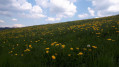
Splendid views throughout the hike.

Always be cautious and plan ahead when you're outdoors. Visorando and the author of this route cannot be held responsible for any accidents occurring on this route.

The GR® and PR® markings are the intellectual property of the Fédération Française de Randonnée Pédestre.

Reviews and comments

4.8 / 5
Based on 4 reviews

Reliability of the description
5 / 5
Ease of following the route
5 / 5
Route interest
4.5 / 5
fripounet21
fripounet21

Thank you.

Machine-translated

pilou457
pilou457

So I've made some changes from point 14 onwards; I think that should do the trick!!!

Machine-translated

fripounet21
fripounet21

It was this one:
 A circular route from Saint-Cyr-de-Valorges to Violay along the ridges
Magnificent

Machine-translated

pilou457
pilou457

Hello, it’s no problem. Please could you give me the exact name of the hike so I can update the description? If you’re interested in the ‘Tête de Cochon’ hike, please sign up with the Tarare ODT. Contact: Bernard Chenaud. You can tell him I sent you (Philippe VAGINAY).

Machine-translated

fripounet21
fripounet21

Hello
No, no, I’m sorry, I took the wrong walk.
It was the walk around Violay.
I tried to delete this comment, which I posted too quickly, but I couldn’t.
My apologies.
Kind regards
François

Machine-translated

pilou457
pilou457

Thanks for the comment. I’ll try to sort out point 14. I’m waiting for my sciatica to clear up and I’m looking into it. I’d also recommend “La Tête de Cochon”, which I created a few years ago. ODT DE TARARE is organising this event, and I’ve been invited on 23 May. If you’re interested...

Machine-translated

fripounet21
fripounet21

Overall rating : 5 / 5

Date of your route : Apr 15, 2024
Reliability of the description : ★★★★★ Very good
Ease of following the route : ★★★★★ Very good
Route interest : ★★★★★ Very good
Very busy route : No

A lovely walk with views of both the Alps and the Auvergne.
There is a slight error at point 14: do not turn left immediately at the cross, but continue for another 200 metres to find the path, as the route map clearly indicates; the commentary may be misleading.

Machine-translated

pilou457
pilou457

Thanks for the comment. Yes, the estimated time on Visorando is overestimated; personally, it took me 8 hours, including a good hour’s break at the restaurant in Cublize.

Machine-translated

paco2000
paco2000

Overall rating : 5 / 5

Date of your route : Dec 30, 2023
Reliability of the description : ★★★★★ Very good
Ease of following the route : ★★★★★ Very good
Route interest : ★★★★★ Very good
Very busy route : No

Thank you for this route, which allowed us to discover the Beaujolais Vert. With the lovely weather, the route was enchanting. We could see the Alps and Mont Blanc.
We stopped for a break in Amplepluis at a bar opposite the church, then by the shores of Lac des Sapins. We really enjoyed Ronno.
We completed the route in 7 hours and 50 minutes, including a 45-minute lunch break.
Thank you. We highly recommend it. It’s true that the estimated time of 11 hours 30 minutes on the information sheet is daunting and makes you hesitate to set off. We felt this time was overestimated, even though my wife and I are keen walkers.

Machine-translated

florun71
florun71
• Edited:

Overall rating : 4.7 / 5

Date of your route : Aug 14, 2021
Reliability of the description : ★★★★★ Very good
Ease of following the route : ★★★★★ Very good
Route interest : ★★★★☆ Good
Very busy route : No

A pleasant route

Machine-translated

Quentindel
Quentindel

Overall rating : 4.7 / 5

Date of your route : Jan 07, 2023
Reliability of the description : ★★★★★ Very good
Ease of following the route : ★★★★★ Very good
Route interest : ★★★★☆ Good
Very busy route : No

I completed this route on my own in 6 hours, including a 15-minute break for a meal. It’s an ideal route if this is your first long hike, as it was for me. There are quite a few stretches of road at times, but they aren’t very busy. I should point out that I walked quite briskly at 6 km/h, so if you plan to walk more slowly, you’ll easily need to add a few hours. 3 litres of water was enough for me as it was only up to 22 degrees; if it’s much hotter, bring more or ask to top up in the various villages. At the 22km mark, there’s a chapel tucked away in the forest with picnic tables – ideal for a bite to eat two-thirds of the way through the route.

Machine-translated

Other walks in the area

For more walks, use our search engine .

The GPS track and description are the property of this route's author. Please do not copy them without permission.