Short tour of Ronzière

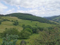
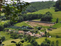
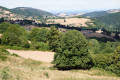
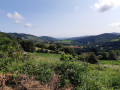
A trip to the heights of Ronzière in Saint-Forgeux offers a beautiful view of the valley.

Details

3283067
Creation:
Last update:
Last review:
  • Walking
    Activity: Walking
  • ↔
    Distance: 4.34 mi
  • ◔
    Average duration: 2h 35 
  • ▲
    Difficulty: Easy

  • ⚐
    Back to start: Yes
  • ↗
    Ascent: + 646 ft
  • ↘
    Descent: - 646 ft

  • ▲
    Highest point: 2,287 ft
  • ▼
    Lowest point: 1,680 ft

Photos

Description of the walk

Arriving via the Saint-Forgeux road, turn left towards the stream. You can park along the road.

(S/E) Take the Chemin de la Bergerie towards the farm. You will need to pass between the buildings (access is permitted for hikers) to reach a path that climbs to the edge of the forest. You will pass another building a little further up.

(1) When you reach Napoly, continue along the road (Chemin du Napoly). Pass Le Satinaire and arrive at Gonnard de Ronzière.

(2) Take the access road to the farm overlooking the road, then cross between the buildings to find a path before reaching other buildings and returning to the Saint-Marcel road.

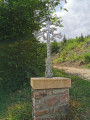
(3) When you reach the Croix de Ronzière, take the path on your right at the edge of the forest.

(4) When you reach another cross, take the path on your right that descends to the bottom of the valley. Cross along a field behind a farm before finding a small path that will take you back to your starting point (S/E).

Waypoints

  1. S/E : mi 0 - alt. 1,703 ft - Ronzière
  2. 1 : mi 0.66 - alt. 2,018 ft - Napoly
  3. 2 : mi 1.73 - alt. 2,011 ft - Gonnard de Ronzière
  4. 3 : mi 2.26 - alt. 2,264 ft - Ronzière Cross
  5. 4 : mi 3.19 - alt. 2,110 ft - Second Cross
  6. S/E : mi 4.34 - alt. 1,703 ft - Ronzière

Notes

The hike is mainly on roads (very little traffic) with a few sections on paths that are sometimes stony or muddy.

Worth a visit

  • Superb view of the valley
  • A wildlife bird sanctuary along the way offers the opportunity to see birds of prey in large aviaries.

Reviews and comments

4.3 / 5
Based on 7 reviews

Reliability of the description
3.9 / 5
Ease of following the route
4.7 / 5
Route interest
4.5 / 5
oneup
oneup

Overall rating : 3.7 / 5

Date of your route : May 11, 2024
Reliability of the description : ★★★★☆ Good
Ease of following the route : ★★★★☆ Good
Route interest : ★★★☆☆ Average
Very busy route : No

Overall, a pleasant short hike, alternating between forest and forest edge passages and occasionally offering some nice views of the surrounding area. A good dose of nature, family-friendly and not too demanding (elevation/distances).

However, there are a few drawbacks:
- Limited parking options at the start, and contrary to what is indicated, the Chemin du Taupier is not an option as it is private property. We met the owner, who seemed exasperated by the illegal parking (and even damage caused by a few unscrupulous hikers).
- The route is well described, but sometimes seems (too?) intrusive, particularly after point 4, which in our case required us to go through two closed gates to enter a kind of enclosure, then pass a few metres from a farm (fortunately we didn't meet anyone, but it would have been very awkward to come face to face with the owners) without identifying any other alternatives. The end of the hike (after point 4) is of little interest and leaves an unpleasant feeling of intrusion.

Machine-translated

ERPAT
ERPAT
• Edited:

Overall rating : 4 / 5

Date of your route : Jun 26, 2023
Reliability of the description : ★★★★☆ Good
Ease of following the route : ★★★★☆ Good
Route interest : ★★★★☆ Good
Very busy route : No

A pleasant route alternating between very sunny sections on small, almost deserted roads (after point 1) and very wooded sections.
The starting point is easy to find if you have taken the precaution of downloading the destination from Visorando to Google Maps or Waze (in my case). Coming from St FORGEUX, when you are almost there, don't hesitate to take the Chemin du Taupier (signposted) on the left towards the stream. There is space to park at the bottom.
Start: take Chemin de la Bergerie (signposted) and go through the wooden gate of the first house without hesitation, then pass the house and the path climbs up to the right.
The rest is easy to find.
After point 4, when you reach the meadow, the path is a little less clear. You need to cross the meadow to your left. The path climbs again and at the end there is a closed gate that can be opened easily with a latch halfway up. You then return to the starting point through undergrowth and paths where the grass is sometimes a little high but never so high that the trail is difficult to follow.
A nice hike to get back into shape in just over two hours.

Machine-translated

a1j1
a1j1

Overall rating : 5 / 5

Date of your route : Nov 28, 2021
Reliability of the description : ★★★★★ Very good
Ease of following the route : ★★★★★ Very good
Route interest : ★★★★★ Very good
Very busy route : No

A magnificent hike in the hills and woods, far from any houses. We did it in the snow, it was superb!

Machine-translated

Vanessalourse
Vanessalourse

Overall rating : 4.3 / 5

Date of your route : Feb 15, 2021
Reliability of the description : ★★★☆☆ Average
Ease of following the route : ★★★★★ Very good
Route interest : ★★★★★ Very good
Very busy route : No

We couldn't find the starting point, so we began at point 2.
Two passages were closed by gates at point 4 to pass in front of the farm on the left. We went through anyway, otherwise we would have had to turn back and we didn't see any alternative nearby.

Machine-translated

losvinsos
losvinsos

Overall rating : 5 / 5

Date of your route : Jan 25, 2021
Reliability of the description : ★★★★★ Very good
Ease of following the route : ★★★★★ Very good
Route interest : ★★★★★ Very good
Very busy route : No

A superb short hike
with the added bonus of a magnificent view of Mont Blanc and the Alps on that day.
A GPS and the GPX route, perfect!

Machine-translated

adrien69
adrien69
• Edited:

Overall rating : 5 / 5

Date of your route : Oct 10, 2020
Reliability of the description : ★★★★★ Very good
Ease of following the route : ★★★★★ Very good
Route interest : ★★★★★ Very good
Very busy route : No

Brilliant, did it today with two little rascals aged 5 and 7 who loved it! Varied terrain, country roads, forests, fields... We followed the GPX route, perfect!

Machine-translated

grandin
grandin ★

It would also be better to provide a map.

Machine-translated

fabricemuhlenbach
fabricemuhlenbach

Overall rating : 1 / 5

Date of your route : Jun 15, 2020
Reliability of the description : ★☆☆☆☆ Very disappointing
Ease of following the route : Not used / Not applicable
Route interest : Not used / Not applicable
Very busy route : No

We were very disappointed with this hike, which we wanted to do with the children and which seemed perfectly suited to them.
We couldn't find the starting point with the directions "When arriving via the Saint-Forgeux road, turn left towards the stream. You can park along the road".
Arriving from where and going in which direction?
We got lost between Pontcharra-sur-Turdine, Saint-Forgeux and Ronzières looking for this famous starting point (our GPS was struggling to find a signal). After going back and forth several times and retracing our steps, we got back in the car and headed for Montrottier to go on a hike at random, following the signs.
The region is very pretty, but next time we'll choose a better signposted hike (with a more reliable starting point such as "park in the car park at the town hall square" or "you can park in front of the church").

Machine-translated

Other walks in the area

For more walks, use our search engine .

The GPS track and description are the property of this route's author. Please do not copy them without permission.