Country:

 City:
City:



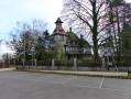
Start from the car park opposite Brémontier-Merval Town Hall.
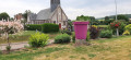
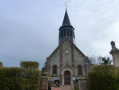
(S/E) Opposite the town hall, turn right and then immediately right again onto Rue de l’Église. Walk past the church until you reach a junction.
Green signposting
(1) Continue to the right along Route de Belleville until you reach a four-way junction.
(2) Carry on straight ahead along Route du Bos Mallard and turn right onto the first track about 500 m further on. Follow the track for about 1.2 km and turn right onto Chemin de la Vigne until you reach the nearby road (D84).
(3) Cross the road and follow Chemin des Gallois straight ahead. Continue to the road, then turn right and follow Chemin du Haut Durand straight ahead. Follow this track uphill to the junction with Route de Belleville (D284).
(4) Turn right then left onto the path almost directly opposite. Walk for about 1.2 km across the plain and up through the woods to reach a picnic table on your left.
Yellow and red markings
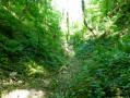
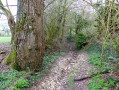
(5) Turn left as you descend into the ravine (watch your ankles). Continue along a path at the edge of the woods and then head down across the fields to reach the Route de la Briqueterie.
(6) Turn left onto Chemin de la Briqueterie (tarmac), pass the water tower at the hamlet known as ‘le Bois Valu’ and continue to the T-junction at the hamlet known as ‘la Briqueterie’.
(7) At the T-junction, turn right onto the tarmac-surfaced Chemin de Belleville (D284) and turn right at the first road, Rue de la Liberté, in Elbeuf-en-Bray. Walk past the town hall and continue to the church.
Blue signposting
(8) Turn left onto Rue du Souvenir Français and then immediately right onto Rue des Bons Enfants, until you reach the junction with Chemin des Chasse-Marées. Continue straight ahead (markings faded). Go straight on across the fields and follow the path that climbs through the woods opposite the wind turbines. At the top, follow the blue markings which branch off to the left, passing between the wind turbines to reach a junction with the Chemin du Camps Caillot.
No markings
(9) Turn right and carry on to the Route du Camp Caillot (D1).
Blue markings
(10) Turn right, pass the hamlet of “Camp Caillot” and continue to the four-way junction with a wayside cross.
Green signposting
(11) Turn left onto Rue du Mont Réal.
(12) Turn right onto Chemin des Surets, pass the Mont Réal farm and continue to the D241.
(13) Turn right onto Chemin des Bas Routhieux. Cross the first road (D57) at Bas Routieux, then a second (D1), and take the path directly opposite. Follow the small gully at the start (watch your ankles), then continue along this path until you reach the tarmac and arrive at the junction you have already passed, where Route du Bos Mallard meets Route de Belleville.
(2) Carry on straight ahead to reach the car park at Brémontier-Merval Town Hall (S/E).


 Visorando Member
 Moderate
 Easy
Easy