Molagnies – Hyancourt Circular Loop

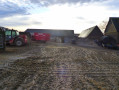
Magnificent panoramic view of the dovecote at the AVA (Aide aux Vieux Animaux) animal sanctuary in Cuy-Saint-Fiacre.

Details

3095793
Creation:
Last update:
Last review:
  • Walking
    Activity: Walking
  • ↔
    Distance: 3.69 mi
  • ◔
    Average duration: 1h 55 
  • ▲
    Difficulty: Easy

  • ⚐
    Back to start: Yes
  • ↗
    Ascent: + 256 ft
  • ↘
    Descent: - 262 ft

  • ▲
    Highest point: 545 ft
  • ▼
    Lowest point: 315 ft

Photos

Description of the walk

Parking is available in the town hall square.

Blue signposting

(S/E) With your back to the town hall, turn right onto Rue de l’Église and, at the end, turn right. At the Y-junction that follows, continue straight ahead onto Rue Saint-Mennevieux (D57).

(1) Take the first path on the left, which is in the bend, just before you reach a wayside cross.
Continue along the path, which goes uphill, until you reach the D571.

(2) Turn onto the track on the right and continue to the next T-junction.

(3) Turn right onto Rue de Hyancourt (in the Oise department). Ignore Impasse Froisson on your right.

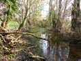
(4) Turn right onto the track just before the Y-junction (back into Seine-Maritime), pass two ponds on your left and reach Impasse des Jonquets. Continue on to the D57, Rue Saint-Mennevieux.

(5) Turn right, passing the first wayside cross on your left.

(1) Carry on straight ahead, turn left at the Y-junction and, at the top of the small hill, turn right into Rue de l’Église to reach the town hall (S/E).


Waypoints

  1. S/E : mi 0 - alt. 443 ft - Rue de l’Église, town hall
  2. 1 : mi 0.29 - alt. 374 ft - Common junction for out-and-back route
  3. 2 : mi 1.17 - alt. 545 ft - X-shaped junction; turn right
  4. 3 : mi 1.85 - alt. 443 ft - Rue de Hyancourt
  5. 4 : mi 2.3 - alt. 371 ft - Path on the right
  6. 5 : mi 3.06 - alt. 348 ft - Rue Saint-Mennevieux
  7. S/E : mi 3.69 - alt. 443 ft - Rue de l’Église, town hall

Notes

This Route No. 13 of the Four Rivers Tourist Trail in Bray is marked in blue from start to finish.
It is excellent for training young children.

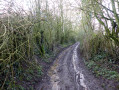
Caution: at (1), on the uphill section, there is a water run-off and it is very muddy in wet weather.
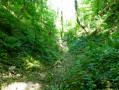
At (4), the path is very muddy, with a rather tricky section. Near the ponds, in wet weather, the path is completely flooded and you’ll need to wade through water 20 cm above your ankles.

Worth a visit

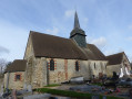
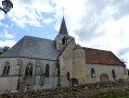
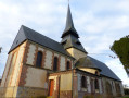
The 12th-century Saint-Manvieu Church, remodelled in the 18th and 19th centuries.

Reviews and comments

4 / 5
Based on 3 reviews

Reliability of the description
3.7 / 5
Ease of following the route
4 / 5
Route interest
4.3 / 5
Philippe Grié
Philippe Grié

Overall rating : 3.3 / 5

Date of your route : Nov 11, 2024
Reliability of the description : ★★★☆☆ Average
Ease of following the route : ★★★★☆ Good
Route interest : ★★★☆☆ Average
Very busy route : No

Caution: between 4 and 5
200 metres’ walk with feet and ankles completely submerged in cold, muddy water
Extremely difficult going at times through brambles and thorns

Machine-translated

benoitrando
benoitrando

Between 4 and 5, the path is indeed poorly maintained but is still visible.

Thanks, Martin

Machine-translated

Martin Ader
Martin Ader

Overall rating : 4.3 / 5

Date of your route : Sep 27, 2020
Reliability of the description : ★★★★☆ Good
Ease of following the route : ★★★★☆ Good
Route interest : ★★★★★ Very good
Very busy route : No

It is actually between points 4 and 5 that the problem lies.

Machine-translated

Martin Ader
Martin Ader

Overall rating : 4.3 / 5

Date of your route : Sep 27, 2020
Reliability of the description : ★★★★☆ Good
Ease of following the route : ★★★★☆ Good
Route interest : ★★★★★ Very good
Very busy route : No

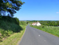
A lovely walk through the Bray countryside towards the charming village of Molagnie.
Lovely sunken paths covered in branches
Blackberries in abundance

The only drawback is that between points 3 and 4 there is a poorly maintained path, part of which crosses a wetland – make sure you wear good wellies if it has rained.

Machine-translated

Other walks in the area

For more walks, use our search engine .

The GPS track and description are the property of this route's author. Please do not copy them without permission.