Les Bruyères in Cuy-Saint-Fiacre

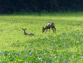
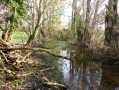
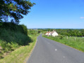
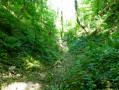
This easy route offers varied scenery: woods and wet meadows where many plants typical of the Bray countryside grow. Part of the route runs alongside a very rich ecological area where heather, an acidophilic plant, grows.

Details

3095936
Creation:
Last update:
Last review:
  • Walking
    Activity: Walking
  • ↔
    Distance: 3.52 mi
  • ◔
    Average duration: 1h 40 
  • ▲
    Difficulty: Easy

  • ⚐
    Back to start: Yes
  • ↗
    Ascent: + 89 ft
  • ↘
    Descent: - 75 ft

  • ▲
    Highest point: 453 ft
  • ▼
    Lowest point: 377 ft

Photos

Description of the walk

Parking and starting point: the village hall car park, Rue Roger Cressent.

Green signposting.

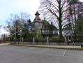
(S/E) Leave the car park, walk past the town hall and turn left onto Rue de l’Abbé Denhez. Ignore the first street on the right and, at the T-junction, turn right onto Rue du Lavoir, then turn right again onto Rue René de Saint-Marceaux.

(1) At the T-junction, turn left onto Rue Roger Cressent. At the next Y-junction, follow the road to the right (Route de Dampierre) until you reach the next junction with the wayside cross.

(2) Take the left-hand branch, Rue des Bruyères, continue for about 400 m and take the first path on the right, which leads straight on to the T-junction with the Chemin de Torchy.

(3) Turn right and continue to the T-junction with the Route de Dampierre (D16).

(4) Turn right again and continue for about 200 m, pass the village sign and take the first path on the left, Chemin du Catel. Continue for 980 m until you reach a crossroads, with the village sign on your right.

(5) Cross the road and continue straight ahead, travelling 490 m to the first T-junction in the middle of the fields.

(6) Take a sharp right-hand bend and carry on to the end of the track to reach Cuy-Saint-Fiacre at Rue des Monts. Turn right and head towards the village hall (S/E).

Waypoints

  1. S/E : mi 0 - alt. 410 ft - Rue Roger Cressent, village hall
  2. 1 : mi 0.3 - alt. 400 ft - Rue Roger Cressent
  3. 2 : mi 0.73 - alt. 420 ft - Calvary
  4. 3 : mi 1.63 - alt. 377 ft - Torchy Path
  5. 4 : mi 2.02 - alt. 420 ft - Route de Dampierre
  6. 5 : mi 2.81 - alt. 420 ft - Chemin du Mort
  7. 6 : mi 3.12 - alt. 453 ft - First junction after the Chemin du Mort
  8. S/E : mi 3.52 - alt. 410 ft - Rue Roger Cressent, village hall

Notes

This ‘Four Rivers in Bray’ route No. 12 is signposted in green from start to finish.
It’s excellent for introducing young children to walking.

Worth a visit

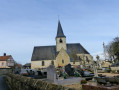
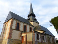
The Romanesque Church of Saint-Martin is surrounded by a small cemetery notable for its very old graves and a war memorial created by the artist François Pompon.

Reviews and comments

4.5 / 5
Based on 2 reviews

Reliability of the description
4.5 / 5
Ease of following the route
4.5 / 5
Route interest
4.5 / 5
User 24858236

Overall rating : 5 / 5

Date of your route : Sep 15, 2025
Reliability of the description : ★★★★★ Very good
Ease of following the route : ★★★★★ Very good
Route interest : ★★★★★ Very good
Very busy route : No

Very interesting hike

Machine-translated

GTI
GTI

Overall rating : 4 / 5

Date of your route : Sep 12, 2022
Reliability of the description : ★★★★☆ Good
Ease of following the route : ★★★★☆ Good
Route interest : ★★★★☆ Good
Very busy route : No

I wanted to get a feel for the local area and take a detour. It worked out well. A lovely walk before I went to lock myself away.

Machine-translated

Other walks in the area

For more walks, use our search engine .

The GPS track and description are the property of this route's author. Please do not copy them without permission.