Les Quatre Chemins in Renage

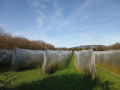
An easy walk towards Charnècles, offering remarkable views of the Vercors, Belledonne and Chartreuse mountains as you pass through parks, orchards and walnut groves that bear witness to the agricultural activity of Criel de Renage.

Details

87261540
Creation:
Last update:
Last review:
  • Walking
    Activity: Walking
  • ↔
    Distance: 3.03 mi
  • ◔
    Average duration: 1h 30 
  • ▲
    Difficulty: Easy

  • ⚐
    Back to start: Yes
  • ↗
    Ascent: + 125 ft
  • ↘
    Descent: - 138 ft

  • ▲
    Highest point: 1,234 ft
  • ▼
    Lowest point: 1,119 ft

Description of the walk

Park in the car park of the former Criel school.

(S/E) With your back to the school, head left onto the road (Chemin du Marais Fleury). At the crossroads, turn right onto Chemin des Combes, which passes through parks, orchards and walnut groves. Continue to the junction with another farm track at a place called Les Bruyères.

(1)Take the track on the left heading north and join the road from Rives to Vourey. Follow it to the left until you reach the Quatre Chemins crossroads.

(2) Head to the right. At the next fork, take the tarmac Chemin de la Puce on the left. At the hangars fitted with solar panels, turn right onto Rue de la Rivoire and reach the junction with Route de Bois Vert.

(3)Follow it to the right for about thirty metres, then turn right just before the house to take a farm track. Continue until you reach the junction with Route de Combe Louvat. Cross it and take a short right-left turn to join Chemin du Grand Taillis. First turn right then left. You will come out onto Chemin du S from the left; continue right along this path to reach the junction with Route de Rives.

(4) Turn right onto it and follow it up to the next junction. Turn left, walk for about 150 m, then turn right onto a barely marked farm track that climbs between pastures and walnut trees and leads back to the Bruyères junction.

(1) Go straight on and follow the outward route in the opposite direction to return to the car park (S/E).

Waypoints

  1. S/E : mi 0 - alt. 1,214 ft - Car park at the former Criel school
  2. 1 : mi 0.51 - alt. 1,178 ft - Les Bruyères, junction of the circular loop
  3. 2 : mi 0.85 - alt. 1,138 ft - Les Quatre Chemins
  4. 3 : mi 1.34 - alt. 1,220 ft - Junction of Route de Bois Vert and Rue de la Rivoire
  5. 4 : mi 2.04 - alt. 1,119 ft - Route de Rives
  6. S/E : mi 3.03 - alt. 1,211 ft - Car park at the former Criel school

Notes

Hiking on our trails is an outdoor activity and involves some risks: you may slip and fall, or find yourself in the path of a mountain bike or a falling branch… Please be careful. Warning: global warming is affecting the vegetation. Trees are weakened and may uproot unexpectedly: Do not venture into the woods in windy or stormy weather. Walking with poles is recommended. Keep an eye on your children and stay on the path. Enjoy your walk.

Worth a visit

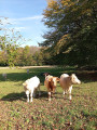
This walk offers a chance to see all the agricultural activities on the Criel plateau: livestock farms, orchards and walnut groves.

Reviews and comments

4.7 / 5
Based on 1 review

Reliability of the description
5 / 5
Ease of following the route
5 / 5
Route interest
4 / 5
Anne38140
Anne38140

Overall rating : 4.7 / 5

Date of your route : Apr 21, 2026
Reliability of the description : ★★★★★ Very good
Ease of following the route : ★★★★★ Very good
Route interest : ★★★★☆ Good
Very busy route : No

A lovely little route with stunning views of the mountains throughout. Easy to extend.

Machine-translated

Other walks in the area

For more walks, use our search engine .

The GPS track and description are the property of this route's author. Please do not copy them without permission.