Le Mollard Rond

This circular route offers joggers a route featuring ascents and descents, mostly through unspoilt countryside. Walkers can also enjoy views of the Vercors and the Chartreuse.

Details

87260553
Creation:
Last update:
Last review:
  • Walking
    Activity: Walking
  • ↔
    Distance: 2.49 mi
  • ◔
    Average duration: 1h 20 
  • ▲
    Difficulty: Easy

  • ⚐
    Back to start: Yes
  • ↗
    Ascent: + 236 ft
  • ↘
    Descent: - 230 ft

  • ▲
    Highest point: 1,220 ft
  • ▼
    Lowest point: 1,024 ft

Description of the walk

Park in the car park of the former Criel school.

(S/E) With your back to the school, take Route du Marais Fleury, turning left towards the north.

(1) At the junction with Chemin des Combes, turn left and continue to the EDF transformer. Turn right onto Chemin des Écureuils and, after the house, follow the path down to the bottom.

(2) Continue to the right and head slightly uphill for a block’s length. Before the road bends to the right, take a path on the left along the wall of Château d’Alivet. This path runs alongside a park and leads to the Route de Rives in Vourey.

(3) Taking care on this relatively busy road, head up to the right towards the houses at Mollard-Rond.

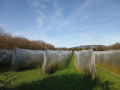
(4) Take the Chemin du Mollard-Rond on the left and continue until you reach some agricultural sheds topped with solar panels.

(5) Follow Chemin de la Puce to the right, which leads to the Quatre Chemins crossroads.

(6) Head left, then turn right at the fork a few dozen metres further on to follow a well-marked farm track. Continue to the Bruyères crossroads.

(7) Take Chemin des Combes on the right and rejoin Route du Marais Fleuri.

(1) Turn left to head back towards the old school in Criel (S/E).

Waypoints

  1. S/E : mi 0 - alt. 1,211 ft - Car park at the former school in Criel
  2. 1 : mi 0.13 - alt. 1,214 ft - Junction of the circular loop
  3. 2 : mi 0.49 - alt. 1,099 ft - Climb to the right - Fure (rivière)
  4. 3 : mi 0.83 - alt. 1,024 ft - Road junction, turn right
  5. 4 : mi 1.02 - alt. 1,102 ft - Le Mollard Rond
  6. 5 : mi 1.29 - alt. 1,217 ft - Chemin de la Puce
  7. 6 : mi 1.63 - alt. 1,138 ft - Les Quatre Chemins
  8. 7 : mi 1.97 - alt. 1,178 ft - Les Bruyères
  9. S/E : mi 2.49 - alt. 1,211 ft - Car park at the former school in Criel

Notes

Hiking on our trails is an outdoor activity and involves certain risks: you may slip and fall, or find yourself in the path of a mountain bike or a falling branch… Please be careful. Warning: global warming is affecting the vegetation. Trees are weakened and may uproot unexpectedly. Do not venture into the woods in windy or stormy weather. Walking with poles is recommended. Keep an eye on your children and stay on the path. Enjoy your walk.

Worth a visit

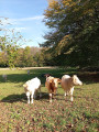
The livestock parks, orchards and walnut groves of the Criel plateau.

Other walks in the area

For more walks, use our search engine .

The GPS track and description are the property of this route's author. Please do not copy them without permission.