


 Country:

 City:



The start is at the car park in the centre of Izeron.
(S/E) From the car park, head down to the left to reach the main road; at the traffic lights, turn right onto the Grande Rue, then take the Route de Grenoble (D1532) for 4 km to reach Cognin-les-Gorges.
At the entrance to the village, after crossing the bridge over the Nan, take the first street on the right (Côte de la Faure)
(1) Ride straight through the village along Rue de Malleval. On leaving the village, take the first road on the right (signposted Malleval).
After 100 metres on flat ground, the road turns left and the first 9 per cent gradient, stretching for 1 km, begins. At the hairpin bend, the gradient levels off until the next bend, 1 km further on.
(2) A quick prayer to the Virgin Mary (statue at the bend) and you’re off again up a gradient of around 8 per cent until you reach the tunnels leading into the Gorges du Nan.
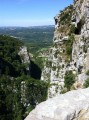
(3). The road is carved into the cliff face and there are a few spots where you can catch a glimpse of the torrent below. The cliff is home to a colony of swallows that skim past the intruders as if to show that we’re on their territory.
The road is narrow, but fortunately there isn’t much traffic – do take care nonetheless.
As you emerge from these gorges, the gradient is very steady all the way to the village of Malleval, at between 6 and 7 per cent.
At the entrance to the village, a monument has been erected in honour of the Resistance fighters who defended this entrance to the Vercors.
The road bypasses the village on the right, then passes back over the village on a slightly steeper gradient of 10 per cent for 500 metres; at the next bend, turn right towards Rencurel and Presles (signposted).
(4) After the bend, if you turn your head slightly to the right, you can see a gap in the ridge: this is the Pas de Pré Coquet at 1,209 m.
(5) Reach it by following a wide arc along the cliff face opposite.
Continue along this road for 500 m.
(6) At the crossroads known as “Patente”, take the road branching off to the left towards Rencurel. After just under 2 km and a few steep sections, you’ll reach the “three-way junction”.
(7) On the left is the road leading to the Col du Mont Noir (800 m), a round trip for those keen on mountain passes.
(7) At the three-way junction “La Patte d’Oie”, turn left onto the “Route forestière de la Croisette”, which, after 3.5 km, joins the “Route forestière de Pra l’Étang”
(8) Take this road on the right towards the hamlet known as “Fontaine de Pétouze”.
(9) Continue along this track for about 5 km until you reach the D292.
(10) Turn right and drive through the village of Presles.
(11) Just after the church, take the small road branching off to the left towards “Les Guinardières”; this climbs gently up to the “Croix Bernard” pass.
(12) Continue along this road, which descends for 3 km and joins the D31.
(13) Turn left onto this road and head down to the church at Saint-Pierre-de-Chérennes::
14:: Leave the D31 and take the small lane branching off to the right. After 100 m, turn right again to take the road to Izeron.
After 600 m, continue to the right along this local track, which leads back to Izeron.
(15) At the entrance to the village, turn right to return to the car park where you started (S/E).

 Visorando Member


 Easy
 Moderate

