The Lunay Bridge

Through woods and fields to discover the Lunay Bridge from Léchelle.

Details

n°8319068
Creation:
Last update:
Last review:
  • Walking
    Activity: Walking
  • ↔
    Distance: 6.14 mi
  • ◔
    Average duration: 2h 55 
  • ▲
    Difficulty: Easy

  • ⚐
    Back to start: Yes
  • ↗
    Ascent: + 112 ft
  • ↘
    Descent: - 112 ft

  • ▲
    Highest point: 548 ft
  • ▼
    Lowest point: 430 ft

Photos

Description of the walk

Car park at the Léchelle community centre.

(S/E) With your back to the car park, turn right onto Rue de la Traconne. Before the bridge, turn left onto Rue de l’Église.

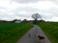
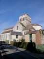
(1) Walk past Saint-Aignan Church and continue along Rue de la Tour. As you leave the village, the tarmac road gives way to a grassy track. Follow this for 1,200 metres, ignoring a path on the right.

(2) At the T-junction, turn left and walk past a telecoms mast. Cross the D236 with care
and carry on straight ahead until you reach another T-junction.

(3) Turn left again, then turn right until you reach the D100.

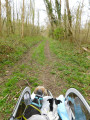
(4) Turn left onto the road (watch out for traffic) and turn right onto the first track, which climbs slightly towards the woods. Go round the woods on the right and you’ll reach the Pont de Lunay.

(5) Cross the bridge and, at the Fork in the road, turn right and follow the fence until you reach the hamlet of Lunay.

(6) Turn right, walk alongside the Bois des Grillons and, at the T-junction, turn left.

(7) As you come out of the woods, take the path on the left towards the road, then follow it to the right.

(8) Walk through the charming hamlet of Cormeron, then turn left onto a path that leads to a road near a football ground, the Stade René Petitpas.

(9) Turn right, cross the level crossing, carefully cross the D100 and then the D236, and you’ll arrive back at the car park of the Léchelle community centre (S/E).


Waypoints

  1. S/E : mi 0 - alt. 436 ft - Car park at the Léchelle community centre
  2. 1 : mi 0.13 - alt. 433 ft - Saint-Aignan Church - Voulzie (la)
  3. 2 : mi 1.13 - alt. 486 ft - T-junction
  4. 3 : mi 1.79 - alt. 525 ft - T-junction
  5. 4 : mi 2.23 - alt. 502 ft - D100
  6. 5 : mi 3.03 - alt. 518 ft - Lunay Bridge
  7. 6 : mi 3.54 - alt. 531 ft - Bois des Grillons
  8. 7 : mi 4.28 - alt. 541 ft - Exit from the woods
  9. 8 : mi 4.77 - alt. 531 ft - The hamlet of Cormeron
  10. 9 : mi 5.66 - alt. 466 ft - “René Petitpas” Stadium
  11. S/E : mi 6.14 - alt. 436 ft - Car park at the Léchelle community centre

Notes

No water points or shops along the route.
Yellow markings in an anti-clockwise direction.

Worth a visit

The rural community centre is the village’s former washhouse.
The Traconne flows into the Voulzie at a place called Les Fontaines.
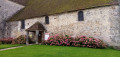
Saint-Aignan Church, founded in the Romanesque period and remodelled in the 12th, 16th and 19th centuries. The porch grille (1777) bears the intertwined initials ‘AM’, of unknown origin.
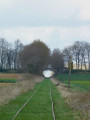
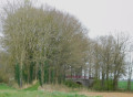
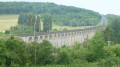
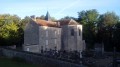
Lunay Bridge: the Provins–Esternay railway line opened here in 1905, carrying passengers and, above all, agricultural produce to Paris. It was repainted in 2024 as part of a community project involving the residents of Léchelles.

Reviews and comments

4.3 / 5
Based on 2 reviews

Reliability of the description
4 / 5
Ease of following the route
4.5 / 5
Route interest
4.5 / 5
pb77
pb77

Thank you for your comment. The bridge was repainted as part of a community project.

Machine-translated

boucles d'or
boucles d'or

Overall rating : 4.5 / 5

Date of your route : Mar 30, 2025
Reliability of the description : Not used / Not applicable
Ease of following the route : ★★★★★ Very good
Route interest : ★★★★☆ Good
Very busy route : No

A lovely walk with a charming bridge to discover.

Machine-translated

pb77
pb77

Hello, I’m glad you enjoyed this walk. It’s true that signposting in the fields isn’t always easy to do.

Machine-translated

Mamou Annie
Mamou Annie

Overall rating : 4.3 / 5

Date of your route : Apr 08, 2025
Reliability of the description : ★★★★☆ Good
Ease of following the route : ★★★★☆ Good
Route interest : ★★★★★ Very good
Very busy route : No

A lovely route through countryside and woodland
Signposting is lacking in places, but there are good directions on the Visorando website.
I highly recommend it

Machine-translated

Other walks in the area

For more walks, use our search engine .

The GPS track and description are the property of this route's author. Please do not copy them without permission.