The walk around the Perthe State Forest

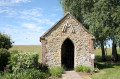
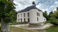
The Perthe State Forest, a Natura 2000 site, is a former airfield destroyed by Allied forces towards the end of 1944. Now in ruins, the site was transferred to the State Forest Service.

Details

n°3501434
Creation:
Last update:
Last review:
  • Walking
    Activity: Walking
  • ↔
    Distance: 7.52 mi
  • ◔
    Average duration: 3h 35 
  • ▲
    Difficulty: Moderate

  • ⚐
    Back to start: Yes
  • ↗
    Ascent: + 108 ft
  • ↘
    Descent: - 112 ft

  • ▲
    Highest point: 413 ft
  • ▼
    Lowest point: 299 ft
  • ⚐ Country: France
  • ⚐ City: Plancy-l'Abbaye (10380)
  • ⚑
    Start/End: N 48.614721° / E 3.958598°
  • ❏
    IGN map(s): Ref. 2715E, 2716E, 2815O, 2816SB
  • Hour-by-hour weather

Photos

Description of the walk

Park in the grassy car park at the foot of the Champs Burottes relay mast.

(S/E) Head south along the edge of the forest. Follow the path to the end of the forest edge.

(1) Turn left at the end of the woodland, before the pumping station. Stay on the edge of the woodland at all times. You’ll reach the edge of the woodland again at a place called Petit Bois.

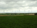
(2) Walk along the left-hand side of the woodland, with a view of the Champfleury wind turbines. You’ll reach the junction with the road cutting through the woodland.

(3) Cross the road, walk along a less wooded section and head for the north-eastern tip of the woodland.

(4) Turn left and continue along the edge of the forest, keeping it on your left. Make several changes of direction, always staying at the edge of the forest. You’ll come to a junction at the north-western tip of the forest.

(5) Turn left, keeping the woodland on your left at all times. Return to the tarmac road and follow it to the left until you reach the car park at the foot of the mobile phone mast (S/E).

Waypoints

  1. S/E : mi 0 - alt. 305 ft - Grassy car park at the foot of the mobile phone mast
  2. 1 : mi 1.09 - alt. 371 ft - Junction before the pumping station
  3. 2 : mi 1.97 - alt. 371 ft - Angle du Petit Bois
  4. 3 : mi 3.49 - alt. 400 ft - Crossing a small road
  5. 4 : mi 4.25 - alt. 384 ft - North-eastern tip of the forest
  6. 5 : mi 6.05 - alt. 358 ft - At the point on the left, keep the forest on your left
  7. S/E : mi 7.52 - alt. 302 ft - Grassy car park at the foot of the mobile phone mast

Notes

Important note for this route: simply walk alongside the forest, keeping it on your left at all times.
No water points; the paths are clear and easily accessible,
No special equipment required, except a raincoat in case of rain.

Worth a visit

Beautiful views over the plain.

Reviews and comments

4.3 / 5
Based on 2 reviews

Reliability of the description
5 / 5
Ease of following the route
5 / 5
Route interest
3 / 5
Roger Flao
Roger Flao

It’s true, the plants have only just started to sprout, but it’s so peaceful. Thanks for popping by. Best wishes

Machine-translated

User 16890347

Overall rating : 4.3 / 5

Date of your route : Apr 10, 2023
Reliability of the description : ★★★★★ Very good
Ease of following the route : ★★★★★ Very good
Route interest : ★★★☆☆ Average
Very busy route : No

It’s a bit of a downer this season. ...

Machine-translated

Roger Flao
Roger Flao

Thank you for visiting the Perthe Forest; although the forest is quite densely populated, it’s a shame that its inhabitants gave you the cold shoulder… But the point was also to imagine how the area was used in the past – the hunting school attached to 914 Air Base in Romilly-sur-Seine, from after the First World War until its destruction and annihilation in 1945!
I hope you enjoy some lovely walks.

Machine-translated

verosano
verosano

Overall rating : 4.3 / 5

Date of your route : Mar 07, 2022
Reliability of the description : ★★★★★ Very good
Ease of following the route : ★★★★★ Very good
Route interest : ★★★☆☆ Average
Very busy route : No

Perfect for the route description and explanations. No difficulties at all. We completed the circular route in 3 hours at a leisurely pace with friends, in the sunshine but with an icy wind. Disappointed by the forest: deserted, an enclave in the middle of fields with wire fencing along the entire eastern and northern sides, countless hunting hides, and caterpillar cocoons on many conifers.

Machine-translated

virgule
virgule

Hello,

I’ll do that one of these days.

Machine-translated

Other walks in the area

For more walks, use our search engine .

The GPS track and description are the property of this route's author. Please do not copy them without permission.