Chemin de Boucharimbault, Châtres-sur-Cher

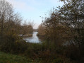
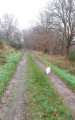
The Chemin de Boucharimbault is ideal for a family walk. You’ll enjoy strolling along the Canal de Berry and the banks of the Cher whilst taking in the views from the higher ground of the town. You can also make the most of your walk to visit the Blues Museum or the water sports centre on fine days.

Details

n°39236136
Creation:
Last update:
Last review:
  • Walking
    Activity: Walking
  • ↔
    Distance: 5.97 mi
  • ◔
    Average duration: 2h 55 
  • ▲
    Difficulty: Easy

  • ⚐
    Back to start: Yes
  • ↗
    Ascent: + 177 ft
  • ↘
    Descent: - 207 ft

  • ▲
    Highest point: 463 ft
  • ▼
    Lowest point: 299 ft

Photos

Description of the walk

From Vierzon, take the D2076 towards Villefranche-sur-Cher. Drive for 11 km to Châtres-sur-Cher. Park at the Place de l’Église.

Signposting: yellow bar

(S/E) With your back to the church, turn right onto Impasse des Fondereaux until you reach the departmental road.

(1) Cross the D976 with care to reach Rue Prosper Legourd. Cross the bridge.

(2) Turn right onto the farm track. Continue to the end of the road at a place called Les Narceilles.

(3) Turn left and follow the Chemin de Bois Maître. Pass the Tour de Bois Maître until you reach a T-junction at the end of the track, which joins the main road. At Corcheloup, turn left to join the D41.

(4) Turn right and follow this road on the left-hand side for 500 m until you reach the track veering off to the left.

(5) Take this forest track to the hamlet of Boucharimbault.

(6) At the first T-junction, turn left towards the houses and follow this path until you reach the road.

(7) Turn left again onto the road and follow it to the T-junction.

(8) Continue along the second road, veering slightly to the left, until you reach the D147.

(9) Cross with care and take the path opposite for about 800 m until you reach the three-way junction.

(10) Leave the pond on your right and continue to the left. Follow the path and then the road to La Modèlerie. You’ll reach the woods just past La Modèlerie.

(11) Take the path leading down to the right, then, in the valley, head up to the left towards the lagoons and La Taille des Rois. First turn right then left. Continue to the next junction in a housing estate.

(12) Turn right, then, at the bend, take the path opposite until you reach the railway line.

(13) Walk along the left-hand side of the railway line, then cross the tracks and take Rue des Usines to the D976.

(14) Pass the cemetery on your left and, at the junction, head straight on towards the D976. Cross the road carefully and follow the banks of the Canal de Berry to the left until you reach the red footbridge.

(15) Head up Impasse des Fondereaux on the left towards Place de l’Église (S/E).

Waypoints

  1. S/E : mi 0 - alt. 338 ft - Saint-Martin’s Church (Châtres-sur-Cher) - Église Saint-Martin (Châtre-sur-Cher)
  2. 1 : mi 0.04 - alt. 344 ft - D976
  3. 2 : mi 0.16 - alt. 361 ft - Railway bridge
  4. 3 : mi 0.46 - alt. 341 ft - Les Narceilles – directions
  5. 4 : mi 1.45 - alt. 453 ft - D41
  6. 5 : mi 1.76 - alt. 459 ft - Y-junction, directional signage
  7. 6 : mi 2.26 - alt. 443 ft - Boucharimbault
  8. 7 : mi 2.54 - alt. 423 ft - Directions
  9. 8 : mi 2.65 - alt. 427 ft - Triangular junction, directional signage
  10. 9 : mi 3.02 - alt. 423 ft - D147
  11. 10 : mi 3.61 - alt. 367 ft - Three-way junction, directional signage
  12. 11 : mi 4.16 - alt. 427 ft - Wood, directional signage
  13. 12 : mi 5.08 - alt. 367 ft - Housing estate
  14. 13 : mi 5.23 - alt. 341 ft - Railway line
  15. 14 : mi 5.47 - alt. 318 ft - RD 976 - Le Cher
  16. 15 : mi 5.9 - alt. 308 ft - Red footbridge, directional signage - Le Cher
  17. S/E : mi 5.97 - alt. 338 ft - Saint-Martin’s Church (Châtres-sur-Cher)

Worth a visit

The Maison du Blues offers a range of ways to discover or enjoy the blues, including a community café and a blues club with an international programme (weekly concerts).

The European Blues Museum, the Blues and the resource centre: a link between the history of the blues and the contemporary blues scene. In this museum, you’ll discover a tribute to honorary president Bobby Rush, as well as a chronological overview of the evolution of the blues and its great artists. Onthe first floor, you can stroll along a ‘Mississippi Street’ with areas dedicated to the evolution of this music and the struggles of African Americans.

Reviews and comments

5 / 5
Based on 1 review

Reliability of the description
5 / 5
Ease of following the route
5 / 5
Route interest
5 / 5
G.L.
G.L.

Overall rating : 5 / 5

Date of your route : May 11, 2026
Reliability of the description : ★★★★★ Very good
Ease of following the route : ★★★★★ Very good
Route interest : ★★★★★ Very good
Very busy route : No

A lovely, varied circular route – thank you very much!

Machine-translated

Other walks in the area

For more walks, use our search engine .

The GPS track and description are the property of this route's author. Please do not copy them without permission.