Col de Mirandol from Fouillouse

An easy hike to one of the most beautiful viewpoints in the Haute-Ubaye

Details

3790676
Creation:
Last update:
Last review:
  • Walking
    Activity: Walking
  • ↔
    Distance: 5.59 mi
  • ◔
    Average duration: 4h 10 
  • ▲
    Difficulty: Moderate

  • ⚐
    Back to start: Yes
  • ↗
    Ascent: + 1,850 ft
  • ↘
    Descent: - 1,841 ft

  • ▲
    Highest point: 7,969 ft
  • ▼
    Lowest point: 6,129 ft

Description of the walk

Park in the designated car park just before the entrance to the village of Fouillouse.

S/E: From the car park, follow the track that leads into the village as far as the Chapel of Saint-Jean-Baptiste.

(1) Just before the chapel, take the small path that descends to the right, going round it (yellow signs andGR® /GRP® markings). Cross a small bridge over the Riou de Fouillouse and start climbing again.

(2) Leave theGR®56on your right and continue straight on, climbing through the forest, following the yellow and red markings (GRP®).

(3) You’ll reach a wide track, which you follow to the left (still following the same markings).

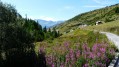
(4) At a fork, take the track on the right and follow it for a few hundred metres. TheGRP® joins a little further on to the left and climbs through a magnificent larch forest, cutting across the track’s hairpin bends.

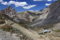
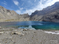
(5) You’ll emerge onto an alpine plateau, offering superb views of the peaks of La Mortice, La Font Sancte, L’Aiguille and Le Brec de Chambeyron, amongst others. Follow the clearly marked path to the Col de Mirandol.

(6) Return via the same route in the opposite direction to the Fouillouse car park (S/E).

Waypoints

  1. S/E : mi 0 - alt. 6,129 ft - Fouillouse car park
  2. 1 : mi 0.38 - alt. 6,224 ft - Saint-Jean-Baptiste Chapel
  3. 2 : mi 0.59 - alt. 6,250 ft - GR / GRP junction
  4. 3 : mi 0.83 - alt. 6,509 ft - Forest track
  5. 4 : mi 0.91 - alt. 6,516 ft - Junction on the track
  6. 5 : mi 1.65 - alt. 7,257 ft - Mountain pasture
  7. 6 : mi 2.8 - alt. 7,969 ft - Col de Mirandol (2433m)
  8. S/E : mi 5.59 - alt. 6,129 ft - Fouillouse car park

Notes

The Fouillouse car park can get very busy, so it’s best to arrive early. This walk can also be a great opportunity for a first overnight stay with children, with its magnificent setting, good path and gentle gradient before reaching some superb camping spots.

Always be cautious and plan ahead when you're outdoors. Visorando and the author of this route cannot be held responsible for any accidents occurring on this route.

The GR® and PR® markings are the intellectual property of the Fédération Française de Randonnée Pédestre.

Reviews and comments

4.4 / 5
Based on 4 reviews

Reliability of the description
4.5 / 5
Ease of following the route
4.8 / 5
Route interest
4 / 5
Manureva
Manureva

Overall rating : 5 / 5

Date of your route : Aug 05, 2026
Reliability of the description : ★★★★★ Very good
Ease of following the route : ★★★★★ Very good
Route interest : ★★★★★ Very good
Very busy route : No

A lovely walk, with part of the ascent through woodland followed by a very open mountain pasture.
Once you reach the pass, there’s a magnificent view of the surrounding peaks; don’t hesitate to walk along the ridge for a bit to enjoy an even more spectacular view.
Not very busy.

Machine-translated

User 2285728

Overall rating : 4.3 / 5

Date of your route : Jul 20, 2026
Reliability of the description : ★★★★★ Very good
Ease of following the route : ★★★★★ Very good
Route interest : ★★★☆☆ Average
Very busy route : No

A short hike to warm up for the half-day trip, there and back. Not particularly interesting. Best avoided in the middle of the afternoon when it’s very hot, as most of the path is completely exposed.

Machine-translated

Anne Favre Juvin
Anne Favre Juvin

Overall rating : 4.3 / 5

Date of your route : Sep 15, 2025
Reliability of the description : ★★★★☆ Good
Ease of following the route : ★★★★★ Very good
Route interest : ★★★★☆ Good
Very busy route : No

Pleasant because the first part is in the forest when it's hot...
Very beautiful view when arriving at the mountain pasture

Machine-translated

MATIC
MATIC

Overall rating : 4 / 5

Date of your route : Jul 29, 2024
Reliability of the description : ★★★★☆ Good
Ease of following the route : ★★★★☆ Good
Route interest : ★★★★☆ Good
Very busy route : No

Very quiet and hassle-free
Spotted a few marmots
Lovely viewpoint over the peaks of La Mortice, Font de Sancte and Aiguille Brec de Chambeyron
It’s possible to head back towards Saint Ours and Meyronnes, but you’ll need two cars

Machine-translated

Other walks in the area

For more walks, use our search engine .

The GPS track and description are the property of this route's author. Please do not copy them without permission.