


Refine your search for walks in Ubayette (rivière)
Ubayette (rivière) walks


 Lac du Lauzanier
 Visorando Member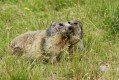
 5.68 mi
 +1,234 ft
 -1,234 ft
 3h 40
3h 40
 Easy
Easy
 Departure from Larche (Alpes-de-Haute-Provence)
A beautiful family hike with the chance to see marmots just a few metres from the path (from the start and also at the lake).
Pas de la Cavale from Larche
 10.32 mi
+2,618 ft
-2,602 ft
7h 00
10.32 mi
+2,618 ft
-2,602 ft
7h 00
 Difficult
Departure from Larche (Alpes-de-Haute-Provence)
Difficult
Departure from Larche (Alpes-de-Haute-Provence)
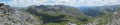
This is a pleasant hike, starting off easy and leading to Lac du Lauzanier. Hikers will encounter many marmots, lakes and waterfalls, ending with a beautiful view from Pas de la Cavale.
La Tête de Plate Longe
 6.02 mi
+3,609 ft
-3,625 ft
5h 55
6.02 mi
+3,609 ft
-3,625 ft
5h 55
 Moderate
Departure from Larche (Alpes-de-Haute-Provence)
Moderate
Departure from Larche (Alpes-de-Haute-Provence)
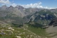
Route starting from Larche for lovers of flora and fauna.
Circular Tête Dure starting from Larche
 6.71 mi
+3,117 ft
-3,117 ft
5h 50
Difficult
Departure from Larche (Alpes-de-Haute-Provence)
6.71 mi
+3,117 ft
-3,117 ft
5h 50
Difficult
Departure from Larche (Alpes-de-Haute-Provence)
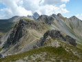
If you’re heading to Col de Larche to see the classic lakes of Lauzanier and Oronaye, stop off at Larche; this quiet village offers numerous opportunities for circular walks, including this one which will take you up to the heights of Tête Dure, aptly named, after a moderately challenging walk through the varied landscapes of the Rouchouse valley.
Saint-Ours – Larche
 Association / Club / Walk leader
 5.26 mi
+1,102 ft
-1,417 ft
3h 25
Moderate
Departure from Meyronnes (Alpes-de-Haute-Provence)
5.26 mi
+1,102 ft
-1,417 ft
3h 25
Moderate
Departure from Meyronnes (Alpes-de-Haute-Provence)
Return to the starting point in Larche via theGRP® de la Frontière Fortifiée.
Maljasset - Larche
15.60 mi
+4,199 ft
-4,898 ft
10h 50
Difficult
Departure from Saint-Paul-sur-Ubaye (Alpes-de-Haute-Provence)
Etape de la traversée des Alpes à partir du hameau de Maljasset qui suit la route de la Haute Ubaye avec une vue époustouflante sur les sommets qui bordent le flanc sud du Queyras. Traversée de la Haute Ubaye dans un univers minéral parmi les sommets de plus de 3000m.
Larche - Saint-Dalmas-le-Selvage
17.35 mi
+5,102 ft
-5,633 ft
12h 25
Difficult
Departure from Larche (Alpes-de-Haute-Provence)
Étape de la traversée des Alpes par le GR®5 de Larche à Saint Dalmas le Selvage. Passage dans le Parc National du Mercantour sauvage et authentique puis transition entre la Haute Tinée et le Vallon de Jalorgues avec un passage sur la plus haute route d'Europe vers le Col de la Bonnette.