Country:

 City:
City:


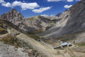
You must park at the Fouillouse car park at the entrance to the hamlet.
(S/E) Leave the car park and turn left towards Fouillouse.
Walk right through the village along the road, then take the track towards Fort de la Plate Lombarde. Follow theGR®5–GR®56–GRP® routes.
‘Allow about 1 hour to reach this fort’.
(1) Just before the fort, there is a junction between theGRP® and theGR®5–GR®56. Head towards the Col du Vallonnet via theGR®5–GR®56(note that both routes lead to the pass). Follow the red and white markings.
(2) Once you reach the pass, leave the path leading to the Col de Stroppia on your left and head towards the Col de Mallemort (approximately 4 km).
(3) At this junction, continue towards the Col de Mallemort, leaving the path leading to the Col du Portiolette on your left. This is the route you will take on the return journey.
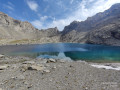
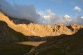
After passing Lac du Vallonnet Inférieur on your left (which was quite dry when we passed through in early August 2020), continue climbing.
(4) Turn left at the junction, following theGR®5–GR®56markings.
(5) When you reach the military road, follow it towards the barracks visible a little further up on the left.
(6) Go round the perimeter wall and climb up to the Col de Mallemort.
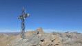
(7) Once at the pass, take the path leading to the battery and the Tête de Viraysse.
(8) Head back down the same way to the barracks.
(6) Leave the track by taking thePR® Mirandol path on your right, which winds through the scree (yellow markings).
(9) At the junction, join theGRP® Tour du Sautron, which comes from the Col du Portiolette, and turn left towards the Col du Vallonnet.
(3) At the junction by the Lower Vallonnet Lake, turn right towards the Col du Vallonnet.
(2) Once you reach the pass, head down towards Fouillouse by following the same route back as on the way up until you reach (S/E).

 Visorando Member
 Very difficult
 Easy
Easy 
 Moderate