Refine your search for walks in Col de Mallemort
Col de Mallemort walks


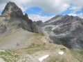
 La Tête de Viraysse and the military fortifications at Saint-Ours
 Visorando Member
 11.22 mi
 +3,212 ft
 -3,215 ft
 7h 55
 Moderate
 Departure from Meyronnes (Alpes-de-Haute-Provence)
At an altitude of 2,772 metres, the Tête de Viraysse and its high military fortifications offer a magnificent panorama of Italy, the Mercantour and the Ubaye in a rugged mountain landscape between the Meyna and the rocks of Saint-Ours.
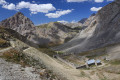
The Viraysse Battery as seen from Fouillouse
 14.03 mi
+3,747 ft
-3,734 ft
9h 45
 Difficult
Departure from Saint-Paul-sur-Ubaye (Alpes-de-Haute-Provence)
Head for the Viraysse Battery from Fouillouse.
Rivers, marmots, military structures (barracks, batteries, forts) and small lakes accompany walkers throughout the hike.
Maljasset - Larche
15.60 mi
+4,199 ft
-4,898 ft
10h 50
Difficult
Departure from Saint-Paul-sur-Ubaye (Alpes-de-Haute-Provence)
Etape de la traversée des Alpes à partir du hameau de Maljasset qui suit la route de la Haute Ubaye avec une vue époustouflante sur les sommets qui bordent le flanc sud du Queyras. Traversée de la Haute Ubaye dans un univers minéral parmi les sommets de plus de 3000m.
GTA, Great Alpine Crossing via the GR®5 and GR®55. From Lake Geneva to Nice.
 342.76 mi
+99,633 ft
-100,915 ft
21 days
 Very difficult
Departure from Saint-Gingolph (Haute-Savoie)
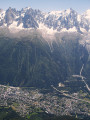
The Grande Traversée des Alpes (GTA) mainly follows the GR®5, with a few possible variations such as the crossing of the Haute Vanoise via the GR®55 and the Via Alpina, which this route takes instead of the GR®5 route via the Col de l’Iseran. It crosses the French Alps from north to south, from Saint-Gingolph to Nice. The guide includes web links to the many accommodation options along the route or nearby: mountain huts, lodges, campsites, cabins and shelters, excluding hotels. Although this guidebook details the GTA as a three-week trek, it can be adapted to suit your own pace, with stages of varying lengths, either completed in one go or in sections over several years. This journey, fuelled by the joy of freedom in unspoilt natural surroundings, will remain a superb and unforgettable experience, offering, moreover, the opportunity to meet many people with whom you can share this same passion for the mountains.
Tour du Sautron
 Association / Club / Walk leader
 32.99 mi
+10,499 ft
-10,469 ft
4 days
Very difficult
Departure from Larche (Alpes-de-Haute-Provence)
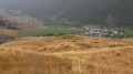
A beautiful hike between the Ubayette Valley and Italy. The Vallon de l’Oronaye, the Stroppia Waterfalls and the Lac des Neuf Couleurs are among the most stunning places to discover in the Southern Alps.
I did this hike with a group of 14 people from the Randogym club in early September 2015. In mid-June 2006, I went on a 5-day hike that followed part of this route, and there were still plenty of snowfields at that time of year.
From Fouillouse to Bousiéyas
 21.25 mi
+6,686 ft
-6,667 ft
15h 35
Very difficult
Departure from Saint-Paul-sur-Ubaye (Alpes-de-Haute-Provence)
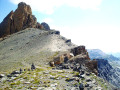
This sixteenth stage completes the crossing of the Chambeyron Massif and, after Larche, enters the Mercantour Massif. From Les Granges de Fouillouse, the GR®5 follows the Riou de Fouillouse upstream, passing the ruins of Fort de Plate Lombarde, then, via the Plate Lombarde valley, reaches the Col du Vallonnet. It then descends to Lac du Vallonnet Inférieur, where it heads due south to join an old military road that climbs towards the Viraysse barracks. From there, the GR®5 crosses the Col de Mallemort and descends to the hamlet of Larche. The route follows the Ubayette, then crosses it and reaches the Pont Rouge car park, which marks the entrance to the Mercantour National Park. It then heads due south, climbing to Lac du Lauzanier, then on to Lac de Derrière la Croix, before reaching the Pas de la Cavale. The descent starts off quite steep but then becomes gentler. After the Salse Morene plateau, the path climbs the Col des Fourches and, from the Camp des Fourches, reaches the hamlet of Bousiéyas.
A circular route from the Val Maira to the Ubaye Valley
 43.80 mi
+14,711 ft
-14,708 ft
5 days
Difficult
Departure from Acceglio (Cuneo)
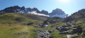
This cross-border route consists of 5 stages. It runs partly through the Val Maira, one of the four valleys of Occitan Piedmont in Italy, and through the Ubaye Valley in France. The first stage is deliberately short. This allows you to drive to Ponte Maira and start the hike on the same day.Allow around 3 hours’ drive from the Roya Valley or the Ubaye Valley.